Crocicchia
| Crocicchia A Crucichja | |
|---|---|
| Commune | |
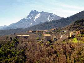 The hamlet of Sant'Andrea and the church, with the Monte San Petrone in the background | |
 Crocicchia Location within Corsica region  Crocicchia | |
| Coordinates: 42°27′58″N 9°21′04″E / 42.4661°N 9.3511°ECoordinates: 42°27′58″N 9°21′04″E / 42.4661°N 9.3511°E | |
| Country | France |
| Region | Corsica |
| Department | Haute-Corse |
| Arrondissement | Corte |
| Canton | Golo-Morosaglia |
| Government | |
| • Mayor (2008–2014) | Ange-Félix Pasqualini |
| Area1 | 4.3 km2 (1.7 sq mi) |
| Population (2008)2 | 43 |
| • Density | 10/km2 (26/sq mi) |
| Time zone | UTC+1 (CET) |
| • Summer (DST) | UTC+2 (CEST) |
| INSEE/Postal code | 2B102 /20290 |
| Elevation |
195–1,041 m (640–3,415 ft) (avg. 600 m or 2,000 ft) |
|
1 French Land Register data, which excludes lakes, ponds, glaciers > 1 km2 (0.386 sq mi or 247 acres) and river estuaries. 2 Population without double counting: residents of multiple communes (e.g., students and military personnel) only counted once. | |
Crocicchia is a commune in the Haute-Corse department of France on the island of Corsica. Since 2015, it is part of the canton of Golo-Morosaglia.[1]
Geography
Crocicchia is bounded on the east by the Casacconi, which flows into the Golo River.
Population
| Historical population | ||
|---|---|---|
| Year | Pop. | ±% |
| 1962 | 59 | — |
| 1968 | 79 | +33.9% |
| 1975 | 58 | −26.6% |
| 1982 | 48 | −17.2% |
| 1990 | 62 | +29.2% |
| 1999 | 50 | −19.4% |
| 2008 | 43 | −14.0% |
See also
References
| Wikimedia Commons has media related to Crocicchia. |
This article is issued from
Wikipedia.
The text is licensed under Creative Commons - Attribution - Sharealike.
Additional terms may apply for the media files.