Farinole
| Farinole Ferringule | |
|---|---|
| Commune | |
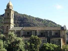 The church in Farinole | |
 Farinole Location within Corsica region  Farinole | |
| Coordinates: 42°43′58″N 9°21′58″E / 42.7328°N 9.3661°ECoordinates: 42°43′58″N 9°21′58″E / 42.7328°N 9.3661°E | |
| Country | France |
| Region | Corsica |
| Department | Haute-Corse |
| Arrondissement | Calvi |
| Canton | Cap Corse |
| Government | |
| • Mayor (2008–2014) | Ange Cherubini |
| Area1 | 14.76 km2 (5.70 sq mi) |
| Population (2008)2 | 216 |
| • Density | 15/km2 (38/sq mi) |
| Time zone | UTC+1 (CET) |
| • Summer (DST) | UTC+2 (CEST) |
| INSEE/Postal code | 2B109 /20253 |
| Elevation |
0–1,120 m (0–3,675 ft) (avg. 200 m or 660 ft) |
|
1 French Land Register data, which excludes lakes, ponds, glaciers > 1 km2 (0.386 sq mi or 247 acres) and river estuaries. 2 Population without double counting: residents of multiple communes (e.g., students and military personnel) only counted once. | |
Farinole (Corsican: Ferringule) is a commune in the Haute-Corse department of France on the island of Corsica.
The village is located between the mountains and the sea between Saint-Florent and Negro with the two hamlets of Sparagaggio and Bracolaccia. It has good views of the gulf and the Désert des Agriates. The village has two sandy beaches and a pebble beach.
Population
| Historical population | ||
|---|---|---|
| Year | Pop. | ±% |
| 1962 | 115 | — |
| 1968 | 121 | +5.2% |
| 1975 | 131 | +8.3% |
| 1982 | 148 | +13.0% |
| 1990 | 176 | +18.9% |
| 1999 | 179 | +1.7% |
| 2008 | 216 | +20.7% |
See also
References
| Wikimedia Commons has media related to Farinole. |
This article is issued from
Wikipedia.
The text is licensed under Creative Commons - Attribution - Sharealike.
Additional terms may apply for the media files.