Conchez-de-Béarn
| Conchez-de-Béarn | ||
|---|---|---|
| Commune | ||
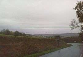 The landscape of Conchez-de-Béarn | ||
| ||
 Conchez-de-Béarn Location within Nouvelle-Aquitaine region  Conchez-de-Béarn | ||
| Coordinates: 43°32′47″N 0°10′06″W / 43.5464°N 0.1683°WCoordinates: 43°32′47″N 0°10′06″W / 43.5464°N 0.1683°W | ||
| Country | France | |
| Region | Nouvelle-Aquitaine | |
| Department | Pyrénées-Atlantiques | |
| Arrondissement | Pau | |
| Canton | Terres des Luys et Coteaux du Vic-Bilh | |
| Intercommunality | Communauté de communes du canton de Garlin | |
| Government | ||
| • Mayor (2008–2014) | Francis Cup | |
| Area1 | 4.49 km2 (1.73 sq mi) | |
| Population (2006)2 | 103 | |
| • Density | 23/km2 (59/sq mi) | |
| Time zone | UTC+1 (CET) | |
| • Summer (DST) | UTC+2 (CEST) | |
| INSEE/Postal code | 64192 /64330 | |
| Elevation |
122–261 m (400–856 ft) (avg. 167 m or 548 ft) | |
|
1 French Land Register data, which excludes lakes, ponds, glaciers > 1 km2 (0.386 sq mi or 247 acres) and river estuaries. 2 Population without double counting: residents of multiple communes (e.g., students and military personnel) only counted once. | ||
.svg.png)
Conchez-de-Béarn is a commune in the Pyrénées-Atlantiques department in south-western France.
See also
References
| Wikimedia Commons has media related to Conchez-de-Béarn. |
This article is issued from
Wikipedia.
The text is licensed under Creative Commons - Attribution - Sharealike.
Additional terms may apply for the media files.