Lichans-Sunhar
| Lichans-Sunhar | |
|---|---|
| Commune | |
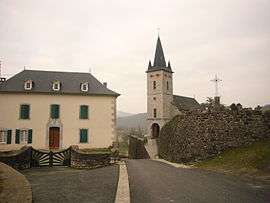 The village of Lichans | |
 Lichans-Sunhar Location within Nouvelle-Aquitaine region  Lichans-Sunhar | |
| Coordinates: 43°05′38″N 0°52′20″W / 43.0939°N 0.8722°WCoordinates: 43°05′38″N 0°52′20″W / 43.0939°N 0.8722°W | |
| Country | France |
| Region | Nouvelle-Aquitaine |
| Department | Pyrénées-Atlantiques |
| Arrondissement | Oloron-Sainte-Marie |
| Canton | Montagne Basque |
| Intercommunality | CA Pays Basque |
| Government | |
| • Mayor (2008–2014) | Jean-Pierre Libilbéhéty |
| Area1 | 3.43 km2 (1.32 sq mi) |
| Population (2006)2 | 75 |
| • Density | 22/km2 (57/sq mi) |
| Time zone | UTC+1 (CET) |
| • Summer (DST) | UTC+2 (CEST) |
| INSEE/Postal code | 64340 /64470 |
| Elevation |
232–589 m (761–1,932 ft) (avg. 245 m or 804 ft) |
|
1 French Land Register data, which excludes lakes, ponds, glaciers > 1 km2 (0.386 sq mi or 247 acres) and river estuaries. 2 Population without double counting: residents of multiple communes (e.g., students and military personnel) only counted once. | |
Lichans-Sunhar (Basque: Lexantzü-Zünharre) is a commune in the Pyrénées-Atlantiques department in south-western France.
It is located in the former province of Soule.
See also
References
External links
| Wikimedia Commons has media related to Lichans-Sunhar. |
- LEXANTZÜ-ZÜNHARRE in the Bernardo Estornés Lasa - Auñamendi Encyclopedia (Euskomedia Fundazioa) (in Spanish)

This article is issued from
Wikipedia.
The text is licensed under Creative Commons - Attribution - Sharealike.
Additional terms may apply for the media files.