Lagor
| Lagor | |
|---|---|
| Commune | |
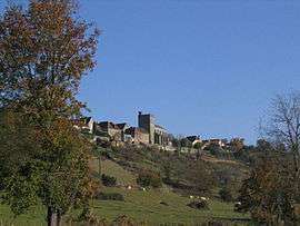 A general view of Lagor | |
 Lagor Location within Nouvelle-Aquitaine region  Lagor | |
| Coordinates: 43°23′36″N 0°39′04″W / 43.3933°N 0.6511°WCoordinates: 43°23′36″N 0°39′04″W / 43.3933°N 0.6511°W | |
| Country | France |
| Region | Nouvelle-Aquitaine |
| Department | Pyrénées-Atlantiques |
| Arrondissement | Pau |
| Canton | Le Cœur de Béarn |
| Intercommunality | Communauté de communes de Lagor |
| Government | |
| • Mayor (2008–2014) | Jacques Bonte |
| Area1 | 20.97 km2 (8.10 sq mi) |
| Population (2006)2 | 1,220 |
| • Density | 58/km2 (150/sq mi) |
| Time zone | UTC+1 (CET) |
| • Summer (DST) | UTC+2 (CEST) |
| INSEE/Postal code | 64301 /64150 |
| Elevation |
82–252 m (269–827 ft) (avg. 95 m or 312 ft) |
|
1 French Land Register data, which excludes lakes, ponds, glaciers > 1 km2 (0.386 sq mi or 247 acres) and river estuaries. 2 Population without double counting: residents of multiple communes (e.g., students and military personnel) only counted once. | |
Lagor is a commune in the Pyrénées-Atlantiques department in south-western France.
See also
References
| Wikimedia Commons has media related to Lagor. |
This article is issued from
Wikipedia.
The text is licensed under Creative Commons - Attribution - Sharealike.
Additional terms may apply for the media files.