Astis
| Astis | |
|---|---|
| Commune | |
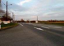
 View of the village | |
 Astis Location within Nouvelle-Aquitaine region  Astis | |
| Coordinates: 43°26′31″N 0°19′37″W / 43.4419°N 0.3269°WCoordinates: 43°26′31″N 0°19′37″W / 43.4419°N 0.3269°W | |
| Country | France |
| Region | Nouvelle-Aquitaine |
| Department | Pyrénées-Atlantiques |
| Arrondissement | Pau |
| Canton | Terres des Luys et Coteaux du Vic-Bilh |
| Intercommunality | CC Luys Béarn |
| Government | |
| • Mayor (2014-2020) | Alain Caïe |
| Area1 | 3.16 km2 (1.22 sq mi) |
| Population (2015)2 | 308 |
| • Density | 97/km2 (250/sq mi) |
| Time zone | UTC+1 (CET) |
| • Summer (DST) | UTC+2 (CEST) |
| INSEE/Postal code | 64070 /64450 |
| Elevation |
160–242 m (525–794 ft) (avg. 234 m or 768 ft) |
|
1 French Land Register data, which excludes lakes, ponds, glaciers > 1 km2 (0.386 sq mi or 247 acres) and river estuaries. 2 Population without double counting: residents of multiple communes (e.g., students and military personnel) only counted once. | |
Astis (Astís in Occitan) is a commune in the Pyrénées-Atlantiques department in the Nouvelle-Aquitaine region of south-western France.
The inhabitants of the commune are known as Astisiens or Astisiennes.[1]
Geography
Astis is located some 20 km north of Pau and some 4 km south of Miossens-Lanusse. Access to the commune is by road D834 (Route de Bordeaux) from Pau entering the commune from the south-west passing through the village and continuing north to Sarron. The D39 road (Route de Morlaas) branches off the D834 in the north of the commune and goes south-east to Anos. The commune has a strip of forest along the length of the commune from north-west to south-east, parallel to the Route de Morlaas with the rest of the commune farmland.[2]
The Luy de France forms the eastern border of the commune as it flows north eventually joining the Luy de Béarn and becoming the Luy river on the eastern border of Castel-Sarrazin commune. The Basta river rises in the south of the commune and flows north-west joining the Luy de France north of the commune.[2]
Places and hamlets[3]
Neighbouring communes and villages[2]
Places adjacent to Astis | |
|---|---|
Toponymy
The commune name in béarnais is also Astis. Michel Grosclaude proposed a Gascon etymology es (an old definitive article) followed by t(h)in ("Dependence") or tin ("singer").[8]
The following table details the origins of the commune name:
| Name | Spelling | Date | Source | Page | Origin | Description |
|---|---|---|---|---|---|---|
| Astis | Estis | 1385 | Raymond | Census | Village | |
| Astis | 1750 | Cassini | Cassini Map |
- Sources
Administration

List of Successive Mayors[12]
| From | To | Name | Party | Position |
|---|---|---|---|---|
| 1790 | 1809 | Jean Sabat | ||
| 1809 | 1815 | Jean Larrieu | ||
| 1815 | 1828 | Joseph Hondagne | ||
| 1828 | 1830 | Bernard Lamazou | ||
| 1830 | 1868 | Pierre Lamazou | ||
| 1868 | 1871 | Jean Larrieu | ||
| 1871 | 1872 | Félix Binde | ||
| 1872 | 1878 | Jean Larrieu Chinchin | ||
| 1878 | 1919 | Jean Lamazou | ||
| 1919 | 1929 | Jean Sebat | ||
| 1929 | 1935 | Julien Lamazou | ||
| 1935 | 1944 | Raymond Guichane | ||
| 1944 | 1945 | Julien Lamazou | ||
| 1945 | 1959 | Pierre Larrieu Bourdale | ||
| 1959 | 1989 | Albert Lafitte | ||
| 1989 | 2014 | Pierrette Barzu | ||
| 2014 | 2020 | Alain Caïe |
(Not all data is known)
Inter-communality

The commune is part of four inter-communal structures:[13]
- the Community of communes of Luys en Béarn;
- the AEP association of the regions of Luy and Gabas;
- the Energy association of Pyrénées-Atlantiques;
- the scholastic association Argelos-Astis;
Demography
In 2010 the commune had 303 inhabitants. The evolution of the number of inhabitants is known from the population censuses conducted in the commune since 1793. From the 21st century, a census of communes with fewer than 10,000 inhabitants is held every five years, unlike larger towns that have a sample survey every year.[Note 1]
| 1793 | 1800 | 1806 | 1821 | 1831 | 1836 | 1841 | 1846 | 1851 |
|---|---|---|---|---|---|---|---|---|
| 157 | 97 | - | 175 | 215 | 232 | 222 | 225 | 220 |
| 1856 | 1861 | 1866 | 1872 | 1876 | 1881 | 1886 | 1891 | 1896 |
|---|---|---|---|---|---|---|---|---|
| 220 | 227 | 213 | 170 | 166 | 180 | 180 | 193 | 189 |
| 1901 | 1906 | 1911 | 1921 | 1926 | 1931 | 1936 | 1946 | 1954 |
|---|---|---|---|---|---|---|---|---|
| 190 | 171 | 167 | 154 | 140 | 128 | 139 | 119 | 108 |
| 1962 | 1968 | 1975 | 1982 | 1990 | 1999 | 2006 | 2010 | - |
|---|---|---|---|---|---|---|---|---|
| 111 | 101 | 98 | 163 | 198 | 266 | 292 | 303 | - |
Sources : Ldh/EHESS/Cassini until 1962, INSEE database from 1968 (population without double counting and municipal population from 2006)

Culture and heritage
Civil heritage
The commune has a number of buildings and structures that are registered as historical monuments:
Religious heritage

The Church of Saint John the Baptist (12th century)![]()
The Church contains many items that are registered as historical objects:
- A Bronze Bell (1591)

- Furniture in the Church
- A Bronze Bell in the bell tower (1591)
- A Ciborium (19th century)
- 2 Altar Candlesticks (19th century)
- 2 Altar Candlesticks (19th century)
- 2 Altar Candlesticks (torch bodies) (19th century)
- A Painting: Saint John in the desert (18th century)
- A Worship bench (19th century)
- Baptismal fonts (19th century)
- 2 Statues: Saint Peter & Saint John (18th century)
- Bas-relief: Christ on the cross between Saint Madeleine & Saint John (18th century)
- A Retable (18th century)
- Altar seating and Tabernacle (18th century)
- Main Altar Seating, Tabernacle, and Retable
Facilities

Astis has a primary school which is shared with Argelos as an inter-communal educational grouping.
See also
External links
- Community of communes of Luys en Béarn (in French)
- Astis on Google Maps
- Astis on Géoportail, National Geographic Institute (IGN) website (in French)
- Astis on the 1750 Cassini Map
- Astis on the INSEE website (in French)
- INSEE (in French)
Notes and references
Notes
- ↑ At the beginning of the 21st century, the methods of identification have been modified by Law No. 2002-276 of 27 February 2002 Archived 6 March 2016 at the Wayback Machine., the so-called "law of local democracy" and in particular Title V "census operations" allows, after a transitional period running from 2004 to 2008, the annual publication of the legal population of the different French administrative districts. For communes with a population greater than 10,000 inhabitants, a sample survey is conducted annually, the entire territory of these communes is taken into account at the end of the period of five years. The first "legal population" after 1999 under this new law came into force on 1 January 2009 and was based on the census of 2006.
References
- ↑ Inhabitants of Pyrénées-Atlantiques (in French)
- 1 2 3 Google Maps
- ↑ Géoportail, IGN (in French)
- 1 2 Ministry of Culture, Mérimée IA00026710 Maison Mourras (in French)
- 1 2 Ministry of Culture, Mérimée IA00026707 Maison Lassus (in French)
- 1 2 Ministry of Culture, Mérimée IA00027386 Chateau (in French)
- 1 2 Ministry of Culture, Mérimée IA00026709 Farmhouse at Lamazou (in French)
- 1 2 Michel Grosclaude, Toponymic Dictionary of communes, Béarn, Edicions reclams & Édition Cairn - 2006, 416 pages, ISBN 2 35068 005 3 (in French)
- ↑ Topographic Dictionary of the Department of Basses-Pyrenees, Paul Raymond, Imprimerie nationale, 1863, Digitised from Lyon Public Library 15 June 2011 (in French)
- ↑ Manuscript from the 14th century - Departmental Archives of Pyrénées-Atlantiques (in French)
- ↑ Cassini Map 1750 - Asson
- ↑ List of Mayors of France (in French)
- ↑ Intercommunality of Pyrénées-Atlantiques Archived May 18, 2014, at the Wayback Machine., Cellule informatique préfecture 64, consulted on 2 March 2012 (in French)
- ↑ Ministry of Culture, Mérimée IA00026708 Maison Larrieu (in French)
- ↑ Ministry of Culture, Mérimée IA00026706 Houses and Farms (in French)
- ↑ Ministry of Culture, Mérimée IA00026705 Fortified complex (in French)
- ↑ Ministry of Culture, Mérimée IA00026704 Church of Saint John the Baptist (in French)
- ↑ Ministry of Culture, Palissy PM64000058 Bronze bell (in French)
- ↑ Ministry of Culture, Palissy PM64001162 Furniture (in French)
- ↑ Ministry of Culture, Palissy PM64001148 2 Altar Candlesticks (in French)
- ↑ Ministry of Culture, Palissy PM64001161 Bronze Bell in the bell tower (in French)
- ↑ Ministry of Culture, Palissy PM64001160 Ciborium (in French)
- ↑ Ministry of Culture, Palissy PM64001159 2 Altar Candlesticks (in French)
- ↑ Ministry of Culture, Palissy PM64001158 2 Altar Candlesticks (in French)
- ↑ Ministry of Culture, Palissy PM64001157 2 Altar Candlesticks (torch bodies) (in French)
- ↑ Ministry of Culture, Palissy PM64001156 Painting: Saint John in the desert (in French)
- ↑ Ministry of Culture, Palissy PM64001155 Worship bench (in French)
- ↑ Ministry of Culture, Palissy PM64001154 Baptismal fonts (in French)
- ↑ Ministry of Culture, Palissy PM64001153 2 Statues: Saint Peter & Saint John (in French)
- ↑ Ministry of Culture, Palissy PM64001152 Bas-relief: Christ on the cross between Saint Madeleine & Saint John (in French)
- ↑ Ministry of Culture, Palissy PM64001151 Retable (in French)
- ↑ Ministry of Culture, Palissy PM64001150 Altar seating and tabernacle (in French)
- ↑ Ministry of Culture, Palissy PM64001149 Main Altar Seating, Tabernacle, and Retable (in French)
| Wikimedia Commons has media related to Astis. |