Fichous-Riumayou
| Fichous-Riumayou | |
|---|---|
| Commune | |
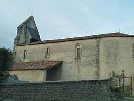 The church of Saint-Girons, in Fichous-Riumayou | |
 Fichous-Riumayou Location within Nouvelle-Aquitaine region  Fichous-Riumayou | |
| Coordinates: 43°29′09″N 0°26′49″W / 43.4858°N 0.4469°WCoordinates: 43°29′09″N 0°26′49″W / 43.4858°N 0.4469°W | |
| Country | France |
| Region | Nouvelle-Aquitaine |
| Department | Pyrénées-Atlantiques |
| Arrondissement | Pau |
| Canton | Artix et Pays de Soubestre |
| Intercommunality | Communauté de communes du canton d'Arzacq |
| Government | |
| • Mayor (2014–2020) | Joël Pintadou |
| Area1 | 6.41 km2 (2.47 sq mi) |
| Population (2013)2 | 182 |
| • Density | 28/km2 (74/sq mi) |
| Time zone | UTC+1 (CET) |
| • Summer (DST) | UTC+2 (CEST) |
| INSEE/Postal code | 64226 /64410 |
| Elevation |
120–250 m (390–820 ft) (avg. 242 m or 794 ft) |
|
1 French Land Register data, which excludes lakes, ponds, glaciers > 1 km2 (0.386 sq mi or 247 acres) and river estuaries. 2 Population without double counting: residents of multiple communes (e.g., students and military personnel) only counted once. | |
Fichous-Riumayou is a commune in the Pyrénées-Atlantiques department and Nouvelle-Aquitaine region of south-western France.
See also
References
| Wikimedia Commons has media related to Fichous-Riumayou. |
This article is issued from
Wikipedia.
The text is licensed under Creative Commons - Attribution - Sharealike.
Additional terms may apply for the media files.