Clayfield, Queensland
| Clayfield Brisbane, Queensland | |||||||||||||||
|---|---|---|---|---|---|---|---|---|---|---|---|---|---|---|---|
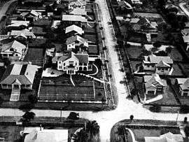 Aerial view of houses in the suburb in 1930 | |||||||||||||||
| Population | 10,555 (2016 census)[1] | ||||||||||||||
| • Density | 3,640/km2 (9,430/sq mi) | ||||||||||||||
| Postcode(s) | 4011 | ||||||||||||||
| Area | 2.9 km2 (1.1 sq mi) | ||||||||||||||
| Location | 7 km (4 mi) from Brisbane CBD | ||||||||||||||
| LGA(s) |
City of Brisbane (Hamilton Ward)[2] | ||||||||||||||
| State electorate(s) | Clayfield | ||||||||||||||
| Federal Division(s) | Brisbane | ||||||||||||||
| |||||||||||||||
Clayfield is an inner northern suburb in the City of Brisbane, Queensland, Australia.[3] It is approximately 7 kilometres (4 mi) from the Brisbane CBD. Clayfield is bordered to the north by Nundah, to the east by Ascot and Hendra, to the west by Wooloowin and to the south by Albion.
Its name derives from the fine white-grey sedimentary clay mined in Albion, between Morgan and Sykes Street, used in the brickworks that once existed between Oriel Road and Reeve Street near Sandgate Road.[3] This industry, once known as "the clay fields", was instrumental in the residential surge of European settlement of inner-north Brisbane.
Kalinga Park and the Kalinga locality lay on the northern limit. Clayfield also encompasses the locality of Eagle Junction.
Demographics
In the 2011 census, Clayfield recorded a population of 10,006 people, 52.6% female and 47.4% male.
The median age of the Clayfield population was 34 years of age, 3 years below the Australian median.
70.3% of people living in Clayfield were born in Australia, compared to the national average of 69.8%; the next most common countries of birth were New Zealand 3.7%, England 3.6%, India 2.5%, Philippines 0.8%, and China 0.8%.
81.9% of people spoke only English at home; the next most popular languages were 1% Italian, 1% Mandarin, 0.7% Punjabi, 0.7% Korean, and 0.7% Hindi.
Heritage listings
Clayfield has a number of heritage-listed sites, including:
- 3 London Road: Lyndhurst[4]
- 8 London Road: Turrawan[5]
- 18 Tarranalma Avenue: Tarranalma[6]
- 25 Enderley Road: Stanley Hall[7]
- 40 Enderley Road: Ralahyne[8]
Facilities
Transport
Clayfield was served by an electric tram line which ran along Sandgate Road until its closure on 13 April 1969. It is now served by bus and train services from the nearby Clayfield railway station and Eagle Junction railway station. Along the capital road (Alexandra Road), a canopy of poinciana and oak trees produce a 'New England' canopy effect.
Education
Schools located within Clayfield include:
- Aviation High
- Clayfield College
- Eagle Junction State Primary School
- St Rita's College
Other schools that serve the Clayfield area include:
- Ascot State Primary School[9]
- Hendra State Primary School[10]
- Holy Cross School,[11] Wooloowin
- Kedron State High School
- Mary MacKillop College,[12] Nundah
- Nundah State Primary School[13]
- Our Lady Help of Christians,[14] Hendra
- St Margaret's Anglican Girls' School, Ascot
- Wooloowin State Primary School[15]
Places of worship
Churches that are located in Clayfield include:
- Clayfield Baptist Church
- Clayfield Gospel Hall
- Clayfield Uniting Church
- St Agatha's Catholic Church
- St Mark's Anglican Church
- Scots Presbyterian Church
Notable residents
- Timothy Joseph O'Leary (1925-1987), flying doctor[16]
- Richard Frank Tunley, developer of educational resources for blind children[17]
- Mary Hyacinthe Petronel White (1900-1984), women's rights campaigner and local government councillor[18]
References
- ↑ Australian Bureau of Statistics (27 June 2017). "Clayfield (State Suburb)". 2016 Census QuickStats. Retrieved 25 October 2013.

- ↑ "Hamilton Ward". Brisbane City Council. Brisbane City Council. Archived from the original on 12 March 2017. Retrieved 12 March 2017.
- 1 2 "Clayfield (entry 44198)". Queensland Place Names. Queensland Government. Retrieved 27 July 2014.
- ↑ "Lyndhurst (entry 601841)". Queensland Heritage Register. Queensland Heritage Council. Retrieved 6 July 2013.
- ↑ "Clayfield House (entry 602452)". Queensland Heritage Register. Queensland Heritage Council. Retrieved 6 July 2013.
- ↑ "Tarranalma (entry 600184)". Queensland Heritage Register. Queensland Heritage Council. Retrieved 6 July 2013.
- ↑ "Stanley Hall (entry 600183)". Queensland Heritage Register. Queensland Heritage Council. Retrieved 6 July 2013.
- ↑ "Ralahyne (entry 600182)". Queensland Heritage Register. Queensland Heritage Council. Retrieved 6 July 2013.
- ↑ "Ascot State Primary School". Archived from the original on 24 November 2003. Retrieved 19 October 2012.
- ↑ "Hendra State Primary School". Archived from the original on 27 July 2012. Retrieved 19 October 2012.
- ↑ "Holy Cross School". Archived from the original on 6 July 2011. Retrieved 19 October 2012.
- ↑ "Mary MacKillop College". Archived from the original on 27 October 2012. Retrieved 19 October 2012.
- ↑ "Nundah State Primary School". Archived from the original on 1 January 2013. Retrieved 19 October 2012.
- ↑ "Our Lady Help of Christians". Archived from the original on 6 July 2011. Retrieved 19 October 2012.
- ↑ "Wooloowin State Primary School". Archived from the original on 10 August 2012. Retrieved 19 October 2012.
- ↑ Smithurst, Barry. O'Leary, Timothy Joseph (Tim) (1925–1987). Canberra: National Centre of Biography, Australian National University. Archived from the original on 3 March 2016. Retrieved 3 August 2015.
- ↑ Buzacott-Speer, Eliza; Begley, Terri (16 October 2017). "Rare 1950s Braille globe designed by Queensland inventor to be digitised for new generation". ABC News. Australian Broadcasting Corporation. Archived from the original on 16 October 2017. Retrieved 14 May 2017.
- ↑ Hacker, Diane. White, Mary Hyacinthe Petronel (1900–1984). Canberra: National Centre of Biography, Australian National University. Archived from the original on 26 September 2015. Retrieved 3 August 2015.
External links
| Wikimedia Commons has media related to Clayfield, Queensland. |
- University of Queensland: Queensland Places: Clayfield
- "Clayfield". BRISbites. Brisbane City Council. Archived from the original on 20 July 2008.
- "Clayfield". Our Brisbane. Brisbane City Council. Archived from the original on 17 December 2007.