Shire of Greenough
| Shire of Greenough Western Australia | |||||||||||||||
|---|---|---|---|---|---|---|---|---|---|---|---|---|---|---|---|
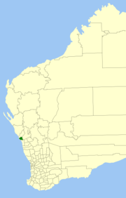 Location in Western Australia | |||||||||||||||
| Population | 15,394 (2007)[1] | ||||||||||||||
| • Density | 8.7865/km2 (22.7570/sq mi) | ||||||||||||||
| Established | 1951 | ||||||||||||||
| Abolished | 2007 | ||||||||||||||
| Area | 1,752.0 km2 (676.5 sq mi) | ||||||||||||||
| Mayor | E J (John) Sewell | ||||||||||||||
| Council seat | Utakarra | ||||||||||||||
| Region | Mid West | ||||||||||||||
| State electorate(s) | Greenough | ||||||||||||||
| Federal Division(s) | O'Connor | ||||||||||||||
|
| |||||||||||||||
| |||||||||||||||
The Shire of Greenough was a local government area in the Mid West region of Western Australia, 420 kilometres (261 mi) north of the state capital, Perth surrounding the city of Geraldton. The Shire covered an area of 1,752 square kilometres (676.5 sq mi), and its seat of government was the outer Geraldton suburb of Utakarra.
Historically a rural area, with the growth of Geraldton in recent years as a port and city, the areas of the Shire closest to Geraldton became increasingly urbanised. The council amalgamated with the City of Geraldton in 2007 to form the City of Geraldton-Greenough. On 1 July 2011 it became part of the City of Greater Geraldton.
History
The Greenough and Geraldton Road Boards – the latter not to be confused with the Geraldton Municipality – were gazetted in 1871. Initially, Greenough included all of Murchison, which split away in 1875 and Mullewa, which formed in 1911. In 1951, Geraldton and Greenough merged, and in 1961 became the Shire of Geraldton-Greenough following the enactment of the Local Government Act 1960. In 1965, it was renamed the Shire of Greenough.[2]
Amalgamation
A recommendation was made to the Minister for Local Government by the Local Government Advisory Board in August 2006 to amalgamate the Shire of Greenough with the City of Geraldton.
The Greenough electors successfully petitioned for a referendum to determine whether amalgamation should proceed. This was held on 2 December 2006, and with a participation rate of 28.74%, a majority of 80% voted against the proposal.[3] However, under the Local Government Act 1995 (clause 10 of Schedule 2.1) as the vote did not attract 50% of registered voters, it did not meet the requirements for a valid poll.[4]
The councillors of both local government authorities resigned at the end of April 2007, and the first elections for new councillors took place in October 2007.
Wards
The Shire was divided into four wards until 2005 – West and Tarcoola Wards, each with four councillors, and North and South wards, each with two councillors. In May 2005, due to a redistribution of boundaries, the Central and Wandina Wards, each with four councillors, and the Chapman North Ward with three councillors were created.
Towns and localities
|
Localities/Suburbs:
|
|
Towns: |
Population
| Year | Population |
|---|---|
| 1921 | 1,375 |
| 1933 | 1,556 |
| 1947 | 1,567 |
| 1954 | 1,371 |
| 1961 | 1,321 |
| 1966 | 1,594 |
| 1971 | 1,920 |
| 1976 | 2,979 |
| 1981 | 4,612 |
| 1986 | 5,798 |
| 1991 | 7,626 |
| 1996 | 10,337 |
| 2001 | 11,927 |
| 2006 | 13,545 |
References
- ↑ Australian Bureau of Statistics (31 March 2008). "Regional Population Growth, Australia, 2007–08 – Western Australia". Retrieved 11 October 2009.
- ↑ WA Electoral Commission, Municipality Boundary Amendments Register (release 2.0), 31 May 2003.
- ↑ Western Australian Electoral Commission (2 December 2006). "Greenough – Voting in Person Referendum". Archived from the original on 30 August 2007. Retrieved 28 April 2007.
- ↑ "Inquiry Reports – Geraldton Greenough Inquiry Report". Local Government Advisory Board. December 2006. Archived from the original on 15 May 2009. Retrieved 28 April 2007.