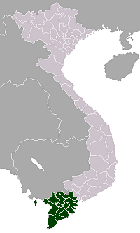
Cần Thơ
| City of Can Tho Thành phố Cần Thơ | |
|---|---|
| Municipality | |
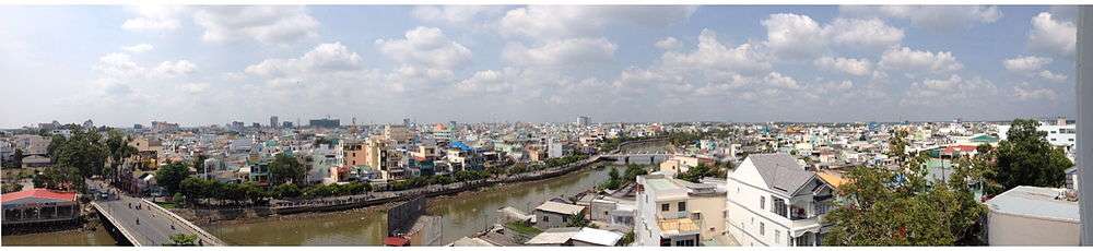
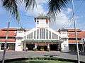
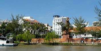 Cityscape of Cần Thơ | |
| Nickname(s): "The capital of the West" (Tây Đô) | |
 Can Tho city map | |
| Coordinates: 10°02′N 105°47′E / 10.033°N 105.783°E | |
| Country | Vietnam |
| Region | Mekong Delta |
| Founded | 1789 |
| Area[1] | |
| • Total | 1,408.9 km2 (544.0 sq mi) |
| Elevation | 0 m (0 ft) |
| Population (2018) | |
| • Total | 1,520,000 |
| • Density | 1,100/km2 (2,800/sq mi) |
| Time zone | UTC+07:00 (ICT) |
| Postal code | 90xxxx |
| Area codes | 292 |
| Vehicle registration | 65 |
| GDP (nominal) | 2013 |
| - Total | 3.6 billion USD |
| - Per capita | 2,980 USD[2] |
| Climate | Aw |
| Website | cantho.gov.vn |
| Cần Thơ | |
.svg.png) "Cần Thơ" in chữ Hán (Chinese characters) | |
| Vietnamese name | |
|---|---|
| Vietnamese alphabet | Cần Thơ |
| Chữ Hán | 芹苴 |
Cần Thơ (Standard Vietnamese: Vietnamese: [kə̂n tʰəː] (![]()
![]()
It is noted for its floating market, rice paper-making village, and picturesque rural canals.[4] It had a population of 1.2 million as of 2011, it has population of 1,520,000 until June 2018, and is located on the south bank of the Hau River, a distributary of the Mekong River. In 2007, about 50 people died when the Cần Thơ Bridge collapsed, causing Vietnam's worst engineering disaster.[5] In 2011, Can Tho International Airport opened.[6]
The city is nicknamed the "western capital" (Tây Đô), and is located 169 kilometres (105 miles) from Ho Chi Minh City.
Administrative system
The city is an independent municipality at the same level as provinces of Vietnam. It was created in the beginning of 2004 by a split of the former Cần Thơ Province into two new administrative units: Cần Thơ City and Hậu Giang Province.
Cần Thơ is subdivided into nine district-level sub-divisions:
- 5 urban districts:
- 4 rural districts:
They are further subdivided into five commune-level towns (or townlets), 36 communes, and 44 wards.
Ninh Kiều, which has the well-known port Ninh Kiều port, is the center district and also the most populated and wealthiest of these districts.[7]
The city borders the provinces of An Giang, Hậu Giang, Kiên Giang, Vĩnh Long and Đồng Tháp.
Transportation

Cần Thơ is connected to the rest of the country by National Route 1A and Can Tho International Airport. The city's bridge which is now completed, is the longest cable-stayed bridge in south-east Asia. The six-lane Saigon–Cần Thơ Expressway is being built in parts from Hồ Chí Minh City to Mỹ Tho. The hydrofoil express boat links this city with Ho Chi Minh City. . There are many vehicles here such as: taxi, grab bikes, buses, van, coaches and so on.
Tourism
The Mekong Delta is considered to be the "rice basket of Vietnam", contributing more than half of the nation's rice production. People say of Cần Thơ:
| “ | Cần Thơ gạo trắng nước trong,
Ai đi đến đó lòng không muốn về. |
” |
| “ | Cần Thơ, white rice, pure water,
All who come wish never to leave. |
” |
Cần Thơ is famous for its floating markets, where people sell and buy things on the river, as well as the bird gardens and the port of Ninh Kiều. The city offers a wide range of tropical fruits such as pomelo, longan, jackfruit, mango, guava, banana, rambutan, mangosteen, dragon fruit and durian. The Cần Thơ City Museum has exhibits on the city's history.[8]
Tourist attractions
- Cần Thơ Bridge
- Thiền viện Trúc Lâm Phương Nam - Buddhist Temple
- Nam Nhã Pagoda
- Bình Thủy Temple
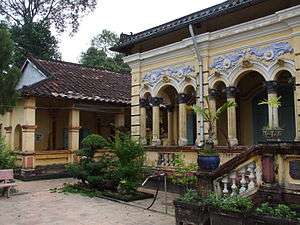
- BInh Thuy Ancient House[9]
- Ninh Kiều Quay
- Cần Thơ pedestrian bridge
- Cái Răng Floating Market, Phong Điền Floating Market
- Bằng Lăng Stork Sanctuary (Thốt Nốt district)
- Canal Tour
- Cantho Cathedral
- Ông Chinese Pagoda
- Pitu Khôsa Răngsey Khmer Pagoda
- Quang Duc Pagoda
- Long Quang Pagoda
- Phat Hoc Pagoda[10]
- My Khanh tourist village
- Can Tho seminary
Education
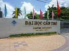
Academic institutions in the city are Cần Thơ University, Cần Thơ Department of Education and Training, Cần Thơ University of Medicine and Pharmacy, Tây Đô University, Nam Cần Thơ University, Cần Thơ College, College of Foreign Economic Relations – Cần Thơ Branch, Medical College, Can Tho Technical Economic College[11] and Vocational College, with its well-known College of Agriculture and Mekong Delta Rice Research Institute, Cần Thơ University of Technology
Climate
Cần Thơ's climate is tropical and monsoonal with two seasons: rainy, from May to November; and dry, from December to April. Average annual humidity is 83%, rainfall 1,635 mm (64 in) and temperature 27 °C (81 °F).
| Climate data for Cần Thơ | |||||||||||||
|---|---|---|---|---|---|---|---|---|---|---|---|---|---|
| Month | Jan | Feb | Mar | Apr | May | Jun | Jul | Aug | Sep | Oct | Nov | Dec | Year |
| Record high °C (°F) | 34.2 (93.6) |
35.2 (95.4) |
38.5 (101.3) |
40.0 (104) |
38.3 (100.9) |
37.3 (99.1) |
36.8 (98.2) |
35.5 (95.9) |
34.8 (94.6) |
35.8 (96.4) |
34.2 (93.6) |
34.0 (93.2) |
40.0 (104) |
| Average high °C (°F) | 30.0 (86) |
30.9 (87.6) |
32.5 (90.5) |
33.4 (92.1) |
32.9 (91.2) |
31.6 (88.9) |
31.1 (88) |
30.7 (87.3) |
30.7 (87.3) |
30.5 (86.9) |
30.2 (86.4) |
29.3 (84.7) |
31.1 (88) |
| Daily mean °C (°F) | 25.2 (77.4) |
25.9 (78.6) |
27.1 (80.8) |
28.3 (82.9) |
27.7 (81.9) |
27.0 (80.6) |
26.7 (80.1) |
26.6 (79.9) |
26.6 (79.9) |
26.7 (80.1) |
26.6 (79.9) |
25.4 (77.7) |
26.6 (79.9) |
| Average low °C (°F) | 22.1 (71.8) |
22.6 (72.7) |
23.7 (74.7) |
24.9 (76.8) |
25.0 (77) |
24.5 (76.1) |
24.3 (75.7) |
24.2 (75.6) |
24.3 (75.7) |
24.3 (75.7) |
24.1 (75.4) |
22.6 (72.7) |
23.9 (75) |
| Record low °C (°F) | 14.8 (58.6) |
17.3 (63.1) |
17.5 (63.5) |
19.2 (66.6) |
18.7 (65.7) |
19.0 (66.2) |
19.5 (67.1) |
19.7 (67.5) |
17.8 (64) |
18.7 (65.7) |
17.5 (63.5) |
16.5 (61.7) |
14.8 (58.6) |
| Average rainfall mm (inches) | 9 (0.35) |
2 (0.08) |
8 (0.31) |
40 (1.57) |
177 (6.97) |
218 (8.58) |
228 (8.98) |
240 (9.45) |
261 (10.28) |
321 (12.64) |
133 (5.24) |
38 (1.5) |
1,674 (65.91) |
| Average rainy days | 1.8 | 0.7 | 1.7 | 5.6 | 16.1 | 20.5 | 21.7 | 22.3 | 22.9 | 22.2 | 14.2 | 6.3 | 155.8 |
| Average relative humidity (%) | 81.6 | 80.1 | 78.3 | 79.3 | 84.3 | 87.0 | 86.7 | 87.5 | 87.9 | 87.1 | 84.9 | 82.8 | 84.0 |
| Mean monthly sunshine hours | 257 | 246 | 287 | 262 | 212 | 176 | 181 | 175 | 164 | 177 | 195 | 228 | 2,561 |
| Source: Vietnam Institute for Building Science and Technology[12] | |||||||||||||
Economy
After 120 years of development, the city now is the delta's most important center of economics, culture, science, and technology. It has a large freshwater port and two industrial parks.
Twin towns and sister cities


Gallery
 Cần Thơ market
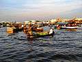 Floating market
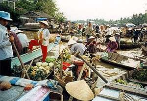 Floating market
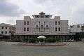 Museum of People's Armed Forces
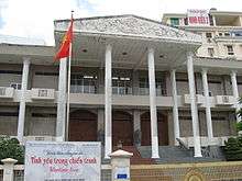 Cần Thơ Museum
References
- ↑ Statistical Handbook of Vietnam 2014 Archived 6 July 2015 at the Wayback Machine., General Statistics Office of Vietnam
- ↑ http://bizlive.vn/kinh-te-dau-tu/can-tho-thu-nhap-binh-quan-dau-nguoi-nam-2013-dat-629-trieu-dong-57775.html
- ↑ "Trang chu". Cổng Thông tin Điện tử thành phố Cần Thơ – CANTHO PORTAL (in Vietnamese and English). Ghi rõ nguồn "CanTho Portal" khi phát hành lại thông tin từ Portal này. 2012. Retrieved 15 October 2012.
- 1 2 Ron Emmons (7 February 2012). Frommer's Vietnam: with Angkor Wat. John Wiley & Sons. ISBN 978-1-118-11997-6. Retrieved 15 October 2012.
- ↑ Jessica Rowson (3 October 2007). "50 deaths in Can Tho bridge collapse". New Civil Engineer. EMAP Ltd. Retrieved 15 October 2012.
- ↑ Emmons, p. 342.
- ↑ SGT (13 April 2012). "Ca Ba Old House is Can Tho classic". Vietnam.net Bridge. VIETNAMNET Bridge. Retrieved 15 October 2012.
- ↑ Emmons, p. 345.
- ↑ https://www.alotrip.com/guide-vietnam-attractions/binh-thuy-ancient-house
- ↑ https://www.citypassguide.com/en/travel/can-tho/attractions/pagodas/phat-hoc-pagoda
- ↑ http://www.ctec.edu.vn/ctec2013/
- ↑ "Vietnam Building Code Natural Physical & Climatic Data for Construction" (PDF) (in Vietnamese). Vietnam Institute for Building Science and Technology. Archived from the original (PDF) on 22 July 2018. Retrieved 23 July 2018.
External links
| Wikimedia Commons has media related to Can Tho. |
| Wikivoyage has a travel guide for Cần Thơ. |
Places adjacent to Cần Thơ | |
|---|---|
Districts of the Mekong River Delta | ||
|---|---|---|
| Cần Thơ city |
|  |
| An Giang Province | ||
| Bạc Liêu Province | ||
| Bến Tre Province | ||
| Cà Mau Province | ||
| Đồng Tháp Province | ||
| Hậu Giang Province |
| |
| Kiên Giang Province | ||
| Long An Province | ||
| Sóc Trăng Province | ||
| Tiền Giang Province |
| |
| Trà Vinh Province | ||
| Vĩnh Long Province | ||
※ denotes provincial seat. | ||
Coordinates: 10°02′N 105°47′E / 10.033°N 105.783°E
| Authority control |
|---|