Sơn La Province
| Sơn La Province Tỉnh Sơn La | |
|---|---|
| Province | |
 | |
 Location of Sơn La within Vietnam | |
| Coordinates: 21°10′N 104°0′E / 21.167°N 104.000°ECoordinates: 21°10′N 104°0′E / 21.167°N 104.000°E | |
| Country |
|
| Region | Northwest |
| Capital | Sơn La |
| Area | |
| • Total | 14,055 km2 (5,427 sq mi) |
| Population (2004) | |
| • Total | 972,800 |
| • Density | 69/km2 (180/sq mi) |
| Demographics | |
| • Ethnicities | Vietnamese, Tai, H'Mông, Mường, Dao |
| Time zone | UTC+7 (ICT) |
| Area codes | 212 |
| ISO 3166 code | VN-05 |
| Website |
www |
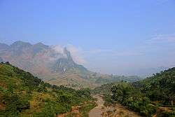
Sơn La (![]()
Sơn La Dam, the largest hydroelectric power station in Southeast Asia.[1] is located in this province.
Administrative divisions
Sơn La is subdivided into 12 district-level sub-divisions:
| Second Tier subdivisions |
Area (km²) |
Third Tier subdivisions | ||
|---|---|---|---|---|
| Ward | Township | Commune | ||
| Sơn La city | 324.93 | 7 | 5 | |
| Bắc Yên District | 1099.36 | 1 | 15 | |
| Mai Sơn District | 1410.30 | 1 | 21 | |
| Mộc Châu District | 1081.66 | 2 | 13 | |
| Mường La District | 1407.90 | 1 | 15 | |
| Phù Yên District | 1227.00 | 1 | 26 | |
| Quỳnh Nhai District | 1049.07 | 11 | ||
| Sông Mã District | 1639.72 | 1 | 19 | |
| Sốp Cộp District | 1477.00 | 9 | ||
| Thuận Châu District | 1535.07 | 1 | 28 | |
| Vân Hồ District | 979.84 | 14 | ||
| Yên Châu District | 843.00 | 1 | 14 | |
They are further subdivided into nine commune-level towns (or townlets), 188 communes, and seven wards.
Etymology
The province's name derives from Sino-Vietnamese 山羅.
See also
- Nà Sản Airport
- Mộc Châu plateau
References
- ↑ "Huge hydro plant starts operation in Vietnam, says official". Intellasia News Services. 2010-12-22. Retrieved 2011-01-22.
External links
Places adjacent to Sơn La Province | |
|---|---|
This article is issued from
Wikipedia.
The text is licensed under Creative Commons - Attribution - Sharealike.
Additional terms may apply for the media files.