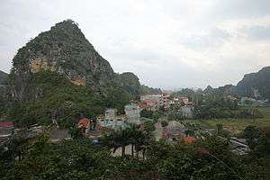
Lạng Sơn
Coordinates: 21°50′52″N 106°45′28″E / 21.84778°N 106.75778°E
| Lạng Sơn Thành phố Lạng Sơn | |
|---|---|
| Provincial city (Class-3) | |
 | |
 Lạng Sơn Location in Vietnam | |
| Coordinates: 21°50′52″N 106°45′28″E / 21.84778°N 106.75778°E | |
| Country |
|
| Province | Lạng Sơn Province |
| Area | |
| • Total | 79 km2 (31 sq mi) |
| Population (2007) | |
| • Total | 148,000 |
| Climate | Cwa |
Lạng Sơn (![]()
History
Due to its geography as Vietnam's gateway to China, Lạng Sơn and its ancient citadel have been in the path of many invasions, and were the site of three French defeats during the colonial era. Occupied by Qing forces during the military buildup that preceded the Sino-French War, the city was occupied by France after the two-week Lạng Sơn Campaign in February 1885. However, the brigade there conducted a hasty retreat after a failed attack at the Battle of Bang Bo into China; the "retreat from Lạng Sơn" became the most controversial aspect of the war and led to the fall of Jules Ferry's ministry.[1] Outnumbered French colonial forces clashed with the Japanese 5th Division in the Battle of Lạng Sơn during the Japanese Vietnam Expedition on 22 September 1940. The French were again compelled to retreat hastily.[2] In 1945 it was again the scene of heavy fighting during the Japanese coup d'état in French Indochina.
After the end of the Pacific War, the French colonial army established a permanent garrison there, which served as the logistics hub for the French border fortresses. It was evacuated in 1950 during Võ Nguyên Giáp's offensive against the French border forts, considered a turning point in the Indochina War. The city was the center of fighting during the Sino-Vietnamese War of 1979, and sustained extensive damage.
Geology and climate

The surface rocks in the area are a Permian limestone, overlain by the early Triassic Lang Son Formation, consisting of flyschoid beds with interbedded sandstones, siltstones and clay shales and some felsic volcanics.[3]
| Climate data for Lạng Sơn | |||||||||||||
|---|---|---|---|---|---|---|---|---|---|---|---|---|---|
| Month | Jan | Feb | Mar | Apr | May | Jun | Jul | Aug | Sep | Oct | Nov | Dec | Year |
| Record high °C (°F) | 31.6 (88.9) |
36.4 (97.5) |
36.7 (98.1) |
38.6 (101.5) |
39.8 (103.6) |
37.6 (99.7) |
37.6 (99.7) |
37.1 (98.8) |
36.6 (97.9) |
35.2 (95.4) |
33.0 (91.4) |
32.2 (90) |
39.8 (103.6) |
| Average high °C (°F) | 17.6 (63.7) |
18.3 (64.9) |
21.8 (71.2) |
26.3 (79.3) |
30.1 (86.2) |
31.3 (88.3) |
31.6 (88.9) |
31.2 (88.2) |
30.1 (86.2) |
27.2 (81) |
23.5 (74.3) |
20.0 (68) |
25.7 (78.3) |
| Daily mean °C (°F) | 13.1 (55.6) |
14.3 (57.7) |
17.9 (64.2) |
22.2 (72) |
25.5 (77.9) |
26.8 (80.2) |
27.2 (81) |
26.6 (79.9) |
25.2 (77.4) |
22.1 (71.8) |
18.2 (64.8) |
14.6 (58.3) |
21.1 (70) |
| Average low °C (°F) | 10.1 (50.2) |
11.6 (52.9) |
15.2 (59.4) |
19.2 (66.6) |
22.0 (71.6) |
23.7 (74.7) |
24.0 (75.2) |
23.7 (74.7) |
22.0 (71.6) |
18.5 (65.3) |
14.6 (58.3) |
10.9 (51.6) |
17.9 (64.2) |
| Record low °C (°F) | −2.1 (28.2) |
−1.7 (28.9) |
0.9 (33.6) |
6.2 (43.2) |
11.1 (52) |
15.1 (59.2) |
18.6 (65.5) |
17.0 (62.6) |
13.2 (55.8) |
7.1 (44.8) |
1.7 (35.1) |
−1.5 (29.3) |
−2.1 (28.2) |
| Average precipitation mm (inches) | 31 (1.22) |
38 (1.5) |
49 (1.93) |
97 (3.82) |
167 (6.57) |
189 (7.44) |
229 (9.02) |
232 (9.13) |
130 (5.12) |
82 (3.23) |
36 (1.42) |
20 (0.79) |
1,301 (51.22) |
| Average precipitation days | 9.5 | 10.4 | 13.2 | 13.1 | 13.5 | 15.4 | 16.4 | 17.0 | 12.7 | 9.4 | 6.4 | 5.6 | 142.7 |
| Average relative humidity (%) | 79.6 | 82.3 | 83.4 | 82.8 | 81.2 | 82.8 | 83.6 | 85.4 | 84.1 | 81.3 | 78.8 | 77.3 | 81.9 |
| Mean monthly sunshine hours | 77 | 58 | 62 | 96 | 176 | 162 | 184 | 174 | 181 | 161 | 137 | 121 | 1,589 |
| Source: Vietnam Institute for Building Science and Technology[4] | |||||||||||||
See also
References
- ↑ Mayeur, Jean-Marie; Rebérioux, Madeleine (1984). The Third Republic from Its Origins to the Great War, 1871-1914. Translated by Foster,, J. R. Cambridge, England: Cambridge University Press. pp. 96–99. ISBN 978-0-521-24931-7. original titles Les débuts de la Troisième République 1871-1898 by Jean-Marie Mayeur and La République radicale? 1898-1914 by Madeleine Rebérioux.
- ↑ Hy V. Luong - Tradition, Revolution, and Market Economy in a North Vietnamese ... 2010- Page 37 "In March 1885, as Chinese troops from Kwangsi defeated a French force of 35,000 in Lạng-Sơn, Black Flag troops ..."
- ↑ Journal of Geology - Issues 15-20 2000 - Page 8 "Lang Sơn Formation of Induan age, lying unconformably upon Upper Permian limestone in the vicinities of Lạng Sơn Town, Bản Thí, Đông Mỏ, Chợ Bãi and Hữu Lũng, includes medium-grained sandstone rhythmically interbedded with .."
- ↑ "Vietnam Building Code Natural Physical & Climatic Data for Construction" (PDF). Vietnam Institute for Building Science and Technology. Archived from the original (PDF) on 22 July 2018. Retrieved 3 August 2018.
