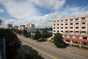
Quảng Ngãi
| Quảng Ngãi Thành phố Quảng Ngãi | |
|---|---|
| Provincial city (Class-2) | |
 | |
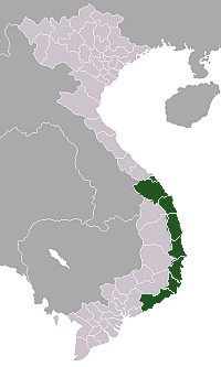
 Quảng Ngãi Location of Quảng Ngãi in Vietnam | |
| Coordinates: 15°7′N 108°48′E / 15.117°N 108.800°E | |
| Country |
|
| Province | Quảng Ngãi Province |
| Area | |
| • Total | 160.1534 km2 (61.8356 sq mi) |
| Population (2013) | |
| • Total | 260,252 |
| • Density | 1,625/km2 (4,210/sq mi) |
| Time zone | UTC+07:00 (Indochina Time) |
| Climate | Am |
Quảng Ngãi (![]()
Climate
Quảng Ngãi has a tropical monsoon climate (Köppen Am). Temperatures are very warm to hot year round, although they do fall substantially between October and March. The rainy season lasts from August to mid-January with a major risk of typhoons and the dry season is from late-January to mid-July.
| Climate data for Quảng Ngãi | |||||||||||||
|---|---|---|---|---|---|---|---|---|---|---|---|---|---|
| Month | Jan | Feb | Mar | Apr | May | Jun | Jul | Aug | Sep | Oct | Nov | Dec | Year |
| Record high °C (°F) | 33.6 (92.5) |
35.3 (95.5) |
37.6 (99.7) |
39.4 (102.9) |
39.5 (103.1) |
41.4 (106.5) |
40.3 (104.5) |
40.3 (104.5) |
39.0 (102.2) |
34.6 (94.3) |
33.7 (92.7) |
32.1 (89.8) |
41.4 (106.5) |
| Average high °C (°F) | 25.7 (78.3) |
27.1 (80.8) |
29.5 (85.1) |
31.9 (89.4) |
33.6 (92.5) |
34.2 (93.6) |
34.4 (93.9) |
34.2 (93.6) |
32.0 (89.6) |
29.6 (85.3) |
27.4 (81.3) |
25.3 (77.5) |
30.4 (86.7) |
| Daily mean °C (°F) | 21.6 (70.9) |
22.4 (72.3) |
24.3 (75.7) |
26.6 (79.9) |
28.3 (82.9) |
28.9 (84) |
28.9 (84) |
28.6 (83.5) |
27.2 (81) |
25.7 (78.3) |
24.0 (75.2) |
22.2 (72) |
25.7 (78.3) |
| Average low °C (°F) | 19.2 (66.6) |
19.7 (67.5) |
21.1 (70) |
23.1 (73.6) |
24.7 (76.5) |
25.2 (77.4) |
24.9 (76.8) |
24.9 (76.8) |
24.1 (75.4) |
23.2 (73.8) |
21.8 (71.2) |
19.9 (67.8) |
22.6 (72.7) |
| Record low °C (°F) | 12.4 (54.3) |
14.1 (57.4) |
13.4 (56.1) |
17.3 (63.1) |
19.6 (67.3) |
20.0 (68) |
21.1 (70) |
20.0 (68) |
20.6 (69.1) |
17.0 (62.6) |
15.5 (59.9) |
12.9 (55.2) |
12.4 (54.3) |
| Average precipitation mm (inches) | 123 (4.84) |
41 (1.61) |
38 (1.5) |
49 (1.93) |
99 (3.9) |
110 (4.33) |
92 (3.62) |
126 (4.96) |
303 (11.93) |
639 (25.16) |
563 (22.17) |
284 (11.18) |
2,466 (97.09) |
| Average precipitation days | 14.8 | 8.4 | 5.5 | 5.8 | 9.7 | 8.9 | 9.9 | 12.2 | 16.4 | 20.7 | 22.2 | 21.5 | 156.2 |
| Average relative humidity (%) | 87.5 | 86.6 | 85.2 | 83.3 | 81.1 | 79.7 | 79.1 | 80.3 | 84.7 | 87.6 | 88.4 | 88.5 | 84.3 |
| Mean monthly sunshine hours | 125 | 154 | 209 | 231 | 259 | 237 | 251 | 232 | 193 | 157 | 111 | 90 | 2,248 |
| Source: Vietnam Institute for Building Science and Technology[1] | |||||||||||||
Tourism
Quảng Ngãi has benefited little from Vietnamese tourist industry. English is not widely spoken, and most hotels deal only with Vietnamese customers.
Local attractions include:
- Mỹ Lai Massacre Memorial Museum (12 km from Quảng Ngãi)
- Ba Tơ Garden
- Quảng Ngãi Square (Phạm Văn Đồng street)
- Trà Khúc River
- Tam Thương Quay
- Thiên Bút Hill
- General Museum of Quảng Ngãi Province
- Ly Son Island
- My Khe Beach
- Châu Sa Champa Citadel (Ancient Amaravati)
Transportation
Quảng Ngãi has rail connections to North-South Railways via Quảng Ngãi railway station. Air transport is served by Chu Lai International Airport in nearby province of Quảng Nam.
References
- ↑ "Vietnam Building Code Natural Physical & Climatic Data for Construction" (PDF). Vietnam Institute for Building Science and Technology. Archived from the original (PDF) on 22 July 2018. Retrieved 31 July 2018.
External links

Coordinates: 15°07′N 108°48′E / 15.117°N 108.800°E
| Da Nang city |
|  |
|---|---|---|
| Bình Định Province | ||
| Bình Thuận Province | ||
| Khánh Hòa Province |
| |
| Ninh Thuận Province | ||
| Phú Yên Province | ||
| Quảng Nam Province | ||
| Quảng Ngãi Province | ||
※ denotes provincial seat. / § Sovereignty over Hoàng Sa & Trường Sa is disputed as 17 October 2018. | ||