Qui Nhơn
| Quy Nhon | |
|---|---|
| Provincial city (Class-1) | |
 Quy Nhon | |
 Quy Nhon Location of in Vietnam | |
| Coordinates: 13°46′N 109°14′E / 13.767°N 109.233°E | |
| Country |
|
| Province | Bình Định |
| Established city | 1986 |
| Area | |
| • Total | 284 km2 (110 sq mi) |
| Population (2009) | |
| • Total | 280,535[1] |
| Climate | Aw |
Quy Nhơn (Vietnamese: [kwi ɲəːŋ] (![]()
History
The town of Quy Nhơn was officially founded in the late 18th century, although its origins stretch back much further to the 11th-century Champa culture, the Tây Sơn dynasty and the 18th century seaport of Thị Nại. During the 1620s the town was host to Portuguese Jesuits who called the place Pulo Cambi.
The city is renowned as the birthplace of 18th century Vietnamese emperor Nguyễn Huệ[2] and, more recently, had a large American military presence during the Vietnam War. Today the city is recognized as a first class city with a geo-economic priority and an urbanized infrastructure. The government describes it as one of the three commercial and tourism centres of the central southern coastal region (with Đà Nẵng and Nha Trang).
Geography
Quy Nhơn has a varied topography, being extremely diversified with mountains and forests, hills, fields, salt marshes, plains, lagoons, lakes, rivers, shorelines, peninsulas and islands. Its coastline is 42 km long with sandy beaches, abundant seafood resources and other natural products of economic value.
The city has sixteen wards: Trần Hưng Đạo, Lê Lợi, Lê Hồng Phong, Trần Phú, Lý Thường Kiệt, Nguyễn Văn Cừ, Đống Đa, Thị Nại, Hải Cảng, Ngô Mây, Ghềnh Ráng, Quang Trung, Nhơn Bình, Nhơn Phú, Bùi Thị Xuân, and Trần Quang Diệu. It has five villages of Nhơn Lý, Nhơn Hội, Nhơn Châu, Nhơn Hải and Phước Mỹ (which was spun off from Tuy Phước District and merged into Quy Nhon city in 2006) with a total area of 284.28 km² and a population of about 284,000 people.
Transportation
Quy Nhơn is served by Vietnam Airlines, VietJet Air, and Jetstar Pacific through Phu Cat Airport, with flights to Hanoi and Ho Chi Minh City.[3]
Quy Nhơn railway station could be reached by a branch off the main line of the North–South railway,[4] but this line was suspended in May 2016. Reunification express trains stop only in Diêu Trì railway station, which is around 10 km west of Quy Nhơn.
Economy
Quy Nhơn is one of the main industrial centres of the South Central Coast, behind only Da Nang and Nha Trang.[5] It is also the major industrial and service centre of Bình Định Province, including its largest industrial facilities at Phu Tai Industrial Park and Nhon Hoi Economic Zone. The city's economic activities include industries, export-imports, seaport services, aquatic product husbandry and tourism. The economic trend, at present, is increasingly service-based at the expense of agriculture, forestry and pisciculture.
Cereals are cultivated on 2548ha of Quy Nhơn's land with an output of 13,021 tons as of 2009, just 2% of the province's total.[6] Other crops included 10,891 tons of vegetables, 2795 tons of sugar-cane, as well as smaller amounts of coconuts, peanuts, and cashew nuts.[6]
Much of the city's industry is concentrated in and around Phu Tai Industrial Park in the west of the city along National Route 1A. Quy Nhon is a major centre of garden furniture manufacturing. It has traditionally been relying on access to wood from Bình Định's forests as well as the Central Highlands provinces of Gia Lai and Kon Tum and even as far as Cambodia's Ratanakiri and Laos' Attapeu Province. Most of the furniture factories are located in Phu Tai Industrial Park. Several chemical enterprises that supply the furniture and wood processing industry have been set up in the vicinity of the industrial park.[7]
Other industries in Quy Nhơn process agricultural and aquatic products, or produce construction materials and paper products.[5] Bidiphar is a pharmaceutical company headquartered in Quy Nhon that is an exception to the city's general focus on basic and wood processing industries. Nhon Hoi Economic Zone is central to the city's and province's industrial development plans. However, as of late 2010 it was still in the early stages of development, with few factories completed.
Quy Nhơn has seen only limited foreign investment. As of 2008, 13 foreign companies employed 1119 people in the city.[6]
Currently the economic structure of Quy Nhơn is a shift towards increasing the proportion of service industries, reducing the rate of agriculture, forestry and fisheries in GDP. The shares of agriculture, forestry and fisheries – industrial and construction – services in GDP in 2006 reached: 36.7% – 28% – 35.3% (planned: 35% – 30% – 35% in 2005 : 38.4% – 26.7% – 34.9%).
- Income per capita in 2010 was 1625 USD / person
Climate
| Climate data for Qui Nhơn | |||||||||||||
|---|---|---|---|---|---|---|---|---|---|---|---|---|---|
| Month | Jan | Feb | Mar | Apr | May | Jun | Jul | Aug | Sep | Oct | Nov | Dec | Year |
| Record high °C (°F) | 34.6 (94.3) |
37.9 (100.2) |
39.8 (103.6) |
42.1 (107.8) |
41.7 (107.1) |
41.4 (106.5) |
39.7 (103.5) |
39.4 (102.9) |
38.9 (102) |
34.7 (94.5) |
34.6 (94.3) |
33.0 (91.4) |
42.1 (107.8) |
| Average high °C (°F) | 26.9 (80.4) |
28.2 (82.8) |
29.9 (85.8) |
31.8 (89.2) |
33.8 (92.8) |
34.4 (93.9) |
34.6 (94.3) |
34.8 (94.6) |
33.0 (91.4) |
30.4 (86.7) |
28.1 (82.6) |
26.5 (79.7) |
31.0 (87.8) |
| Daily mean °C (°F) | 23.2 (73.8) |
24.0 (75.2) |
25.5 (77.9) |
27.5 (81.5) |
29.1 (84.4) |
29.8 (85.6) |
29.9 (85.8) |
29.9 (85.8) |
28.5 (83.3) |
26.8 (80.2) |
25.4 (77.7) |
23.8 (74.8) |
26.9 (80.4) |
| Average low °C (°F) | 21.1 (70) |
21.6 (70.9) |
23.0 (73.4) |
24.9 (76.8) |
26.2 (79.2) |
26.8 (80.2) |
26.8 (80.2) |
26.9 (80.4) |
25.6 (78.1) |
24.5 (76.1) |
23.4 (74.1) |
21.8 (71.2) |
24.4 (75.9) |
| Record low °C (°F) | 15.2 (59.4) |
15.7 (60.3) |
15.8 (60.4) |
19.4 (66.9) |
19.1 (66.4) |
21.7 (71.1) |
20.6 (69.1) |
20.7 (69.3) |
20.5 (68.9) |
17.9 (64.2) |
15.0 (59) |
15.5 (59.9) |
15.2 (59.4) |
| Average precipitation mm (inches) | 64 (2.52) |
28 (1.1) |
24 (0.94) |
31 (1.22) |
84 (3.31) |
64 (2.52) |
38 (1.5) |
62 (2.44) |
227 (8.94) |
549 (21.61) |
437 (17.2) |
199 (7.83) |
1,807 (71.14) |
| Average precipitation days | 13.0 | 6.0 | 4.3 | 4.1 | 8.7 | 7.5 | 7.2 | 8.6 | 16.0 | 20.7 | 21.2 | 19.1 | 136.3 |
| Average relative humidity (%) | 80.9 | 81.9 | 82.7 | 82.6 | 79.7 | 74.2 | 71.4 | 70.4 | 77.9 | 83.4 | 83.6 | 82.6 | 79.3 |
| Mean monthly sunshine hours | 162 | 194 | 251 | 262 | 270 | 243 | 254 | 234 | 193 | 169 | 123 | 115 | 2,470 |
| Source: Vietnam Institute for Building Science and Technology[8] | |||||||||||||
Education
Quy Nhon has two universities: Quy Nhon University and Quang Trung University. As of 2009 they had a total teaching staff of 601 and 23,383 students, 13,704 of whom were female.[6] There were 19,900 primary school students and 28,500 secondary school students.[6]
Notable people
- Xavier Le Pichon (1937–), French geophysicist
Gallery
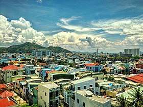 Paranomic view of Qui Nhơn city
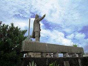 Trần Hưng Đạo monument in Hải Minh, Qui Nhơn.
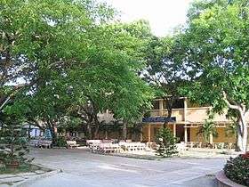
- High school in Qui Nhơn.
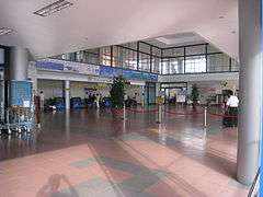
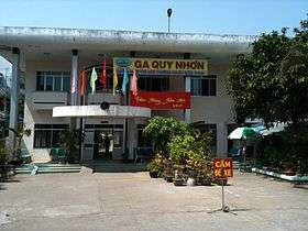 Qui Nhơn train station.
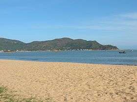
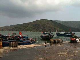 Qui Nhơn beach.
 A port in Qui Nhơn.
 Qui Nhơn.
- Qui Nhơn beach.
References
- 1 2 "Tổng điều tra dân số và nhà ở Việt Nam năm 2009: Kết quả toàn bộ". Ban chỉ đạo Tổng điều tra dân số và nhà ở trung ương. p. 23.
- ↑ Discover Vietnam Archived April 9, 2010, at the Wayback Machine.
- ↑ "Domestic flights in Vietnam". Indochina Travel Service (in Vietnamese and English). Dong Duong Co. 2012. Retrieved 15 October 2012.
- ↑ https://web.archive.org/web/20100418132723/http://www.vr.com.vn/English/hientaihoatdong.html. Archived from the original on April 18, 2010. Retrieved November 21, 2009. Missing or empty
|title=(help) - 1 2 Atlat Dia li Viet Nam (Geographical Atlas of Vietnam). NXB Giao Duc, Hanoi: 2010
- 1 2 3 4 5 Bình Định Statistics Office (2010): Bình Định Statistical Yearbook 2009. Statistical Publishing House, Hanoi
- ↑ People's Committee Bình Định (2007): Yearbook of Information on Enterprises in Bình Định Province. Labour Publishing House, Hanoi: 162-165
- ↑ "Vietnam Building Code Natural Physical & Climatic Data for Construction" (PDF). Vietnam Institute for Building Science and Technology. Archived from the original (PDF) on 22 July 2018. Retrieved 20 July 2018.
Notes
External links
| Wikimedia Commons has media related to Quy Nhon. |

Coordinates: 13°46′N 109°14′E / 13.767°N 109.233°E
| Da Nang city |
|  |
|---|---|---|
| Bình Định Province | ||
| Bình Thuận Province | ||
| Khánh Hòa Province |
| |
| Ninh Thuận Province | ||
| Phú Yên Province | ||
| Quảng Nam Province | ||
| Quảng Ngãi Province | ||
※ denotes provincial seat. / § Sovereignty over Hoàng Sa & Trường Sa is disputed as 17 October 2018. | ||
| Authority control |
|---|