Tây Ninh Province
| Tây Ninh Province Tỉnh Tây Ninh | |
|---|---|
| Province | |
| Nickname(s): Western Security | |
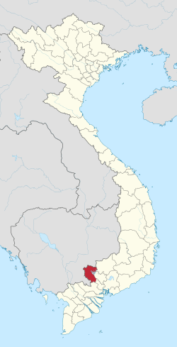 Location of Tây Ninh within Vietnam | |
| Coordinates: 11°20′N 106°10′E / 11.333°N 106.167°ECoordinates: 11°20′N 106°10′E / 11.333°N 106.167°E | |
| Country |
|
| Region | Southeast |
| Capital | Tây Ninh |
| Government | |
| • People's Committee Chair | Phan Thành Thắm |
| Area[1] | |
| • Total | 4,032.6 km2 (1,557.0 sq mi) |
| Area rank | [1] |
| Population (2014) | |
| • Total | 1,104,200 |
| • Density | 270/km2 (710/sq mi) |
| Demographics | |
| • Ethnicities | Vietnamese, Chăm, Khmer, Hoa |
| HDI | |
| • HDI (2011) | 0.537 |
| Time zone | UTC+7 (ICT) |
| Calling code | 66 |
| ISO 3166 code | VN-37 |
| Website |
www |
Tây Ninh is a province in the Southeast region of Vietnam on the border with Cambodia. Its capital is the town of Tây Ninh.
Tây Ninh Province has a population of 989,800 and an area of 4,028 km².
History
As a former Khmer territory, the province is called Raung Damrey. Vietnamese encroached and conquered Raung Damrey in 1770. The Cao Đài religion originated in Tây Ninh. It is the birthplace of Trình Minh Thế, a nationalist and military leader during the end of the First Indochina War.
Administrative divisions
Tây Ninh is subdivided into nine district-level sub-divisions:
- 8 districts:
- 1 provincial city:
- Tây Ninh (capital)
They are further subdivided into eight commune-level towns (or townlets), 80 communes, and seven wards.
References
- 1 2 Statistical Handbook of Vietnam 2014, General Statistics Office Of Vietnam
External links
- Official Tây Ninh Province website

Places adjacent to Tây Ninh Province | |
|---|---|
This article is issued from
Wikipedia.
The text is licensed under Creative Commons - Attribution - Sharealike.
Additional terms may apply for the media files.