Bình Thủy District
| Bình Thủy District Quận Bình Thủy | |
|---|---|
| Urban district | |
 | |
| Country |
|
| Province | Cần Thơ |
| Area | |
| • Total | 27 sq mi (69 km2) |
| Population (2003) | |
| • Total | 87,665 |
| Time zone | UTC+07:00 (Indochina Time) |
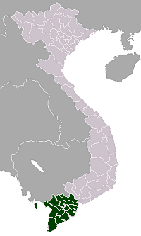
Bình Thủy is a district of Cần Thơ in the Mekong Delta region of Vietnam. His Khmer name is Kâmpoul Meas (កំពូលមាស).[1] As of 2003 the district had a population of 87,665.[2] The district covers an area of 69 km².[2]
Administrative divisions
The district is divided into 8 wards (phường):
- Trà Nóc: 712 ha, 10,513 people (2007)
- Trà An: 565,67 ha, 5,339 people (2007)
- An Thới: 384,83 ha, 14,445 people (2007)
- Bùi Hữu Nghĩa: 637,12 ha, 11,185 people (2007)
- Thới An Đông: 1.167,56 ha, 9,438 people (2004)
- Bình Thuỷ
- Long Tuyền: 1.413,55 ha, 13,250 people (2004)
- Long Hoà: 1.395,08 ha, 13,471 people (2004).
Notable landmarks
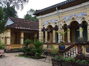
- Đình Bình Thủy
- Long Quang Pagoda
References
- ↑ សទ្ទានុក្រមខេមរយានកម្មបារាំង-ខ្មែរ, ភ្នំពេញ ក្រសួងអប់រំជាតិ វិទ្យាស្ថានខេមរយានកម្ម គ.ស. ១៩៧៣, ទំព័រ ៣៨៩ ។
- 1 2 "Districts of Vietnam". Statoids. Retrieved March 13, 2009.
Districts of the Mekong River Delta | ||
|---|---|---|
| Cần Thơ city |
|  |
| An Giang Province | ||
| Bạc Liêu Province | ||
| Bến Tre Province | ||
| Cà Mau Province | ||
| Đồng Tháp Province | ||
| Hậu Giang Province |
| |
| Kiên Giang Province | ||
| Long An Province | ||
| Sóc Trăng Province | ||
| Tiền Giang Province |
| |
| Trà Vinh Province | ||
| Vĩnh Long Province | ||
※ denotes provincial seat. | ||
Coordinates: 10°03′42″N 105°43′17″E / 10.06167°N 105.72139°E
This article is issued from
Wikipedia.
The text is licensed under Creative Commons - Attribution - Sharealike.
Additional terms may apply for the media files.