Càng Long District
| Càng Long District Huyện Càng Long | |
|---|---|
| Rural district | |
| Country |
|
| Region | Mekong Delta |
| Province | Trà Vinh |
| Capital | Càng Long |
| Area | |
| • Total | 110 sq mi (284 km2) |
| Population (2003) | |
| • Total | 165,747 |
| Time zone | UTC+7 (UTC + 7) |
Càng Long is a rural district (huyện) of Trà Vinh Province in the Mekong Delta region of Vietnam. As of 2003 the district had a population of 165,747.[1] The district covers an area of 284 km². The district capital lies at Càng Long.[1] In Sino-Vietnamese script, used until 1945, the city's name is given as 冈隆.
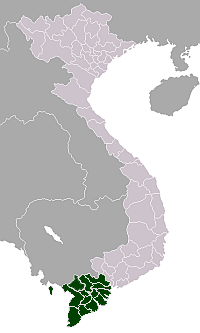
Càng Long district is located in the northern province of Trà Vinh. On the east side it borders the town of Trà Vinh, Bến Tre Province and boundary in the northeast and Châu Thành district in the southeast. To the north is Vũng Liêm District, Vĩnh Long.
The centre of the district is located along the Highway 53, Trà Vinh and Vĩnh Long 21 km and 43 km away respectively.
Càng Long district is the gateway to the economic - cultural - social area of Trà Vinh province in the Mekong Delta region.
Climate
| Climate data for Càng Long District (Càng Long) | |||||||||||||
|---|---|---|---|---|---|---|---|---|---|---|---|---|---|
| Month | Jan | Feb | Mar | Apr | May | Jun | Jul | Aug | Sep | Oct | Nov | Dec | Year |
| Record high °C (°F) | 34.1 (93.4) |
34.8 (94.6) |
35.8 (96.4) |
36.8 (98.2) |
36.8 (98.2) |
35.3 (95.5) |
34.1 (93.4) |
34.1 (93.4) |
33.9 (93) |
33.1 (91.6) |
32.5 (90.5) |
32.3 (90.1) |
36.8 (98.2) |
| Average high °C (°F) | 29.6 (85.3) |
30.3 (86.5) |
31.8 (89.2) |
33.1 (91.6) |
32.7 (90.9) |
31.5 (88.7) |
31.0 (87.8) |
30.7 (87.3) |
30.6 (87.1) |
30.3 (86.5) |
30.0 (86) |
29.3 (84.7) |
30.9 (87.6) |
| Daily mean °C (°F) | 25.4 (77.7) |
25.8 (78.4) |
27.1 (80.8) |
28.4 (83.1) |
28.1 (82.6) |
27.3 (81.1) |
26.9 (80.4) |
26.8 (80.2) |
26.8 (80.2) |
26.8 (80.2) |
26.5 (79.7) |
25.5 (77.9) |
26.8 (80.2) |
| Average low °C (°F) | 22.7 (72.9) |
22.9 (73.2) |
23.9 (75) |
25.0 (77) |
25.3 (77.5) |
24.8 (76.6) |
24.5 (76.1) |
24.4 (75.9) |
24.5 (76.1) |
24.5 (76.1) |
24.2 (75.6) |
23.0 (73.4) |
24.1 (75.4) |
| Record low °C (°F) | 18.4 (65.1) |
19.1 (66.4) |
18.5 (65.3) |
21.9 (71.4) |
22.5 (72.5) |
21.4 (70.5) |
21.8 (71.2) |
21.7 (71.1) |
22.3 (72.1) |
21.5 (70.7) |
19.6 (67.3) |
17.2 (63) |
17.2 (63) |
| Average precipitation mm (inches) | 2 (0.08) |
4 (0.16) |
10 (0.39) |
50 (1.97) |
182 (7.17) |
206 (8.11) |
216 (8.5) |
241 (9.49) |
242 (9.53) |
299 (11.77) |
127 (5) |
30 (1.18) |
1,611 (63.43) |
| Average precipitation days | 0.9 | 0.5 | 1.1 | 5.0 | 17.0 | 18.9 | 21.4 | 20.9 | 22.2 | 19.7 | 10.9 | 4.5 | 143.0 |
| Average relative humidity (%) | 79.8 | 78.7 | 78.0 | 79.1 | 84.0 | 86.5 | 87.2 | 87.6 | 88.1 | 87.7 | 84.8 | 82.4 | 83.7 |
| Mean monthly sunshine hours | 262 | 264 | 301 | 271 | 218 | 179 | 189 | 178 | 163 | 173 | 203 | 220 | 2,621 |
| Source: Vietnam Institute for Building Science and Technology[2] | |||||||||||||
References
- 1 2 "Districts of Vietnam". Statoids. Retrieved March 13, 2009.
- ↑ "Vietnam Building Code Natural Physical & Climatic Data for Construction" (PDF) (in Vietnamese). Vietnam Institute for Building Science and Technology. Archived from the original (PDF) on 22 July 2018. Retrieved 5 August 2018.
Coordinates: 9°55′01″N 106°10′01″E / 9.917°N 106.167°E
Districts of the Mekong River Delta | ||
|---|---|---|
| Cần Thơ city |
|  |
| An Giang Province | ||
| Bạc Liêu Province | ||
| Bến Tre Province | ||
| Cà Mau Province | ||
| Đồng Tháp Province | ||
| Hậu Giang Province |
| |
| Kiên Giang Province | ||
| Long An Province | ||
| Sóc Trăng Province | ||
| Tiền Giang Province |
| |
| Trà Vinh Province | ||
| Vĩnh Long Province | ||
※ denotes provincial seat. | ||