Briercrest
| Briercrest | |
|---|---|
| Village | |
| Village of Briercrest | |
 Briercrest  Briercrest | |
| Coordinates: 50°06′N 105°10′W / 50.1°N 105.16°WCoordinates: 50°06′N 105°10′W / 50.1°N 105.16°W | |
| Country | Canada |
| Province | Saskatchewan |
| Region | Southeast |
| Census division | 4 |
| Rural Municipality | Redburn |
| Post office Founded | 1903 |
| Government | |
| • Type | Municipal |
| • Governing body | Briercrest Village Council |
| • Mayor | William Duncan |
| • Administrator | Linda Senchuk |
| Area | |
| • Total | 0.62 km2 (0.24 sq mi) |
| Population (2016) | |
| • Total | 159 |
| • Density | 256.4/km2 (664/sq mi) |
| Time zone | CST |
| Postal code | S0H 0K0 |
| Area code(s) | 306 |
| Website | Village of Briercrest |
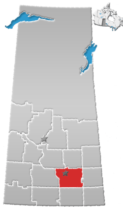
Briercrest (2016 Population: 159) is a village within the Rural Municipality of Redburn No. 130, Saskatchewan, Canada. The village is located 41.6 km southeast of the city of Moose Jaw and 77.2 km southwest of the city of Regina. When the post office formed in 1903, it was a part of the Federal Electoral District: Assiniboia, North West Territories, as well as part of the provisional district of Assiniboia West, North West Territories, until the province of Saskatchewan was formed in 1905.
Historical education
Coventry SD 213 North West Territories, was one of the first one-room schools started in 1891. Hipperholme SD 467 North West Territories soon followed in 1899. Many more one room school districts soon followed in the early 1900s to survive until the mid 20th century when they were gradually replaced with the Briercrest Family of Schools.
Briercrest College and Seminary
Although founded in the village of Briercrest in 1935, Briercrest Bible Institute (now Briercrest College and Seminary) moved to Caronport. In 1946, a bigger facility was needed for the increasing number of students, and the airbase at Caronport became the school's new home. The school, however, continued to honour its early history by retaining the name of its village birthplace.
Book
"Wheat Fields and Wild Roses Briercrest and Districts." Briercrest & District Historical Society Box 14, Briercrest Sask 1988. Village of Briercrest and area. Blue Hill Cemetery, Briercrest Cemetery and Briercrest Lutheran Cemetery.
Demographics
| Canada census – Briercrest community profile | |||
|---|---|---|---|
| 2016 | 2011 | 2006 | |
| Population: | 159 (+ 43.2% from 2011) | 111 (-5.1% from 2006) | 117 (-3.5% from 2001) |
| Land area: | 0.62 km2 (0.24 sq mi) | 0.62 km2 (0.24 sq mi) | 0.62 km2 (0.24 sq mi) |
| Population density: | 256.4/km2 (664/sq mi) | 179.0/km2 (464/sq mi) | 188.7/km2 (489/sq mi) |
| Median age: | 40.1 (M: 40.8, F: 34.5) | 39.5 (M: 36.8, F: 45.0) | 46.8 (M: 48.5, F: 45.5) |
| Total private dwellings: | 67 | 61 | 54 |
| Median household income: | $(not available) | ||
| References: 2016[1] 2011[2] 2006[3] earlier[4] | |||
Area statistics
- Lat (DMS) 50° 10' 00" N
- Long (DMS) 105° 16' 00" W
- Dominion Land Survey Section 18 Tsp 14 Rge 24 W2
- Time zone (est) UTC−6
References
- ↑ "2016 Community Profiles". Canada 2016 Census. Statistics Canada. February 21, 2017.
- ↑ "2011 Community Profiles". Canada 2011 Census. Statistics Canada. July 5, 2013. Retrieved 2011-02-24.
- ↑ "2006 Community Profiles". Canada 2006 Census. Statistics Canada. March 30, 2011. Retrieved 2009-02-24.
- ↑ "2001 Community Profiles". Canada 2001 Census. Statistics Canada. February 17, 2012.
External links
- Official Village of Briercrest website
- Moose Jaw Gen Web Region
- Saskatchewan Gen Web - One Room School Project- Briercrest
| Subdivisions | |
|---|---|
| Communities | |
| Cities | |
| Topics |
|
| |