Annur
| Annur | |
|---|---|
| Suburb | |
 Annur Location in Tamil Nadu, India | |
| Coordinates: 11°14′N 77°06′E / 11.23°N 77.10°ECoordinates: 11°14′N 77°06′E / 11.23°N 77.10°E | |
| Country |
|
| State | Tamil Nadu |
| District | Coimbatore rural |
| Metro | Coimbatore |
| Elevation | 338 m (1,109 ft) |
| Population (2011) | |
| • Total | 20,079 |
| Languages | |
| • Official | Tamil |
| Time zone | UTC+5:30 (IST) |
| PIN | 641653[1] |
| Telephone code | +91-4254 |
| Vehicle registration | TN 40, TN 38 Y |


Annur is a town panchayat and taluk headquarters of Annur Taluk of Coimbatore district. It is a suburb of Coimbatore city located north-east about 30 kilometres (19 miles) from the center of the city. Nearest airport is Coimbatore International Airport, which is about 27 kilometres (17 miles) and the nearest railway station is Coimbatore Central, which is about 30 kilometres (19 miles) away. Other cities/towns nearby Annur are Mettupalayam, which is 21 kilometres (13 miles) away in the west, Avanashi, which is 18 kilometres (11 miles) away in the east and Punjai Puliampatti, which is about 18 kilometres (11 miles) in the north.
Etymology
The name Annur is believed to have been come from "Vanniyur", later transformed to Anniyur and now to Annur. The myth behind the name says that, over 1000 years ago, when a small hunter hit a stone under a "Vanni" tree, it started bleeding. He was astonished and called the village people to look after this issue. Later they found a "Suyambu" Lord Shiva Idol there and built a temple [Manneswarar temple].[2]
Geography
Annur is located at 11°14′N 77°08′E / 11.23°N 77.13°E.[3] It has an average elevation of 338 metres (1108 feet). Annur is well connected by roads including the National Highway 209 (NH209) (Dindugal to Bangalore highway) and the State Highway 80 (SH80).
Demographics
According to 2011 census taken by the Government of India,[4] Annur had a population of 20,079, of which, males constitute 9,971 and females constitute 10,108. Annur has a literacy rate of 73.53%.
References
- ↑ http://www.indiapost.gov.in/Pdf/Alphabetical_Index_of_Delivery_Offices_on_Speed_Post_Network.pdf
- ↑

- ↑ "Maps, Weather, and Airports for Annur, India". www.fallingrain.com. Retrieved 18 April 2018.
- ↑ Census of India: Search Details
Places adjacent to Annur | |
|---|---|
| State symbols |
|
|---|---|
| Governance |
|
| Topics | |
| Districts |
|
| Major cities | |
| District Headquarters | 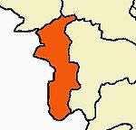 | |
|---|---|---|
| Country | ||
| State | ||
| Region | ||
| Taluks | ||
| Municipal Corporations | ||
| Municipalities | ||
| Rivers | ||
| History | ||
| Places of interest |
| |
| Universities | ||
| ||