Suita, Osaka
| Suita 吹田市 | |||
|---|---|---|---|
| Special city | |||
 Suita City Hall | |||
| |||
 Location of Suita in Osaka Prefecture | |||
 Suita Location in Japan | |||
| Coordinates: 34°45′34″N 135°31′1″E / 34.75944°N 135.51694°ECoordinates: 34°45′34″N 135°31′1″E / 34.75944°N 135.51694°E | |||
| Country | Japan | ||
| Region | Kansai | ||
| Prefecture | Osaka Prefecture | ||
| Government | |||
| • Mayor | Tetsuya Inoue (since May 2011) | ||
| Area | |||
| • Total | 36.11 km2 (13.94 sq mi) | ||
| Population (October 1, 2016) | |||
| • Total | 378,322 | ||
| • Density | 10,000/km2 (27,000/sq mi) | ||
| Symbols | |||
| • Tree | Camphor Laurel | ||
| • Flower | Satsuki azalea | ||
| Time zone | UTC+9 (JST) | ||
| City hall address |
1-3-40 Izumichō, Suita-shi, Osaka-fu 564-8550 | ||
| Website |
www | ||


Suita (吹田市 Suita-shi) is a city located in northern Osaka Prefecture, Japan.
As of October 1, 2016, the city has an estimated population of 378,322 and a population density of 9,880 persons per km². The total area is 36.11 km².
The city was founded on April 1, 1940, and was the site of Expo '70, a World's Fair held in 1970. The J-League soccer club Gamba Osaka plays at Suita City Football Stadium.
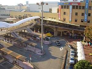
It is connected to central by Hankyu Railway, West Japan Railway Company and the Osaka Municipal Subway. The Osaka Monorail also passes through the area, connecting the city to Osaka, the Expo Commemoration Park and Osaka International Airport.
| Suita | ||
|---|---|---|
| Year | Pop. | ±% |
| 1940 | 66,094 | — |
| 1950 | 78,415 | +18.6% |
| 1960 | 120,203 | +53.3% |
| 1970 | 257,590 | +114.3% |
| 1980 | 326,968 | +26.9% |
| 1990 | 342,179 | +4.7% |
| 2000 | 346,145 | +1.2% |
| 2005 | 351,168 | +1.5% |
| 2010 | 351,771 | +0.2% |
| 2015 | 374,468 | +6.5% |
Economy
Major companies and industries
- Asahi Suita Brewery
- Headquarters of SNK, the producer of Neo Geo arcade boards and games
- Mister Donut, a fast food franchise that offers doughnuts, coffee, muffins and pastries.
Education
Universities
- Kansai University's main branch is located here. It is accessible through Kandaimae Station on the Hankyu Senri Line.
- Osaka University's main administrative campus is hosted here, right beside the Expo Park. It is accessible via the Osaka Monorail at Handaibyoinmae Station, or via Hankyu Senri Line at Kita-Senri Station.
- Osaka Gakuin University, accessible through Kishibe Station on JR Kyoto Line.
- Senri Kinran University, accessible through Kita-Senri Station on Hankyu Senri Line.
Student dormitories
- Osaka University Foreign Student House
- Senri International Student House
- Kansai University International Student House
- JASSO Student House
Culture
Museums
- National Museum of Ethnology
- International Institute for Children's Literature, Osaka[1]
- The Japan Folk Crafts Museum, Osaka[2]
- Kansai University Museum
- Suita City Museum
Transportation
Rail

(<< for Kyoto) - Senrioka - Kishibe - Suita - (for Ōsaka >>)
(<< for Kyoto Kawaramachi) - Shojaku - (for Osaka Umeda >>)
(<< for Tenjimbashisuji Rokuchōme, Osaka Municipal Subway Sakaisuji Line) - Suita - Toyotsu - Kandai-mae - Senriyama - Minami-Senri - Yamada - Kita-Senri (line terminus)
- Midosuji Line (Kita-Osaka Kyuko Railway Namboku Line)
(<< for Umeda, Nakamozu) - Esaka (last stop on the Midosuji Line) - Ryokuchi-koen (in Toyonaka) - Momoyamadai - (for Senri-Chuo >>)
(<< for Osaka Airport) - Yamada - Banpaku Kinen Koen - (for Kadoma-shi >>)
(<< for Saito-nishi) - Koen-higashiguchi - Banpaku Kinen Koen (line terminus)
Highway
Sister cities


Suita was involved in Bankstown's first international Sister City in March 1989.[5]
References
- ↑ "一般財団法人大阪国際児童文学振興財団". www.iiclo.or.jp. Retrieved 10 April 2018.
- ↑ "大阪日本民芸館". www.mingeikan-osaka.or.jp. Retrieved 10 April 2018.
- ↑ " Retrieved on February 16, 2012.
- ↑ http://www.city.suita.osaka.jp/home/soshiki/div-toshimiryoku/bunspo/_70902/_70903.html
- ↑ "Bankstown's Sister Cities (PDF)." Retrieved on July 20, 2007.
External links
| Wikimedia Commons has media related to Suita, Osaka. |
- Suita City official website (in Japanese)
- Suita City official website (in English)
| Wards of Osaka | ||
|---|---|---|
| Wards of Sakai | ||
| Core cities | ||
| Special cities | ||
| Cities | ||
| Districts | ||