Pan-Borneo Highway
Lebuhraya Pan Borneo (Malaysian & Bruneian) Jalan Lintas Kalimantan (Indonesian) | |
|---|---|
| Route information | |
| Length | 5,324 km (3,308 mi) |
| Component highways |
(Sematan-Sungai Tujuh, Tedungan-Pandaruan and Trusan-Merapok) (Sindumin-Kudat) (Berungis-Sandakan) (Mile 32 Checkpoint-Tawau) Brunei Pan-Borneo Highway (Sungai Tujuh-Kuala Lurah and Kampung Puni-Labu) Trans-Kalimantan Highway Northern Route (Along Malaysia-Indonesia border; Tamajuk-Sei Ular) Trans-Kalimantan Highway Central Route (Pontianak-Samarinda) Trans-Kalimantan Highway Southern Route (Sambas-Simanggaris) |
| Major junctions | |
| Southwest end | Sematan, Sarawak |
| -- Muara–Tutong Highway | |
| Northeast end | Serudong, Sabah |
| Location | |
| Countries | Malaysia, Brunei Darussalam |
| Major cities |
Bandar Seri Begawan, Jerudong, Gadong, Berakas, Kuching, Sri Aman, Sarikei, Sibu, Bintulu, Miri, Limbang, Lawas, Sipitang, Beaufort, Keningau, Papar, Kota Kinabalu, Kota Belud, Sandakan, Tawau, Seria, Lumut, Sungai Liang, Tutong |
| Highway system | |
| Asian Highway Network | |


Pan Borneo Highway (Malay: Lebuhraya Pan Borneo), also known as Trans-Borneo Highway or Trans-Kalimantan Highway (Indonesian: Jalan Lintas Kalimantan), is a road network on Borneo Island connecting two Malaysian states, Sabah and Sarawak, with Brunei and Kalimantan region in Indonesia. The highway is numbered AH150 in the Asian Highway Network and as Federal Route 1 in Sarawak. In Sabah, the route numbers given are 1, 13 and 22.[1] The highway is a joint project between both governments which started as soon as the formation of Malaysian Federation in 1963 which comprised Malaya, Sabah, Sarawak and Singapore. The lack of a road network system in Sarawak was the main factor of the construction.
The length of the entire highway is expected to be about 2,083 kilometres (1,294 mi) for the Malaysian section, 168 kilometres (104 mi) for the Bruneian section and 3,073 kilometres (1,909 mi) for the Indonesian section.[2] The Indonesian sections of the Pan Borneo Highway is known as the Trans-Kalimantan Highway. The western route connects the city of Pontianak to Tebedu.
Route background
The Pan-Borneo Highway, Asian Highway Route AH150 is supposed to be a circular highway that runs along the coastlines of Sabah, Sarawak, Brunei and Kalimantan.[2] However, a missing link does exist from Serudong, Sabah to Simanggaris, North Kalimantan, which is supposed to connect Sabah with North Kalimantan.[3]
The Malaysian section of the Pan-Borneo Highway is signposted as Federal Route 1 in Sarawak and Federal Routes 1, 22 and 13 in Sabah.[1] The 1,077-km highway in Sarawak is divided to 92 sections altogether, and the sections are sometimes being signposted alongside with the route number with the syntax of xx-yy, where xx is the route number and yy is the section code. In Brunei, the highway is signposted simply as the AH150.
In Kalimantan, the Trans-Kalimantan Highway consists of three main highways. The northern route, also dubbed as Trans Border Highway (Jalan Lintas Perbatasan), runs along the Malaysia-Indonesia border from Tamajuk to Sei Ular. The central route runs from Pontianak to Samarinda through the interior of Kalimantan. The southern route, which runs along the coastline of Kalimantan from Sambas to Simanggaris, is gazetted as the Indonesian section of the Asian Highway Route AH150.[2] None of the three highways bear any route number yet.
The Malaysian and Indonesian sections are linked together by a highway known as the Trans-Malindo Highway (Jalan Lintas Malindo), which is gazetted as Federal Route 21 in Malaysia.
History
The Pan-Borneo Highway was built due to the lack of the intercity highway network in the island of Borneo. In East Malaysia, the intercity highway plan only existed after the Second World War ended in 1945, after the states of North Borneo (Sabah) and Sarawak were ceded to Britain to become British Crown Colonies.[4] By 1949, the Governor of North Borneo reported that there were 130 miles (210 km) of roads paved with asphalt, 23 miles (37 km) of other metalled roads, 225 miles (362 km) of dirt roads and 578 miles (930 km) of bridle paths.[5]
The construction of the intercity highway network in Sabah and Sarawak intensified at a faster pace after both states joined to form the Federation of Malaysia in 1963. In Sabah, the first federally-funded intercity highway project ever constructed was the Federal Route 22 from Kota Kinabalu to Sandakan, as a joint project between the Malaysian federal government with the government of Australia.[6] Also dubbed as the "Malaysia-Australia Road Project" (MARP), the construction of the FT22 highway began in 1968 and was completed in 1982 with Telupid town became the main centre of the project headquarters.[7][8]
In the meantime, the Kota Kinabalu–Papar section of the Federal Route 1 was completed in 1964, followed by the Kota Kinabalu–Kudat section which was completed in the 1970s.[5] The entire Sabah Federal Route 1 was completed in 1981 after the construction of the final section from Papar to Sindumin was completed that year. Two years later in 1983, the construction of the Tawau–Semporna Highway (part of the FT13 highway and the entire section of the SA51 highway) was completed.[8] The construction of the remaining section of the FT13 highway was completed in early 1990s after the construction of Sungai Kinabatangan and Sungai Segama bridges were completed.[9]
Meanwhile, in Sarawak, the construction of the first intercity trunk highway in Sarawak was commenced in 1965, dubbed as the "First Trunk Road".[10] Most of the highway network in Sarawak was constructed within the decades of 1960s to 1980s.[4] The Lawas–Merapok–Sindumin section was completed in 1981[8] while the final missing link from Sibu to Bintulu was completed in 1985.[11] However, the highway had not been fully paved with asphalt yet at that time; it was only by the end of Sixth Malaysia Plan (RMK6) in 1995 that the FT1 highway in Sarawak was fully paved.[10]
Before 1996, all routes in the Pan-Borneo Highway network in Malaysia were state highways. After the Federal Roads Act 1959 was made effective in Sabah and Sarawak in 1984, those highways were re-gazetted as federal highways in 1996 with the route number of FT1 (from Sematan to Kudat through Brunei), FT13 (Mile 32 Sandakan to Tawau) and FT22 (Tamparuli to Sandakan).[1][12] Those highways were later gazetted as a part of Asian Highway Network Route AH150.[13][2]
Meanwhile, the road transportation network in Kalimantan region did not exist until 1970s when logging roads were built by logging companies. Later, about 75% of the logging roads were converted to national roads.[14] The Trans-Kalimantan Highway (southern route) was completed in 2016 with the opening of the Tayan Bridge.[15]
Although some sections had been upgraded to divided highways, the Pan-Borneo Highway was notorious for its poor condition in many sections. As of 2010, 1,184 kilometres (736 mi) of the Indonesian Trans-Kalimantan Highway was built below the Asian Highway Network Class III standards (lane width: 3.0 m; design speed limit: 80 km/h).[2] Meanwhile, the overall condition in many sections of the Malaysian section of the Highway was poor with many potholes, because most sections of the highway were built with standards as low as JKR R3 (design speed limit: 70 km/h; minimum lane width: 3.0 m).[16][17] A study to upgrade the entire highway to a super two highway under JKR R5 standard (design speed limit: 100 km/h; minimum lane width: 3.5 m) was done, which was expected to cost RM16 billion.[17] Ultimately, the Malaysian federal government had opted to upgrade the Pan-Borneo Highway to a divided highway.[18] The upgrade works of the Pan-Borneo Highway to a divided highway is expected to be completed by 2023 for the Sarawakian section and by 2025 for the Sabahan section, with the overall cost of RM27 billion.[19][20]
Intersections along the Pan Borneo Highway
- Malaysia Federal Route 1 (Sarawak)#List of interchanges, intersections and towns
- Brunei Pan-Borneo Highway#List of interchanges, intersections and towns
- Malaysia Federal Route 1 (Sabah)#List of interchanges
- Malaysia Federal Route 22#List of interchanges
- Malaysia Federal Route 13 (Sabah)#List of interchanges
See also
References
- 1 2 3 "List of Sarawakian Main Federal Routes" (PDF). Ministry of Works (Malaysia). Retrieved 12 October 2017.
- 1 2 3 4 5 "Chapter 3: Current Status of ASEAN Transport Sector" (PDF). Jakarta: ERIA Study Team and ASEAN Secretariat as part of ASEAN Strategic Transport Plan 2011–2015. October 2010: 3–1/3–95. Retrieved 16 November 2013.
- ↑ "Pan-Borneo Highway 95.2pc completed". Daily Express. 21 July 2005. Archived from the original on 21 February 2008. Retrieved 16 March 2018.
- 1 2 R.D. Hill; Jennifer M. Bray (1 January 1978). Geography and the Environment in Southeast Asia: Proceedings of the Geology Jubilee Symposium, The University of Hong Kong, 21-25 June 1976. Hong Kong University Press. pp. 247–. ISBN 978-962-209-009-5.
- 1 2 "Sabah Early History". Sabah State Government. Borneo 360. Retrieved 12 October 2017.
- ↑ "Perjanjian Pelaksanaan Projek Hydro Elektrik di Pergau dan Projek Jalanraya di Sandakan" (in Malay). National Archives of Malaysia. 22 November 2011. Archived from the original on 6 March 2016. Retrieved 12 October 2017.
- ↑ "Sejarah Pewujudan Daerah" (in Malay). Telupid District Office. Archived from the original on 16 March 2018. Retrieved 16 March 2018.
- 1 2 3 Mahathir Mohamad (17 November 1981). Sempena Pembukaan Rasmi Lebuhraya Papar ke Sindumin (Speech). Papar-Sindumin Highway FT1 inaugural speech. Sabah, Malaysia: Prime Minister's Office. Retrieved 13 March 2013.
- ↑ Indian Concrete Journal. Cement Marketing Company of India. 1993.
- 1 2 Ashoka Mody (1997). Infrastructure Strategies in East Asia: The Untold Story. World Bank Publications. pp. 35–. ISBN 978-0-8213-4027-1.
- ↑ Loi Teck Hui (16 August 2017). Practising Corporate Social Responsibility in Malaysia: A Case Study in an Emerging Economy. Springer. pp. 76–. ISBN 978-3-319-62476-1.
- ↑ Federal Roads Act 1959 (Act 376). Accessed on 8 November 2015.
- ↑ "Asian Highway Database: AH Network in Member Countries". United Nations Economic and Social Commission for Asia and the Pacific. Archived from the original on 25 January 2013. Retrieved 19 September 2015.
- ↑ Ahmad Arif; Haryo Damardono (27 February 2009). "Trans-Kalimantan, Dilema Sebuah Jalan" (in Indonesian). Kompas. Retrieved 19 October 2017.
- ↑ S Ilham A (23 March 2016). "Jembatan Tayan diresmikan, Trans Kalimantan semakin lancar" (in Indonesian). Rappler. Retrieved 19 October 2017.
- ↑ Zaain Zin (17 December 2011). "Naik taraf jalan Pan Borneo RM16b" (in Malay). Utusan Malaysia. Retrieved 14 January 2012.
- 1 2 Jack Wong (17 December 2011). "Study gets underway for proposed upgrading of much-maligned Pan Borneo Highway". The Star. Retrieved 14 January 2012.
- ↑ Angelina Sinyang (1 April 2015). "Pan Borneo Sarawak dilancar" (in Malay). Utusan Malaysia. Retrieved 19 October 2017.
- ↑ "Lebuhraya Pan Borneo Sarawak dijangka siap pada 2023 - Rosnah". Bernama (in Malay). Berita Harian. 26 November 2015. Retrieved 19 October 2017.
- ↑ "Lebuhraya Pan Borneo dijangka siap sepenuhnya menjelang 2025". Bernama (in Malay). Berita Harian. 11 October 2014. Retrieved 19 October 2017.
External links

- Sabah Pan-Borneo Highway
- Sarawak Pan-Borneo Highway

| Across the whole continent | 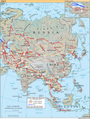 | |
|---|---|---|
| Southeast Asia | ||
| East Asia, Northeast Asia and Southeast Asia | ||
| South Asia | ||
| North Asia, Central Asia and Southwest Asia | ||