Çaro, Pyrénées-Atlantiques
| Çaro | |
|---|---|
| Commune | |
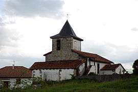 The church of Çaro | |
 Çaro Location within Nouvelle-Aquitaine region  Çaro | |
| Coordinates: 43°08′55″N 1°12′58″W / 43.1486°N 1.2161°WCoordinates: 43°08′55″N 1°12′58″W / 43.1486°N 1.2161°W | |
| Country | France |
| Region | Nouvelle-Aquitaine |
| Department | Pyrénées-Atlantiques |
| Arrondissement | Bayonne |
| Canton | Montagne Basque |
| Intercommunality | CA Pays Basque |
| Government | |
| • Mayor (2008–2014) | Robert Garicoïtz |
| Area1 | 4.01 km2 (1.55 sq mi) |
| Population (2006)2 | 194 |
| • Density | 48/km2 (130/sq mi) |
| Time zone | UTC+1 (CET) |
| • Summer (DST) | UTC+2 (CEST) |
| INSEE/Postal code | 64166 /64220 |
| Elevation |
174–305 m (571–1,001 ft) (avg. 205 m or 673 ft) |
|
1 French Land Register data, which excludes lakes, ponds, glaciers > 1 km2 (0.386 sq mi or 247 acres) and river estuaries. 2 Population without double counting: residents of multiple communes (e.g., students and military personnel) only counted once. | |
Çaro (Basque: Zaro) is a commune in the Pyrénées-Atlantiques department in south-western France.
It is located in the former province of Lower Navarre.
External links
| Wikimedia Commons has media related to Çaro. |
This article is issued from
Wikipedia.
The text is licensed under Creative Commons - Attribution - Sharealike.
Additional terms may apply for the media files.