Yamato, Kanagawa
Yamato (大和市, Yamato-shi) is a city located in central Kanagawa Prefecture, Japan.
Yamato 大和市 | |
|---|---|
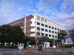 Yamato City Hall | |
 Flag  Seal | |
 Location of Yamato in Kanagawa Prefecture | |
 Yamato | |
| Coordinates: 35°29′N 139°27′E | |
| Country | Japan |
| Region | Kantō |
| Prefecture | Kanagawa Prefecture |
| Government | |
| • Mayor | Satoru Ōki |
| Area | |
| • Total | 27.09 km2 (10.46 sq mi) |
| Population (May 1, 2017) | |
| • Total | 234,859 |
| • Density | 8,700/km2 (22,000/sq mi) |
| Time zone | UTC+9 (Japan Standard Time) |
| City symbols | |
| • Tree | Yamazakura (Prunus jamasakura) |
| • Flower | Nogiku (a group of Asteraceae) |
| • Bird | Azure-winged magpie |
| Phone number | 046-263-1111 |
| Address | 1-1-1 Shimotsuruma, Yamato-shi, Kanagawa-ken 242-8601 |
| Website | www.city.yamato.lg.jp |
As of May 1, 2017, the city has an estimated population of 234,859, with 104,432 households,[1] and a population density of 8,700 persons per km2. The total area is 27.09 km2 (10.46 sq mi).[2]
History
The area around present-day Yamato city has been inhabited for thousands of years. Archaeologists have found stone tools from the Japanese Paleolithic period and ceramic shards from the Jōmon period at numerous locations in the area. It is mentioned in the Engishiki records from the Heian period. By the Kamakura period, this area part of the Shibuya shōen. It came under control of the Ashikaga clan in the early Muromachi period and was later part of the territories of the Later Hōjō clan from Odawara. With the start of the Edo period, the area was part of the tenryō territory in Sagami Province controlled directly by the Tokugawa shogunate, but administered through various hatamoto. Under the rule of the 5th shōgun, Tokugawa Tsunayoshi, one of these hatamoto, Sakamoto Shigeharu (1630–1693) by virtue of his position as Ōmetsuke and Jisha-bugyō, exceeded 10,000 koku in income, and thus became daimyō of the newly proclaimed Fukami Domain in October 1682. However, his revenues decreased below 10,000 koku in May 1687 and the domain was suppressed.
During the cadastral reforms after the Meiji Restoration, the area of present-day Yamato became part of Kōza District, Kanagawa Prefecture. On April 1, 1889, it was administratively divided into Shibuya Village and Tsurumi Village, which later changed its name on September 25, 1891 to Yamato Village. The area was connected by rail in 1926 via the Sagami Railway and in 1929 by the Odakyu Electric Railway, leading to an increase in population. The Imperial Japanese Navy Sagamino Air Base was established in 1940. Yamato Village became Yamato Town in 1943, and Shibuya Village became Shibuya Town in 1944. However, Shibuya was dissolved in 1955, with a portion merging with nearby Fujisawa, and the remaining portion reverting to village status. That portion was merged with Yamato in 1957, which became Yamato City in 1959. In April 2000, Yamato exceeded 200,000 in population, and was proclaimed a special city.
Geography
Yamato is located in the plains of north-central Kanagawa Prefecture. Izumi no Mori, a nature park in the heart of the city, is open year-round, and its springs are the source of the Hikiji River.
Surrounding municipalities
Transportation
Railway
Government
The city passed an ordinance against using cell phones and walking in 2020.[3]
International relations
Twin towns — Sister cities
Yamato is twinned with:

Noted people from Yamato
- Jungo Fujimoto - professional football player
- Mitsuko Horie - singer, voice actress
- Ryuichi Kawamura - singer-songwriter
- Takeo Kawamura - professional baseball player
- Eiko Kawashima - singer-songwriter
- Nahomi Kawasumi - professional football player
- Masahiko Kondō - singer
- Hiroshi Nagano - singer, actor
- Noriko Narazaki - judoka
- Shinobu Ohno - professional football player
References
- "Statistics of Yamato City" (in Japanese). Japan: Yamato City. Retrieved 5 May 2017.
- "Introduction of Yamato City" (in Japanese). Japan: Yamato City. Retrieved 5 May 2017.
- "Yamato becomes Japan's 1st city to 'ban' use of phones while walking". Mainichi Shimbun. 2020-06-25. Retrieved 2020-06-25.
External links
![]()
- Official Website (in Japanese)
Yokohama (capital) | ||
| Wards of Yokohama | ||
| Wards of Kawasaki | ||
| Wards of Sagamihara | ||
| Core city |
| |
| Special cities | ||
| Cities | ||
| Districts | ||
| Authority control |
|
|---|