Woodrow, Saskatchewan
Woodrow is an unincorporated community in the Canadian province of Saskatchewan approximately 6 miles west of Lafleche. This present day agricultural area was once the hub of the local area with lumber yards, grain elevators, 3 churches and 3 or more general stores. The village was formally dissolved on March 21, 2002; it is now administered by the RM of Wood River.[5]
Woodrow | |
|---|---|
.jpg) Woodrow grain elevators | |
 Location of Woodrow in Saskatchewan  Woodrow, Saskatchewan (Canada) | |
| Coordinates: 49.695°N 106.723°W | |
| Country | Canada |
| Province | Saskatchewan |
| Region | Saskatchewan |
| Census division | 3 |
| Rural Municipality | RM of Wood River |
| Post office Founded | 1909-06-01 |
| Incorporated (Village) | N/A |
| Dissolved | March 21, 2002 |
| Government | |
| • Governing body | RM of Wood River |
| Area | |
| • Total | 0.42 km2 (0.16 sq mi) |
| Population (2006) | |
| • Total | 5 |
| • Density | 11.9/km2 (31/sq mi) |
| Time zone | CST |
| Postal code | S0H 4M0 |
| Area code(s) | 306 |
| Highways | Highway 13 Highway 610 |
| Waterways | Thomson Lake |
| [1][2][3][4] | |
Demographics
| Canada census – Woodrow, Saskatchewan community profile | |||
|---|---|---|---|
| 2006 | |||
| Population: | 5 (-66.7% from 2001) | ||
| Land area: | 0.42 km2 (0.16 sq mi) | ||
| Population density: | 11.9/km2 (31/sq mi) | ||
| Median age: | NA (M: NA, F: NA) | ||
| Total private dwellings: | 11 | ||
| Median household income: | $NA | ||
| References: 2006[6] earlier[7] | |||
Infrastructure
Transportation
Saskatchewan Transportation Company provide intercity bus service until the end of May, 2017, when Brad Wall's Saskatchewan Party government discontinued this 70 year old service.[8]
Churches
The Woodrow Gospel Chapel began service in 1909, and was based on immigrants from North Dakota when the community was originally known as Hoffnungsfeld.[9]
Climate
| Climate data for Woodrow (1981-2010, possibly inaccurate) | |||||||||||||
|---|---|---|---|---|---|---|---|---|---|---|---|---|---|
| Month | Jan | Feb | Mar | Apr | May | Jun | Jul | Aug | Sep | Oct | Nov | Dec | Year |
| Record high °C (°F) | — | 7.0 (44.6) |
23.0 (73.4) |
22.0 (71.6) |
29.0 (84.2) |
31.0 (87.8) |
43.0 (109.4) |
36.5 (97.7) |
34.5 (94.1) |
26.0 (78.8) |
15.0 (59.0) |
7.0 (44.6) |
43.0 (109.4) |
| Average high °C (°F) | — | −7.0 (19.4) |
— | — | 19.4 (66.9) |
— | 32.9 (91.2) |
28.9 (84.0) |
20.3 (68.5) |
15.0 (59.0) |
3.8 (38.8) |
— | — |
| Daily mean °C (°F) | — | −12.3 (9.9) |
— | — | 11.5 (52.7) |
— | 23.0 (73.4) |
19.4 (66.9) |
12.2 (54.0) |
7.8 (46.0) |
−2.1 (28.2) |
— | — |
| Average low °C (°F) | — | −17.4 (0.7) |
— | — | 3.9 (39.0) |
— | 13.3 (55.9) |
9.8 (49.6) |
4.3 (39.7) |
0.1 (32.2) |
−8.0 (17.6) |
— | — |
| Record low °C (°F) | — | −36.0 (−32.8) |
−23.0 (−9.4) |
−15.0 (5.0) |
−6.0 (21.2) |
4.0 (39.2) |
6.0 (42.8) |
0.5 (32.9) |
−3.0 (26.6) |
−13.0 (8.6) |
−23.0 (−9.4) |
−29.0 (−20.2) |
−36.0 (−32.8) |
| Average precipitation mm (inches) | 17.1 (0.67) |
9.1 (0.36) |
18.0 (0.71) |
18.9 (0.74) |
56.3 (2.22) |
77.1 (3.04) |
56.1 (2.21) |
34.5 (1.36) |
33.7 (1.33) |
19.0 (0.75) |
15.1 (0.59) |
11.5 (0.45) |
366.4 (14.43) |
| Source: Environment Canada[10] | |||||||||||||
See also
References
- National Archives, Archivia Net, Post Offices and Postmasters
- Government of Saskatchewan, MRD Home, Municipal Directory System, archived from the original (– Scholar search) on November 21, 2008
- Canadian Textiles Institute. (2005), CTI Determine your provincial constituency
- Commissioner of Canada Elections, Chief Electoral Officer of Canada (2005), Elections Canada On-line
- "Restructured Villages". Saskatchewan Ministry of Municipal Affairs. Retrieved 2010-12-20.
- "2006 Community Profiles". 2006 Canadian Census. Statistics Canada. March 30, 2011. Retrieved 2009-02-24.
- "2001 Community Profiles". 2001 Canadian Census. Statistics Canada. February 17, 2012.
- "Saskatchewan Transportation Company: Route Map" (PDF). Saskatchewan Transportation Company. Retrieved 2010-12-20.
- "Woodrow Gospel Chapel". Global Anabaptist Mennonite Encyclopedia Online. Retrieved 2010-12-20.
- Environment Canada Canadian Climate Normals 1981–2010, accessed 1 November 2017
Places adjacent to Woodrow, Saskatchewan | ||||||||||
|---|---|---|---|---|---|---|---|---|---|---|
| ||||||||||
| Towns | 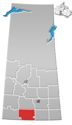 | ||||||
|---|---|---|---|---|---|---|---|
| Villages | |||||||
| Rural municipalities | |||||||
| First Nations |
| ||||||
| Indian reserves | |||||||
| Unincorporated communities |
| ||||||
This article is issued from Wikipedia. The text is licensed under Creative Commons - Attribution - Sharealike. Additional terms may apply for the media files.