Domar Upazila
Domar (Bengali: ডোমার) is an Upazila of Nilphamari District in the Division of Rangpur, Bangladesh.[1]
Domar ডোমার | |
|---|---|
Upazila | |
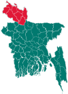
 Domar Location in Bangladesh | |
| Coordinates: 26°6′N 88°50.2′E | |
| Country | |
| Division | Rangpur Division |
| District | Nilphamari District |
| Area | |
| • Total | 250.84 km2 (96.85 sq mi) |
| Population (1991) | |
| • Total | 175,507 |
| • Density | 700/km2 (1,800/sq mi) |
| Time zone | UTC+6 (BST) |
| Website | Official Map of Domar |
Geography
Domar is located at 26.1000°N 88.8361°E . It has 33490 households and total area 250.84 km2.
Demographics
As of the 1991 Bangladesh census, Domar has a population of 175507. Males constitute 51.16% of the population, and females 48.84%. This Upazila's eighteen up population is 87290. Domar has an average literacy rate of 39% (7+ years), and the national average of 32.4% literate.[2]
Administration
Domar Pourashava (municipality), 9 wards, Mayor Monsurul Islam Danu (from 10 August 2011 till now). Area is 9.421 km2.
Domar has 10 unions or wards, 47 mauzas/mahallas, and 47 villages and 1 pouroshava (sub-city corporation).
Chairman : Md Tofael Ahmed
Women Vice Chairman : Sree Sandha Rani
Vice Chairman : Md. Abdul Hakim
Upazila Nirbahi Officer (UNO): Mst. Sabiha Sultana
See also
- Upazilas of Bangladesh
- Districts of Bangladesh
- Divisions of Bangladesh
References
- Riasat Karim (2012), "Domar Upazila", in Sirajul Islam and Ahmed A. Jamal (ed.), Banglapedia: National Encyclopedia of Bangladesh (Second ed.), Asiatic Society of Bangladesh
- "Population Census Wing, BBS". Archived from the original on 2005-03-27. Retrieved November 10, 2006.
| Upazila/Thana: | ||
|---|---|---|
Capital: Rangpur | ||
| Dinajpur District |
|  |
| Gaibandha District | ||
| Kurigram District | ||
| Lalmonirhat District | ||
| Nilphamari District | ||
| Panchagarh District | ||
| Rangpur District | ||
| Thakurgaon District | ||