Newark, Texas
Newark is a city in Tarrant and Wise counties in the U.S. state of Texas. The population was 1,005 at the 2010 census.[3]
Newark, Texas | |
|---|---|
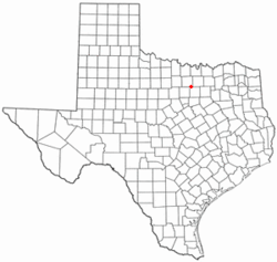 Location of Newark, Texas | |
 | |
| Coordinates: 33°0′49″N 97°29′18″W | |
| Country | United States |
| State | Texas |
| Counties | Wise, Tarrant |
| Established | 1951 |
| Government | |
| • Type | The City of Newark is a type "A" General Law Municipality. The City Council consists of a Mayor and five councilmembers. The Council appoints a City Attorney, an Internal Auditor and a Municipal Judge. Council members also appoint citizens to serve on various Boards and Commissions. |
| Area | |
| • Total | 0.9 sq mi (2 km2) |
| • Land | 0.9 sq mi (2 km2) |
| • Water | 0.0 sq mi (0 km2) |
| Elevation | 696 ft (212 m) |
| Population (2010) | |
| • Total | 1,005 |
| • Estimate (2018) | 1,203 |
| • Density | 1,100/sq mi (430/km2) |
| Time zone | UTC-6 (Central (CST)) |
| • Summer (DST) | UTC-5 (CDT) |
| ZIP code | 76071 |
| Area code(s) | 817 |
| FIPS code | 48-50772[1] |
| GNIS feature ID | 1342557[2] |
History
According to the Handbook of Texas, settlement began in the mid-1850s, referring to the community as Caddo Village because of numerous remnants of the Caddo Indian culture found along the banks of the West Fork of the Trinity River. After the Rock Island Railroad reached the town in 1893, officials surveyed town lots; the community was named after Newark, New Jersey, perhaps the hometown of G. K. Foster, the civil engineer who helped survey the town. Newark was a prosperous farming community until the 1920s. It regained its status as a retail market for area farmers by the end of the 1940s. In 1951 Newark incorporated.[4]
Geography
Newark is located at 33°0′49″N 97°29′18″W (33.013542, -97.488418). According to the United States Census Bureau, the city has a total area of 0.89 square miles (2.3 km2), all land.[5]
Surrounding municipalities | ||||||||||
|---|---|---|---|---|---|---|---|---|---|---|
| ||||||||||
Demographics
| Historical population | |||
|---|---|---|---|
| Census | Pop. | %± | |
| 1960 | 392 | — | |
| 1970 | 407 | 3.8% | |
| 1980 | 466 | 14.5% | |
| 1990 | 651 | 39.7% | |
| 2000 | 887 | 36.3% | |
| 2010 | 1,005 | 13.3% | |
| Est. 2018 | 1,203 | [6] | 19.7% |
| U.S. Decennial Census[7] | |||
At the 2000 census there were 887 people in 314 households, including 231 families, in the city. The population density was 1,286.5 people per square mile (496.3/km²). There were 363 housing units at an average density of 526.5/sq mi (203.1/km²). The racial makeup of the city was 89.97% White, 0.23% African American, 0.56% Native American, 0.45% Asian, 7.55% from other races, and 1.24% from two or more races. Hispanic or Latino of any race were 10.71%.[1]
Of the 314 households 41.7% had children under the age of 18 living with them, 58.3% were married couples living together, 10.5% had a female householder with no husband present, and 26.4% were non-families. 20.1% of households were one person and 6.7% were one person aged 65 or older. The average household size was 2.82 and the average family size was 3.23.
The age distribution was 31.3% under the age of 18, 9.7% from 18 to 24, 30.2% from 25 to 44, 21.2% from 45 to 64, and 7.6% 65 or older. The median age was 32 years. For every 100 females, there were 93.2 males. For every 100 females age 18 and over, there were 95.8 males.
The median household income was $34,750 and the median family income was $39,028. Males had a median income of $30,486 versus $20,833 for females. The per capita income for the city was $14,330. About 11.1% of families and 11.9% of the population were below the poverty line, including 11.1% of those under age 18 and 20.8% of those age 65 or over.
References
- "U.S. Census website". United States Census Bureau. Retrieved 2008-01-31.
- "US Board on Geographic Names". United States Geological Survey. 2007-10-25. Retrieved 2008-01-31.
- "Profile of General Population and Housing Characteristics: 2010 Demographic Profile Data (DP-1): Newark city, Texas". United States Census Bureau. Retrieved December 1, 2011.
- Handbook of Texas, History of Newark
- "US Gazetteer Files 2016-Places-Texas". US Census. Retrieved 7 January 2017.
- "Population and Housing Unit Estimates". Retrieved May 30, 2019.
- "Census of Population and Housing". Census.gov. Retrieved June 4, 2015.
External links
Municipalities and communities of Wise County, Texas, United States | ||
|---|---|---|
| Cities | 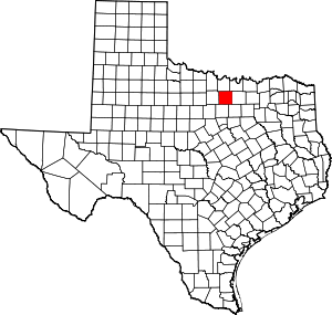 Wise County map | |
| Towns | ||
| CDPs | ||
| Other unincorporated communities | ||
| Ghost towns | ||
| Footnotes | ‡This populated place also has portions in an adjacent county or counties | |
Municipalities and communities of Tarrant County, Texas, United States | ||
|---|---|---|
| Cities |
|  Tarrant County map |
| Towns | ||
| CDPs | ||
| Other unincorporated communities |
| |
| Historical communities | ||
| Ghost towns | ||
| Footnotes | ‡ This populated place also has portions in an adjacent county or counties ‡‡ Previously considered a census-designated place | |
