Rhome, Texas
Rhome (pronounced Rome) is a city in Wise County, Texas, United States. The population was 1522 at the 2010 census.[3]


Rhome, Texas | |
|---|---|
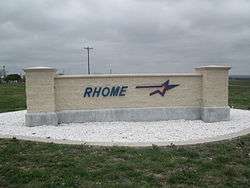 Rhome sign off of U.S. Route 287 | |
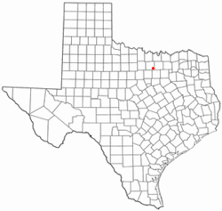 Location of Rhome, Texas | |
 | |
| Coordinates: 33°4′44″N 97°29′36″W | |
| Country | United States |
| State | Texas |
| County | Wise |
| Area | |
| • Total | 4.7 sq mi (12 km2) |
| • Land | 4.6 sq mi (12 km2) |
| • Water | 0.1 sq mi (0.3 km2) |
| Elevation | 942 ft (287 m) |
| Population (2010) | |
| • Total | 1,522 |
| • Estimate (2018) | 1,824 |
| • Density | 320/sq mi (130/km2) |
| Time zone | UTC-6 (Central (CST)) |
| • Summer (DST) | UTC-5 (CDT) |
| ZIP code | 76078 |
| Area code(s) | 817 |
| FIPS code | 48-61700[1] |
| GNIS feature ID | 1345152[2] |
Rhome has a large 12-plaque war exhibit located at Veterans Memorial Park, in a residential area east of the downtown.
Geography
Rhome is located at 33°4′44″N 97°29′36″W (33.078895, -97.493199). According to the United States Census Bureau, the city has a total area of 4.7 square miles (12 km2), of which, 4.6 square miles (12 km2) of it is land and 0.1 square miles (0.26 km2) is water.[4]
Demographics
| Historical population | |||
|---|---|---|---|
| Census | Pop. | %± | |
| 1940 | 340 | — | |
| 1950 | 461 | 35.6% | |
| 1960 | 412 | −10.6% | |
| 1970 | 393 | −4.6% | |
| 1980 | 478 | 21.6% | |
| 1990 | 605 | 26.6% | |
| 2000 | 551 | −8.9% | |
| 2010 | 1,522 | 176.2% | |
| Est. 2018 | 1,824 | [5] | 19.8% |
| U.S. Decennial Census[6] | |||


At the 2000 census there were 551 people in 222 households, including 162 families, in the city. The population density was 310.6 people per square mile (120.2/km²). There were 248 housing units at an average density of 139.8 per square mile (54.1/km²). The racial makeup of the city was 90.74% White, 0.73% African American, 1.09% Native American, 0.36% Asian, 0.18% Pacific Islander, 5.99% from other races, and 0.91% from two or more races. Hispanic or Latino of any race were 10.71%.[1]
Of the 222 households 36.0% had children under the age of 18 living with them, 55.0% were married couples living together, 12.6% had a female householder with no husband present, and 26.6% were non-families. 23.4% of households were one person and 9.0% were one person aged 65 or older. The average household size was 2.48 and the average family size was 2.91.
The age distribution was 27.6% under the age of 18, 7.4% from 18 to 24, 30.3% from 25 to 44, 22.9% from 45 to 64, and 11.8% 65 or older. The median age was 33 years. For every 100 females, there were 105.6 males. For every 100 females age 18 and over, there were 95.6 males.
The median household income was $40,667 and the median family income was $45,625. Males had a median income of $34,667 versus $24,861 for females. The per capita income for the city was $16,965. About 10.3% of families and 13.6% of the population were below the poverty line, including 19.3% of those under age 18 and 17.8% of those age 65 or over.
In popular culture
- Dallas band Old 97's named their first record Hitchhike to Rhome. The title comes from a lyric in the song "Stoned."
References
- "U.S. Census website". United States Census Bureau. Retrieved 2008-01-31.
- "US Board on Geographic Names". United States Geological Survey. 2007-10-25. Retrieved 2008-01-31.
- "Population and Housing Unit Counts, 2010 Census of Population and Housing" (PDF). Texas: 2010. Retrieved 7 January 2017.
- "US Gazetteer Files 2016-Places-Texas". US Census. Retrieved 7 January 2017.
- "Population and Housing Unit Estimates". Retrieved May 30, 2019.
- "Census of Population and Housing". Census.gov. Retrieved June 4, 2015.
External links

Municipalities and communities of Wise County, Texas, United States | ||
|---|---|---|
| Cities |  Wise County map | |
| Towns | ||
| CDPs | ||
| Other unincorporated communities | ||
| Ghost towns | ||
| Footnotes | ‡This populated place also has portions in an adjacent county or counties | |