List of the major 4000-meter summits of North America
The following sortable table comprises the 124 mountain peaks of greater North America[1] with at least 4000 meters (13,123 feet) of elevation and at least 500 meters (1640 feet) of topographic prominence.[2]
The summit of a mountain or hill may be measured in three principal ways:
- The topographic elevation of a summit measures the height of the summit above a geodetic sea level.[3][4]
- The topographic prominence of a summit is a measure of how high the summit rises above its surroundings.[5][4]
- The topographic isolation (or radius of dominance) of a summit measures how far the summit lies from its nearest point of equal elevation.[6]
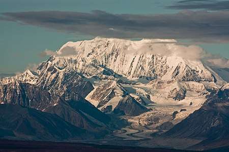
In greater North America, only Denali exceeds 6000 meters (19,685 feet) elevation. Three major summits exceed 5500 meters (18,045 feet), 11 exceed 5000 meters (16,404 feet), 21 exceed 4500 meters (14,764 feet), the following 124 major summits exceed 4000 meters (13,123 feet), 277 exceed 3500 meters (11,483 feet), and 401 exceed 3000 meters (9843 feet) elevation.
Major 4000-meter summits
Of the 124 major 4000-meter summits of greater North America, 102 are located in the United States (excluding two in Hawaiʻi), 19 in Canada, eight in México, and two in Guatemala. Six of these peaks lie on the Canada-United States border and one lies on the México-Guatemala border.
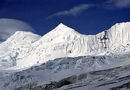
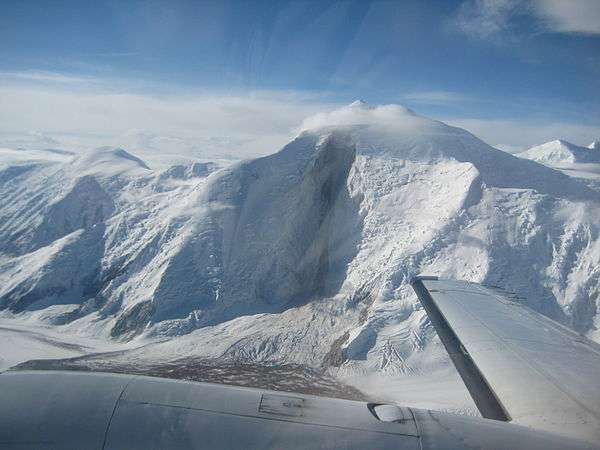
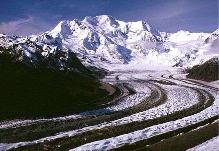
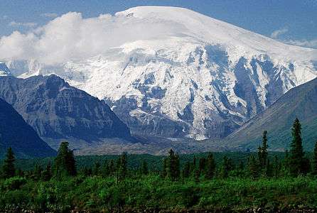
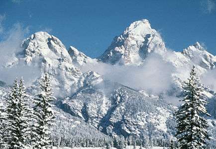
Gallery
 3. Pico de Orizaba is the highest summit of México.
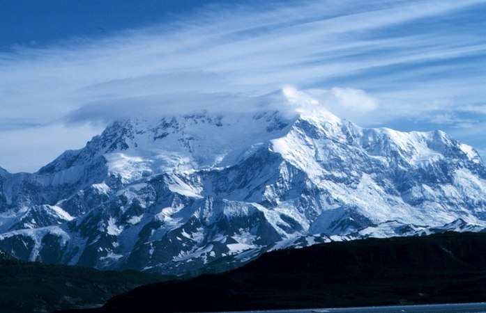
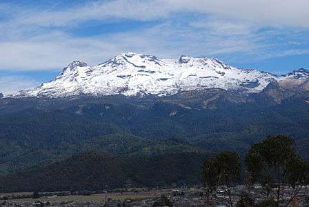
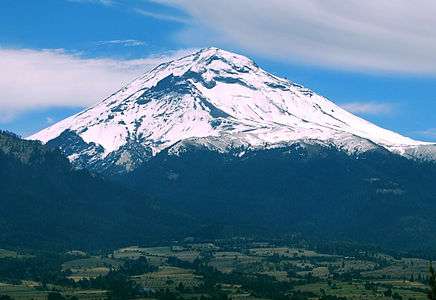 5. Popocatépetl is the second highest summit of México.
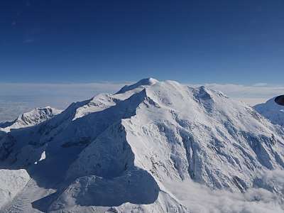 6. Mount Foraker is the second highest major summit of the Alaska Range.
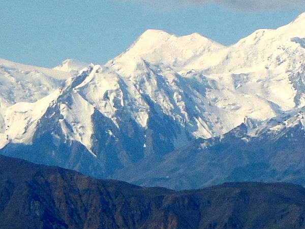
 8. Iztaccihuatl is the third highest summit of México.
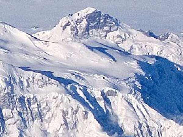
 17. Nevado de Toluca is the fourth highest summit of México.
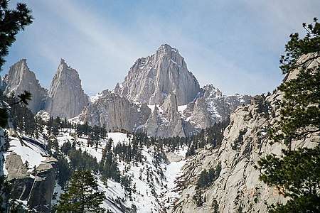 24. Mount Whitney highest summit of the Sierra Nevada and California.
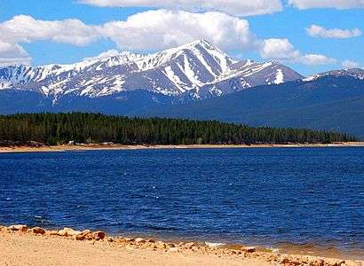

 72. Mount Hayes is the highest summit of the eastern Alaska Range.
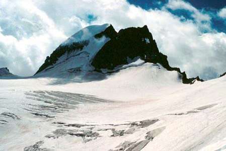
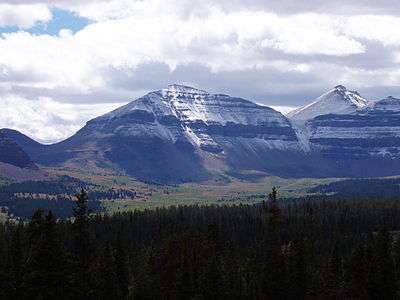 93. Kings Peak is the highest summit of the Uinta Range and Utah.
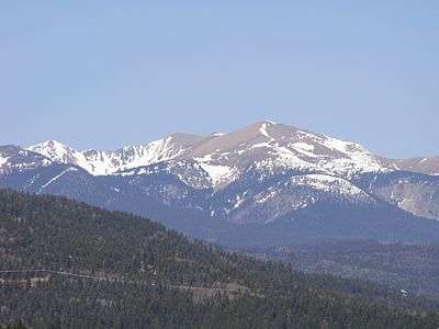 118. Wheeler Peak is the highest summit of New Mexico.
See also
- North America
- Geography of North America
- Geology of North America
- Lists of mountain peaks of North America
- List of mountain peaks of North America
- List of the highest major summits of North America
- List of the major 5000-meter summits of North America
- List of the major 4000-meter summits of North America
- List of the major 3000-meter summits of North America
- List of the highest islands of North America
- List of the most prominent summits of North America
- List of the ultra-prominent summits of North America
- List of the most isolated major summits of North America
- List of extreme summits of North America
- List of mountain peaks of Greenland
- List of mountain peaks of Canada
- List of mountain peaks of the Rocky Mountains
- List of mountain peaks of the United States
- List of mountain peaks of México
- List of mountain peaks of Central America
- List of mountain peaks of the Caribbean
- List of the highest major summits of North America
- Category:Mountains of North America
- List of mountain peaks of North America
- Physical geography
Notes
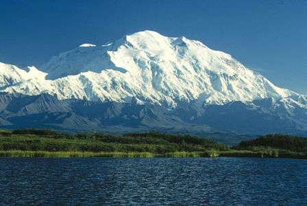
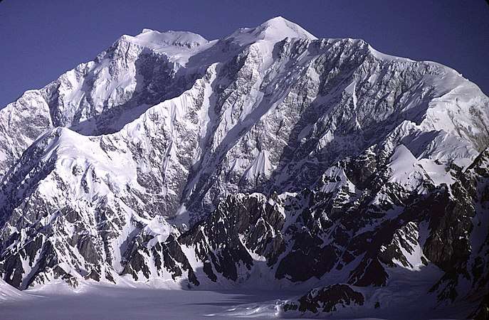
- The summit of Denali is the highest point of the Alaska Range, the State of Alaska, the United States of America, and greater North America. Denali is the third most topographically prominent and third most topographically isolated summit on Earth after Mount Everest and Aconcagua.
- The summit of Mount Logan is the highest point of the Saint Elias Mountains, Yukon, and all of Canada.
- The summit of Pico de Orizaba is the highest point of Estado Libre y Soberano de Puebla, Estado Libre y Soberano de Veracruz de Ignacio de la Llave, and all of México.
- Mount Saint Elias is the second highest major summit of both Canada and the United States.
- Popocatépetl on the border of Puebla is the highest point of both Estado Libre y Soberano de México and Estado Libre y Soberano de Morelos.
- Popocatépetl is the southernmost 5000-meter (16,404-foot) summit of México and greater North America.
- Mount Foraker is the westernmost 5000-meter (16,404-foot) summit of Alaska, the United States, and greater North America.
- The summit of Mount Lucania is the highest point of the northern Saint Elias Mountains.
- Mount Lucania is the northernmost summit of its elevation in Canada.
- Iztaccíhuatl is the northernmost and westernmost 5000-meter (16,404-foot) summit of México.
- The summit of Mount Bona is the highest point of the northwest Saint Elias Mountains.
- Mount Steele is the northernmost and easternmost 5000-meter (16,404-foot) summit of Canada.
- The summit of Mount Blackburn is the highest point of the Wrangell Mountains.
- Mount Wood is the northernmost summit of its elevation in Canada.
- Mount Vancouver is the easternmost summit of its elevation in Canada.
- Nevado de Toluca is the westernmost summit of its elevation in México.
- Mount Fairweather lies on the international border between Alaska and British Columbia. The peak is the highest point of the Canadian Province of British Columbia and the southernmost and easternmost summit of its elevation in both Canada and the United States.
- La Malintzin on the border of Puebla is the highest point of Estado Libre y Soberano de Tlaxcala.
- La Malintzin is the northernmost summit of its elevation in México.
- The summit of Mount Whitney is the highest point of the Sierra Nevada, the State of California, and the contiguous United States.
- Mount Whitney is the southernmost and easternmost summit of its elevation in United States.
- The summit of Mount Elbert is the highest point of the U.S. State of Colorado, the Rocky Mountains of North America, and the entire Mississippi River drainage basin.
- Mount Massive is the second highest major summit of the Rocky Mountains.
- The elevation of Mount Massive includes an adjustment of +2.087 m (6.85 ft) from NGVD 29 to NAVD 88.
- The summit of Mount Harvard is the highest point of the Collegiate Peaks.
- Mount Harvard is the southernmost and easternmost summit of its elevation in the Rocky Mountains.
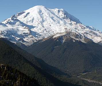
- The summit of Mount Rainier is the highest point of the Cascade Range and the U.S. State of Washington. Mount Rainier is the most prominent summit in the contiguous United States and the fourth most prominent in North America.
- The elevation of Mount Rainier includes an adjustment of +1.914 m (6.28 ft) from NGVD 29 to NAVD 88.
- The elevation of Mount Williamson includes an adjustment of +1.807 m (5.93 ft) from NGVD 29 to NAVD 88.
- The summit of Blanca Peak is the highest point of the Sangre de Cristo Mountains and the entire Rio Grande drainage basin.
- Blanca Peak is the southernmost ultra-prominent summit of the Rocky Mountains.
- The elevation of Blanca Peak includes an adjustment of +1.755 m (5.76 ft) from NGVD 29 to NAVD 88.
- The elevation of La Plata Peak includes an adjustment of +1.983 m (6.51 ft) from NGVD 29 to NAVD 88.
- The summit of Uncompahgre Peak is the highest point of the San Juan Mountains and the entire Gulf of California drainage basin.
- Uncompahgre Peak is the westernmost summit of its elevation in the Rocky Mountains.
- The summit of Crestone Peak is the highest point of the Crestones.
- The elevation of Crestone Peak includes an adjustment of +1.76 m (5.77 ft) from NGVD 29 to NAVD 88.
- The summit of Mount Lincoln is the highest point of the Mosquito Range and the entire Missouri River drainage basin.
- Mount Lincoln is the northernmost summit of its elevation in the Rocky Mountains.
- The summit of Castle Peak is the highest point of the Elk Mountains.
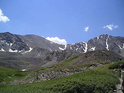
- The summit of Grays Peak is the highest point of the Front Range and the Continental Divide in North America.
- Grays Peak is the northernmost summit of its elevation in the Rocky Mountains.
- The summit of Mount Antero is the highest point of the southern Sawatch Range.
- The summit elevation of Mount Evans includes a vertical offset of +1.798 m (5.9 ft) from the station benchmark.
- The summit of Longs Peak is the highest point of the northern Front Range.
- Longs Peak is the northernmost 14,000-foot (4267-meter) summit of the Rocky Mountains.
- The summit of Mount Wilson is the highest point of the San Miguel Mountains.
- Mount Wilson is the westernmost summit of its elevation in the Rocky Mountains.
- The elevation of Mount Wilson includes an adjustment of +1.899 m (6.23 ft) from NGVD 29 to NAVD 88.
- The summit of White Mountain Peak is the highest point of the White Mountains.
- The summit of North Palisade is the highest point of the Palisades.
- The elevation of North Palisade includes an adjustment of +1.867 m (6.13 ft) from NGVD 29 to NAVD 88.
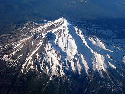
- The summit of Mount Shasta is the highest point of the southern Cascade Range.
- The summit of Mount Sneffels is the highest point of the Sneffels Range.
- The elevation of Capitol Peak includes an adjustment of +1.991 m (6.53 ft) from NGVD 29 to NAVD 88.
- Pikes Peak is the easternmost 14,000-foot (4267-meter) summit and ultra-prominent summit of the Rocky Mountains. Pikes Peak was the inspiration for the lyrics of America the Beautiful.
- The summit of Windom Peak is the highest point of the Needle Mountains.
- Mount Eolus may be higher than Windom Peak.
- The elevation of Windom Peak includes an adjustment of +1.785 m (5.86 ft) from NGVD 29 to NAVD 88.
- The summit of Culebra Peak is the highest point of the Culebra Range.
- Culebra Peak is the southernmost 14,000-foot (4267-meter) summit of the Rocky Mountains.
- The elevation of Culebra Peak includes an adjustment of +1.74 m (5.71 ft) from NGVD 29 to NAVD 88.
- The summit of San Luis Peak is the highest point of the La Garita Mountains.
- The summit of Mount of the Holy Cross is the highest point of the northern Sawatch Range.
- The summit elevation of Mount of the Holy Cross includes a vertical offset of +0.61 m (2 ft) from the station benchmark.
- The summit of Nevado de Colima is the highest point of Estado Libre y Soberano de Jalisco.
- Nevado de Colima is the northernmost and westernmost 4000-meter (13,123-foot) summit of México.
- The elevation of Mount Humphreys includes an adjustment of +1.842 m (6.04 ft) from NGVD 29 to NAVD 88.
- The elevation of Mount Keith includes an adjustment of +1.795 m (5.89 ft) from NGVD 29 to NAVD 88.
- Mount Strickland is the northernmost summit of its elevation in Canada.
- The summit of Mount Ouray is the highest point of the far southern Sawatch Range.
- The elevation of Vermilion Peak includes an adjustment of +1.827 m (5.99 ft) from NGVD 29 to NAVD 88.
- Avalanche Peak is the northernmost summit of its elevation in Canada.
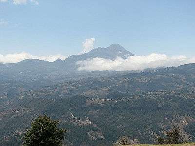
- The summit of Volcán Tajumulco is the highest point of the Sierra de las Nubes, the Republic of Guatemala, and all of Central America.
- Volcán Tajumulco is the southernmost and easternmost 4000-meter (13,123-foot) summit of greater North America.
- The elevation of Mount Darwin includes an adjustment of +1.886 m (6.19 ft) from NGVD 29 to NAVD 88.
- The summit of Mount Hayes is the highest point of the Hayes Range.
- Mount Hayes is the northernmost 4000-meter (13,123-foot) summit of Alaska, the United States, and greater North America.
- Cofre de Perote is the easternmost summit of its elevation in México.
- The summit of Gannett Peak is the highest point of the Wind River Range, the U.S. State of Wyoming, and the central Rocky Mountains.
- Gannett Peak is the northernmost and westernmost summit of its elevation in the Rocky Mountains.
- The summit of Mount Kaweah is the highest point of the Great Western Divide.
- Mount Kaweah is the southernmost summit of its elevation in United States.
- The elevation of Mount Kaweah includes an adjustment of +1.652 m (5.42 ft) from NGVD 29 to NAVD 88.
- The summit of Grand Teton is the highest point of the Teton Range.
- Grand Teton is the northernmost and westernmost 4000-meter (13,123-foot) summit of the Rocky Mountains.
- The elevation of Mount Gabb includes an adjustment of +1.958 m (6.42 ft) from NGVD 29 to NAVD 88.
- The elevation of Bald Mountain includes an adjustment of +1.922 m (6.31 ft) from NGVD 29 to NAVD 88.
- The elevation of Mount Oso includes an adjustment of +1.776 m (5.83 ft) from NGVD 29 to NAVD 88.
- The elevation of Mount Tom includes an adjustment of +1.379 m (4.52 ft) from NGVD 29 to NAVD 88.
- The elevation of Bard Peak includes an adjustment of +1.707 m (5.6 ft) from NGVD 29 to NAVD 88.
- West Spanish Peak is the easternmost 4000-meter (13,123-foot) summit of the Rocky Mountains and the United States.
- The elevation of West Spanish Peak includes an adjustment of +1.468 m (4.82 ft) from NGVD 29 to NAVD 88.
- The summit of Mount Powell is the highest point of the Gore Range.
- The elevation of Mount Powell includes an adjustment of +1.771 m (5.81 ft) from NGVD 29 to NAVD 88.
- The summit of Hagues Peak is the highest point of the Mummy Range.
- The elevation of Mount Dubois includes an adjustment of +1.879 m (6.16 ft) from NGVD 29 to NAVD 88.
- The elevation of Tower Mountain includes an adjustment of +1.796 m (5.89 ft) from NGVD 29 to NAVD 88.
- The elevation of Treasure Mountain includes an adjustment of +2.008 m (6.59 ft) from NGVD 29 to NAVD 88.
- The summit of Kings Peak is the highest point of the Uinta Mountains, the U.S. State of Utah, and the western Rocky Mountains.
- The elevation of Kings Peak includes an adjustment of +1.807 m (5.93 ft) from NGVD 29 to NAVD 88.
- The summit of North Arapaho Peak is the highest point of the Indian Peaks.
- The elevation of North Arapaho Peak includes an adjustment of +1.763 m (5.78 ft) from NGVD 29 to NAVD 88.
- The elevation of Mount Pinchot includes an adjustment of +1.81 m (5.94 ft) from NGVD 29 to NAVD 88.
- The elevation of Parry Peak includes an adjustment of +1.763 m (5.78 ft) from NGVD 29 to NAVD 88.
- The summit of Bill Williams Peak is the highest point of the Williams Mountains.
- The elevation of Bill Williams Peak includes an adjustment of +2.044 m (6.71 ft) from NGVD 29 to NAVD 88.
- The elevation of Sultan Mountain includes an adjustment of +1.649 m (5.41 ft) from NGVD 29 to NAVD 88.
- The elevation of Mount Herard includes an adjustment of +1.64 m (5.38 ft) from NGVD 29 to NAVD 88.
- Volcán Tacaná on the international border with Guatemala is the highest point of Estado Libre y Soberano de Chiapas.
- The elevation of West Buffalo Peak includes an adjustment of +1.834 m (6.02 ft) from NGVD 29 to NAVD 88.
- Mount Craig is the northernmost 4000-meter (13,123-foot) summit of Canada.
- The summit of Summit Peak is the highest point of the southern San Juan Mountains.
- Dolores Peak may be higher than Middle Peak.
- The elevation of Middle Peak includes an adjustment of +1.809 m (5.94 ft) from NGVD 29 to NAVD 88.
- The elevation of Antora Peak includes an adjustment of +1.883 m (6.18 ft) from NGVD 29 to NAVD 88.
- The elevation of Henry Mountain includes an adjustment of +2.037 m (6.68 ft) from NGVD 29 to NAVD 88.
- The summit of Hesperus Mountain is the highest point of the La Plata Mountains.
- The elevation of Hesperus Mountain includes an adjustment of +1.65 m (5.41 ft) from NGVD 29 to NAVD 88.
- The elevation of Jacque Peak includes an adjustment of +1.866 m (6.12 ft) from NGVD 29 to NAVD 88.
- The elevation of Bennett Peak includes an adjustment of +1.782 m (5.85 ft) from NGVD 29 to NAVD 88.
- The summit of Wind River Peak is the highest point of the southern Wind River Range.
- The summit of Mount Waddington is the highest point of the Coast Mountains.
- Mount Waddington is the southernmost and easternmost 4000-meter (13,123-foot) summit of Canada.
- The summit of Mount Marcus Baker is the highest point of the Chugach Mountains.
- The summit of Cloud Peak is the highest point of the Bighorn Mountains.
- Cloud Peak is the northernmost 4000-meter (13,123-foot) summit of the Rocky Mountains.
- The summit of Wheeler Peak is the highest point of the Taos Mountains and the U.S. State of New Mexico.
- Wheeler Peak is the southernmost 4000-meter (13,123-foot) summit of the Rocky Mountains.
- The summit of Francs Peak is the highest point of the Absaroka Range.
- The summit of Twilight Peak is the highest point of the West Needle Mountains.
- The elevation of Twilight Peak includes an adjustment of +1.537 m (5.04 ft) from NGVD 29 to NAVD 88.
- The summit of Mount Ritter is the highest point of the Ritter Range.
- The elevation of Mount Ritter includes an adjustment of +1.786 m (5.86 ft) from NGVD 29 to NAVD 88.
- The elevation of Red Slate Mountain includes an adjustment of +1.893 m (6.21 ft) from NGVD 29 to NAVD 88.
References
- This article defines greater North America as the portion of the continental landmass of the Americas extending westward and northward from the Isthmus of Panama plus the ocean islands surrounding that landmass. This article defines the ocean islands of greater North America to include the coastal islands of North America, the islands of the Caribbean Sea, the Lucayan Archipelago, the islands of Greenland (Kalaallit Nunaat), the islands of Canada, and the islands of Alaska. The Hawaiian Islands are not included because they are considered part of Oceania.
- This article defines a significant summit as a summit with at least 100 meters (328.1 feet) of topographic prominence, and a major summit as a summit with at least 500 meters (1640 feet) of topographic prominence. All summits in this article have at least 500 meters of topographic prominence. An ultra-prominent summit is a summit with at least 1500 meters (4921 feet) of topographic prominence.
- All elevations in the 48 states of the contiguous United States include an elevation adjustment from the National Geodetic Vertical Datum of 1929 (NGVD 29) to the North American Vertical Datum of 1988 (NAVD 88). For further information, please see this United States National Geodetic Survey note.
- If the elevation or prominence of a summit is calculated as a range of values, the arithmetic mean is shown.
- The topographic prominence of a summit is the topographic elevation difference between the summit and its highest or key col to a higher summit. The summit may be near its key col or quite far away. The key col for Denali in Alaska is the Isthmus of Rivas in Nicaragua, 7642 kilometers (4749 miles) away.
- The topographic isolation of a summit is the great-circle distance to its nearest point of equal elevation.
- "Denali". Peakbagger.com. Retrieved 4 May 2016.
- "Denali". Bivouac.com. Retrieved 4 May 2016.
- "Mount Logan". Peakbagger.com. Retrieved 4 May 2016.
- "Mount Logan". Bivouac.com. Retrieved 4 May 2016.
- "Pico de Orizaba". Peakbagger.com. Retrieved 4 May 2016.
- "Pico de Orizaba". Bivouac.com. Retrieved 4 May 2016.
- "Mount Saint Elias". Peakbagger.com. Retrieved 4 May 2016.
- "Mount Saint Elias". Bivouac.com. Retrieved 4 May 2016.
- "Popocatépetl". Peakbagger.com. Retrieved 4 May 2016.
- "Popocatépetl". Bivouac.com. Retrieved 4 May 2016.
- "Mount Foraker". Peakbagger.com. Retrieved 4 May 2016.
- "Mount Foraker". Bivouac.com. Retrieved 4 May 2016.
- "Mount Lucania". Peakbagger.com. Retrieved 4 May 2016.
- "Mount Lucania". Bivouac.com. Retrieved 4 May 2016.
- "Iztaccíhuatl". Peakbagger.com. Retrieved 4 May 2016.
- "Iztaccíhuatl". Bivouac.com. Retrieved 4 May 2016.
- "King Peak". Peakbagger.com. Retrieved 4 May 2016.
- "King Peak". Bivouac.com. Retrieved 4 May 2016.
- "Mount Bona". Peakbagger.com. Retrieved 4 May 2016.
- "Mount Bona". Bivouac.com. Retrieved 4 May 2016.
- "Mount Steele". Peakbagger.com. Retrieved 4 May 2016.
- "Mount Steele". Bivouac.com. Retrieved 4 May 2016.
- "MT BLACKBURN". Datasheet for NGS Station UV4136. U.S. National Geodetic Survey. Retrieved 4 May 2016.
- "Mount Blackburn". Peakbagger.com. Retrieved 4 May 2016.
- "Mount Blackburn". Bivouac.com. Retrieved 4 May 2016.
- "Mount Sanford". Peakbagger.com. Retrieved 4 May 2016.
- "Mount Sanford". Bivouac.com. Retrieved 4 May 2016.
- "Mount Wood". Peakbagger.com. Retrieved 4 May 2016.
- "Mount Wood". Bivouac.com. Retrieved 4 May 2016.
- "Mount Vancouver". Peakbagger.com. Retrieved 4 May 2016.
- "Mount Vancouver". Bivouac.com. Retrieved 4 May 2016.
- "Mount Slaggard". Peakbagger.com. Retrieved 4 May 2016.
- "Mount Slaggard". Bivouac.com. Retrieved 4 May 2016.
- "Nevado de Toluca". Peakbagger.com. Retrieved 4 May 2016.
- "Nevado de Toluca". Bivouac.com. Retrieved 4 May 2016.
- "Mount Fairweather". Peakbagger.com. Retrieved 4 May 2016.
- "Mount Fairweather". Bivouac.com. Retrieved 4 May 2016.
- "Mount Hubbard". Peakbagger.com. Retrieved 4 May 2016.
- "Mount Hubbard". Bivouac.com. Retrieved 4 May 2016.
- "Mount Bear". Peakbagger.com. Retrieved 4 May 2016.
- "Mount Bear". Bivouac.com. Retrieved 4 May 2016.
- "Mount Walsh". Peakbagger.com. Retrieved 4 May 2016.
- "Mount Walsh". Bivouac.com. Retrieved 4 May 2016.
- "Mount Hunter". Peakbagger.com. Retrieved 4 May 2016.
- "Mount Hunter". Bivouac.com. Retrieved 4 May 2016.
- "La Malintzin". Peakbagger.com. Retrieved 4 May 2016.
- "La Malintzin". Bivouac.com. Retrieved 4 May 2016.
- "WHITNEY". Datasheet for NGS Station GT1811. U.S. National Geodetic Survey. Retrieved 4 May 2016.
- "Mount Whitney". Peakbagger.com. Retrieved 4 May 2016.
- "Mount Whitney". Bivouac.com. Retrieved 4 May 2016.
- "BOUNDARY POINT 180". Datasheet for NGS Station UV3032. U.S. National Geodetic Survey. Retrieved 4 May 2016.
- "Mount Alverstone". Peakbagger.com. Retrieved 4 May 2016.
- "Mount Alverstone". Bivouac.com. Retrieved 4 May 2016.
- "University Peak". Peakbagger.com. Retrieved 4 May 2016.
- "University Peak". Bivouac.com. Retrieved 4 May 2016.
- "MOUNT ELBERT". Datasheet for NGS Station KL0637. U.S. National Geodetic Survey. Retrieved 4 May 2016.
- "Mount Elbert". Peakbagger.com. Retrieved 4 May 2016.
- "Mount Elbert". Bivouac.com. Retrieved 4 May 2016.
- "MOUNT MASSIVE CAIRN". Datasheet for NGS Station KL0640. U.S. National Geodetic Survey. Retrieved 4 May 2016.
- "Mount Massive". Peakbagger.com. Retrieved 4 May 2016.
- "Mount Massive". Bivouac.com. Retrieved 4 May 2016.
- "HARVARD". Datasheet for NGS Station JL0879. U.S. National Geodetic Survey. Retrieved 4 May 2016.
- "Mount Harvard". Peakbagger.com. Retrieved 4 May 2016.
- "Mount Harvard". Bivouac.com. Retrieved 4 May 2016.
- "Mount Rainier". Peakbagger.com. Retrieved 4 May 2016.
- "Mount Rainier". Bivouac.com. Retrieved 4 May 2016.
- "Mount Williamson". Peakbagger.com. Retrieved 4 May 2016.
- "Mount Williamson". Bivouac.com. Retrieved 4 May 2016.
- "McArthur Peak". Peakbagger.com. Retrieved 4 May 2016.
- "McArthur Peak". Bivouac.com. Retrieved 4 May 2016.
- "Blanca Peak". Peakbagger.com. Retrieved 4 May 2016.
- "Blanca Peak". Bivouac.com. Retrieved 4 May 2016.
- "La Plata Peak". Peakbagger.com. Retrieved 4 May 2016.
- "La Plata Peak". Bivouac.com. Retrieved 4 May 2016.
- "UNCOMPAHGRE". Datasheet for NGS Station JL0798. U.S. National Geodetic Survey. Retrieved 4 May 2016.
- "Uncompahgre Peak". Peakbagger.com. Retrieved 4 May 2016.
- "Uncompahgre Peak". Bivouac.com. Retrieved 4 May 2016.
- "Crestone Peak". Peakbagger.com. Retrieved 4 May 2016.
- "Crestone Peak". Bivouac.com. Retrieved 4 May 2016.
- "MT LINCOLN". Datasheet for NGS Station KL0627. U.S. National Geodetic Survey. Retrieved 4 May 2016.
- "Mount Lincoln". Peakbagger.com. Retrieved 4 May 2016.
- "Mount Lincoln". Bivouac.com. Retrieved 4 May 2016.
- "CASTLE PK". Datasheet for NGS Station KL0659. U.S. National Geodetic Survey. Retrieved 4 May 2016.
- "Castle Peak". Peakbagger.com. Retrieved 4 May 2016.
- "Castle Peak". Bivouac.com. Retrieved 4 May 2016.
- "GRAYS PEAK". Datasheet for NGS Station KK2036. U.S. National Geodetic Survey. Retrieved 4 May 2016.
- "Grays Peak". Peakbagger.com. Retrieved 4 May 2016.
- "Grays Peak". Bivouac.com. Retrieved 4 May 2016.
- "MT ANTERO". Datasheet for NGS Station JL0883. U.S. National Geodetic Survey. Retrieved 4 May 2016.
- "Mount Antero". Peakbagger.com. Retrieved 4 May 2016.
- "Mount Antero". Bivouac.com. Retrieved 4 May 2016.
- "EVANS". Datasheet for NGS Station KK2030. U.S. National Geodetic Survey. Retrieved 4 May 2016.
- "Mount Evans". Peakbagger.com. Retrieved 4 May 2016.
- "Mount Evans". Bivouac.com. Retrieved 4 May 2016.
- "LONGS PEAK". Datasheet for NGS Station LL1346. U.S. National Geodetic Survey. Retrieved 4 May 2016.
- "Longs Peak". Peakbagger.com. Retrieved 4 May 2016.
- "Longs Peak". Bivouac.com. Retrieved 4 May 2016.
- "Mount Wilson". Peakbagger.com. Retrieved 4 May 2016.
- "Mount Wilson". Bivouac.com. Retrieved 4 May 2016.
- "WHITE MOUNTAIN PEAK". Datasheet for NGS Station HR2559. U.S. National Geodetic Survey. Retrieved 4 May 2016.
- "White Mountain Peak". Peakbagger.com. Retrieved 4 May 2016.
- "White Mountain Peak". Bivouac.com. Retrieved 4 May 2016.
- "NORTH PALISADE". Datasheet for NGS Station HR2629. U.S. National Geodetic Survey. Retrieved 4 May 2016.
- "North Palisade". Peakbagger.com. Retrieved 4 May 2016.
- "North Palisade". Bivouac.com. Retrieved 4 May 2016.
- "PRINCETON". Datasheet for NGS Station JL0886. U.S. National Geodetic Survey. Retrieved 4 May 2016.
- "Mount Princeton". Peakbagger.com. Retrieved 4 May 2016.
- "Mount Princeton". Bivouac.com. Retrieved 4 May 2016.
- "YALE". Datasheet for NGS Station JL0889. U.S. National Geodetic Survey. Retrieved 4 May 2016.
- "Mount Yale". Peakbagger.com. Retrieved 4 May 2016.
- "Mount Yale". Bivouac.com. Retrieved 4 May 2016.
- "MT SHASTA". Datasheet for NGS Station MX1016. U.S. National Geodetic Survey. Retrieved 4 May 2016.
- "Mount Shasta". Peakbagger.com. Retrieved 4 May 2016.
- "Mount Shasta". Bivouac.com. Retrieved 4 May 2016.
- "MAROON PEAK". Datasheet for NGS Station KL0805. U.S. National Geodetic Survey. Retrieved 4 May 2016.
- "Maroon Peak". Peakbagger.com. Retrieved 4 May 2016.
- "Maroon Peak". Bivouac.com. Retrieved 4 May 2016.
- "Mount Wrangell". Peakbagger.com. Retrieved 4 May 2016.
- "Mount Wrangell". Bivouac.com. Retrieved 4 May 2016.
- "SNEFFLES". Datasheet for NGS Station JL0826. U.S. National Geodetic Survey. Retrieved 4 May 2016.
- "Mount Sneffels". Peakbagger.com. Retrieved 4 May 2016.
- "Mount Sneffels". Bivouac.com. Retrieved 4 May 2016.
- "CAPITOL PK". Datasheet for NGS Station KL0688. U.S. National Geodetic Survey. Retrieved 4 May 2016.
- "Capitol Peak". Peakbagger.com. Retrieved 4 May 2016.
- "Capitol Peak". Bivouac.com. Retrieved 4 May 2016.
- "PIKES PEAK". Datasheet for NGS Station JK1242. U.S. National Geodetic Survey. Retrieved 4 May 2016.
- "Pikes Peak". Peakbagger.com. Retrieved 4 May 2016.
- "Pikes Peak". Bivouac.com. Retrieved 4 May 2016.
- "Windom Peak". Peakbagger.com. Retrieved 4 May 2016.
- "Windom Peak". Bivouac.com. Retrieved 4 May 2016.
- "Mount Augusta". Peakbagger.com. Retrieved 4 May 2016.
- "Mount Augusta". Bivouac.com. Retrieved 4 May 2016.
- "HANDIES". Datasheet for NGS Station HL0635. U.S. National Geodetic Survey. Retrieved 4 May 2016.
- "Handies Peak". Peakbagger.com. Retrieved 4 May 2016.
- "Handies Peak". Bivouac.com. Retrieved 4 May 2016.
- "Culebra Peak". Peakbagger.com. Retrieved 4 May 2016.
- "Culebra Peak". Bivouac.com. Retrieved 4 May 2016.
- "SAN LUIS PEAK CAIRN". Datasheet for NGS Station HL0570. U.S. National Geodetic Survey. Retrieved 4 May 2016.
- "San Luis Peak". Peakbagger.com. Retrieved 4 May 2016.
- "San Luis Peak". Bivouac.com. Retrieved 4 May 2016.
- "MT HOLY CROSS ET". Datasheet for NGS Station KL0649. U.S. National Geodetic Survey. Retrieved 4 May 2016.
- "Mount of the Holy Cross". Peakbagger.com. Retrieved 4 May 2016.
- "Mount of the Holy Cross". Bivouac.com. Retrieved 4 May 2016.
- "Nevado de Colima". Peakbagger.com. Retrieved 4 May 2016.
- "Nevado de Colima". Bivouac.com. Retrieved 4 May 2016.
- "GRIZZLY". Datasheet for NGS Station KL0800. U.S. National Geodetic Survey. Retrieved 4 May 2016.
- "Grizzly Peak". Peakbagger.com. Retrieved 4 May 2016.
- "Grizzly Peak". Bivouac.com. Retrieved 4 May 2016.
- "MT HUMPHREYS". Datasheet for NGS Station HR2626. U.S. National Geodetic Survey. Retrieved 4 May 2016.
- "Mount Humphreys". Peakbagger.com. Retrieved 4 May 2016.
- "Mount Humphreys". Bivouac.com. Retrieved 4 May 2016.
- "MT KEITH". Datasheet for NGS Station GT1807. U.S. National Geodetic Survey. Retrieved 4 May 2016.
- "Mount Keith". Peakbagger.com. Retrieved 4 May 2016.
- "Mount Keith". Bivouac.com. Retrieved 4 May 2016.
- "Mount Strickland". Peakbagger.com. Retrieved 4 May 2016.
- "Mount Strickland". Bivouac.com. Retrieved 4 May 2016.
- "MOUNT OURAY RESET". Datasheet for NGS Station JL0672. U.S. National Geodetic Survey. Retrieved 4 May 2016.
- "Mount Ouray". Peakbagger.com. Retrieved 4 May 2016.
- "Mount Ouray". Bivouac.com. Retrieved 4 May 2016.
- "Vermilion Peak". Peakbagger.com. Retrieved 4 May 2016.
- "Vermilion Peak". Bivouac.com. Retrieved 4 May 2016.
- "Avalanche Peak". Peakbagger.com. Retrieved 4 May 2016.
- "Avalanche Peak". Bivouac.com. Retrieved 4 May 2016.
- "Atna Peaks". Peakbagger.com. Retrieved 4 May 2016.
- "Atna Peaks". Bivouac.com. Retrieved 4 May 2016.
- "Volcán Tajumulco". Peakbagger.com. Retrieved 4 May 2016.
- "REGAL MOUNTAIN". Datasheet for NGS Station UV4133. U.S. National Geodetic Survey. Retrieved 4 May 2016.
- "Regal Mountain". Peakbagger.com. Retrieved 4 May 2016.
- "Regal Mountain". Bivouac.com. Retrieved 4 May 2016.
- "MT DARWIN". Datasheet for NGS Station HR2631. U.S. National Geodetic Survey. Retrieved 4 May 2016.
- "Mount Darwin". Peakbagger.com. Retrieved 4 May 2016.
- "Mount Darwin". Bivouac.com. Retrieved 4 May 2016.
- "Mount Hayes". Peakbagger.com. Retrieved 4 May 2016.
- "Mount Hayes". Bivouac.com. Retrieved 4 May 2016.
- "SILVERHEELS ET". Datasheet for NGS Station KL0629. U.S. National Geodetic Survey. Retrieved 4 May 2016.
- "Mount Silverheels". Peakbagger.com. Retrieved 4 May 2016.
- "Mount Silverheels". Bivouac.com. Retrieved 4 May 2016.
- "PYRAMID". Datasheet for NGS Station HL0589. U.S. National Geodetic Survey. Retrieved 4 May 2016.
- "Rio Grande Pyramid". Peakbagger.com. Retrieved 4 May 2016.
- "Rio Grande Pyramid". Bivouac.com. Retrieved 4 May 2016.
- "Cofre de Perote". Peakbagger.com. Retrieved 4 May 2016.
- "Cofre de Perote". Bivouac.com. Retrieved 4 May 2016.
- "GANNETT PEAK CAIRN". Datasheet for NGS Station OW0356. U.S. National Geodetic Survey. Retrieved 4 May 2016.
- "Gannett Peak". Peakbagger.com. Retrieved 4 May 2016.
- "Gannett Peak". Bivouac.com. Retrieved 4 May 2016.
- "Mount Kaweah". Peakbagger.com. Retrieved 4 May 2016.
- "Mount Kaweah". Bivouac.com. Retrieved 4 May 2016.
- "GRAND TETON". Datasheet for NGS Station OX0838. U.S. National Geodetic Survey. Retrieved 4 May 2016.
- "Grand Teton". Peakbagger.com. Retrieved 4 May 2016.
- "Grand Teton". Bivouac.com. Retrieved 4 May 2016.
- "Mount Cook". Peakbagger.com. Retrieved 4 May 2016.
- "Mount Cook". Bivouac.com. Retrieved 4 May 2016.
- "MORGAN". Datasheet for NGS Station HR2627. U.S. National Geodetic Survey. Retrieved 4 May 2016.
- "Mount Morgan". Peakbagger.com. Retrieved 4 May 2016.
- "Mount Morgan". Bivouac.com. Retrieved 4 May 2016.
- "Mount Gabb". Peakbagger.com. Retrieved 4 May 2016.
- "Mount Gabb". Bivouac.com. Retrieved 4 May 2016.
- "Bald Mountain". Peakbagger.com. Retrieved 4 May 2016.
- "Bald Mountain". Bivouac.com. Retrieved 4 May 2016.
- "Mount Oso". Peakbagger.com. Retrieved 4 May 2016.
- "Mount Oso". Bivouac.com. Retrieved 4 May 2016.
- "MT JACKSON ET". Datasheet for NGS Station KL0650. U.S. National Geodetic Survey. Retrieved 4 May 2016.
- "Mount Jackson". Peakbagger.com. Retrieved 4 May 2016.
- "Mount Jackson". Bivouac.com. Retrieved 4 May 2016.
- "MT TOM LOOKOUT TOWER". Datasheet for NGS Station HR2770. U.S. National Geodetic Survey. Retrieved 4 May 2016.
- "Mount Tom". Peakbagger.com. Retrieved 4 May 2016.
- "Mount Tom". Bivouac.com. Retrieved 4 May 2016.
- "Bard Peak". Peakbagger.com. Retrieved 4 May 2016.
- "Bard Peak". Bivouac.com. Retrieved 4 May 2016.
- "West Spanish Peak". Peakbagger.com. Retrieved 4 May 2016.
- "West Spanish Peak". Bivouac.com. Retrieved 4 May 2016.
- "Mount Powell". Peakbagger.com. Retrieved 4 May 2016.
- "Mount Powell". Bivouac.com. Retrieved 4 May 2016.
- "HAGUE RM". Datasheet for NGS Station LL1350. U.S. National Geodetic Survey. Retrieved 4 May 2016.
- "Hagues Peak". Peakbagger.com. Retrieved 4 May 2016.
- "Hagues Peak". Bivouac.com. Retrieved 4 May 2016.
- "Mount Dubois". Peakbagger.com. Retrieved 4 May 2016.
- "Mount Dubois". Bivouac.com. Retrieved 4 May 2016.
- "Tower Mountain". Peakbagger.com. Retrieved 4 May 2016.
- "Tower Mountain". Bivouac.com. Retrieved 4 May 2016.
- "Treasure Mountain". Peakbagger.com. Retrieved 4 May 2016.
- "Treasure Mountain". Bivouac.com. Retrieved 4 May 2016.
- "Kings Peak". Peakbagger.com. Retrieved 4 May 2016.
- "Kings Peak". Bivouac.com. Retrieved 4 May 2016.
- "NORTH ARAPAHOE PEAK CAIRN". Datasheet for NGS Station LL1357. U.S. National Geodetic Survey. Retrieved 4 May 2016.
- "North Arapaho Peak". Peakbagger.com. Retrieved 4 May 2016.
- "North Arapaho Peak". Bivouac.com. Retrieved 4 May 2016.
- "Mount Pinchot". Peakbagger.com. Retrieved 4 May 2016.
- "Mount Pinchot". Bivouac.com. Retrieved 4 May 2016.
- "Mount Natazhat". Peakbagger.com. Retrieved 4 May 2016.
- "Mount Natazhat". Bivouac.com. Retrieved 4 May 2016.
- "Mount Jarvis". Peakbagger.com. Retrieved 4 May 2016.
- "Mount Jarvis". Bivouac.com. Retrieved 4 May 2016.
- "Parry Peak". Peakbagger.com. Retrieved 4 May 2016.
- "Parry Peak". Bivouac.com. Retrieved 4 May 2016.
- "Bill Williams Peak". Peakbagger.com. Retrieved 4 May 2016.
- "Bill Williams Peak". Bivouac.com. Retrieved 4 May 2016.
- "Sultan Mountain". Peakbagger.com. Retrieved 4 May 2016.
- "Sultan Mountain". Bivouac.com. Retrieved 4 May 2016.
- "Mount Herard". Peakbagger.com. Retrieved 4 May 2016.
- "Mount Herard". Bivouac.com. Retrieved 4 May 2016.
- "Volcán Tacaná". Peakbagger.com. Retrieved 4 May 2016.
- "Volcán Tacaná". Bivouac.com. Retrieved 4 May 2016.
- "BUFFALO WEST PEAK CAIRN". Datasheet for NGS Station JL0653. U.S. National Geodetic Survey. Retrieved 4 May 2016.
- "West Buffalo Peak". Peakbagger.com. Retrieved 4 May 2016.
- "West Buffalo Peak". Bivouac.com. Retrieved 4 May 2016.
- "Mount Craig". Peakbagger.com. Retrieved 4 May 2016.
- "Mount Craig". Bivouac.com. Retrieved 4 May 2016.
- "Tressider Peak". Peakbagger.com. Retrieved 4 May 2016.
- "Tressider Peak". Bivouac.com. Retrieved 4 May 2016.
- "SUMMIT". Datasheet for NGS Station HL0503. U.S. National Geodetic Survey. Retrieved 4 May 2016.
- "Summit Peak". Peakbagger.com. Retrieved 4 May 2016.
- "Summit Peak". Bivouac.com. Retrieved 4 May 2016.
- "Middle Peak". Peakbagger.com. Retrieved 4 May 2016.
- "Middle Peak". Bivouac.com. Retrieved 4 May 2016.
- "Antora Peak". Peakbagger.com. Retrieved 4 May 2016.
- "Antora Peak". Bivouac.com. Retrieved 4 May 2016.
- "Henry Mountain". Peakbagger.com. Retrieved 4 May 2016.
- "Henry Mountain". Bivouac.com. Retrieved 4 May 2016.
- "Hesperus Mountain". Peakbagger.com. Retrieved 4 May 2016.
- "Hesperus Mountain". Bivouac.com. Retrieved 4 May 2016.
- "Mount Silverthrone". Peakbagger.com. Retrieved 4 May 2016.
- "Mount Silverthrone". Bivouac.com. Retrieved 4 May 2016.
- "Jacque Peak". Peakbagger.com. Retrieved 4 May 2016.
- "Jacque Peak". Bivouac.com. Retrieved 4 May 2016.
- "Bennett Peak". Peakbagger.com. Retrieved 4 May 2016.
- "Bennett Peak". Bivouac.com. Retrieved 4 May 2016.
- "WIND". Datasheet for NGS Station NS0274. U.S. National Geodetic Survey. Retrieved 4 May 2016.
- "Wind River Peak". Peakbagger.com. Retrieved 4 May 2016.
- "Wind River Peak". Bivouac.com. Retrieved 4 May 2016.
- "Mount Waddington". Peakbagger.com. Retrieved 4 May 2016.
- "Mount Waddington". Bivouac.com. Retrieved 4 May 2016.
- "CONEJOS". Datasheet for NGS Station HL0502. U.S. National Geodetic Survey. Retrieved 4 May 2016.
- "Conejos Peak". Peakbagger.com. Retrieved 4 May 2016.
- "Conejos Peak". Bivouac.com. Retrieved 4 May 2016.
- "Mount Marcus Baker". Peakbagger.com. Retrieved 4 May 2016.
- "Mount Marcus Baker". Bivouac.com. Retrieved 4 May 2016.
- "CLOUD PEAK". Datasheet for NGS Station PW0524. U.S. National Geodetic Survey. Retrieved 4 May 2016.
- "Cloud Peak". Peakbagger.com. Retrieved 4 May 2016.
- "Cloud Peak". Bivouac.com. Retrieved 4 May 2016.
- "WHEELER". Datasheet for NGS Station GM0779. U.S. National Geodetic Survey. Retrieved 4 May 2016.
- "Wheeler Peak". Peakbagger.com. Retrieved 4 May 2016.
- "Wheeler Peak". Bivouac.com. Retrieved 4 May 2016.
- "FRANCS PK 2". Datasheet for NGS Station OW0325. U.S. National Geodetic Survey. Retrieved 4 May 2016.
- "Francs Peak". Peakbagger.com. Retrieved 4 May 2016.
- "Francs Peak". Bivouac.com. Retrieved 4 May 2016.
- "Twilight Peak". Peakbagger.com. Retrieved 4 May 2016.
- "Twilight Peak". Bivouac.com. Retrieved 4 May 2016.
- "S RIVER". Datasheet for NGS Station HL0558. U.S. National Geodetic Survey. Retrieved 4 May 2016.
- "South River Peak". Peakbagger.com. Retrieved 4 May 2016.
- "South River Peak". Bivouac.com. Retrieved 4 May 2016.
- "Mount Ritter". Peakbagger.com. Retrieved 4 May 2016.
- "Mount Ritter". Bivouac.com. Retrieved 4 May 2016.
- "RED SLATE MOUNTAIN". Datasheet for NGS Station HR2690. U.S. National Geodetic Survey. Retrieved 4 May 2016.
- "Red Slate Mountain". Peakbagger.com. Retrieved 4 May 2016.
External links
- Natural Resources Canada (NRC)
- United States Geological Survey (USGS)
- United States National Geodetic Survey (NGS)
- Instituto Nacional de Estadística, Geografía e Informática (INEGI)
- Bivouac.com
- Peakbagger.com
- Peaklist.org
- Peakware.com
- Summitpost.org