Cloud Peak
Cloud Peak is the highest peak within the Bighorn Mountains in the U.S. state of Wyoming. It rises to an elevation of 13,171 feet (4,015 m)[1] and provides onlookers with dramatic views and vistas. The mountain can be climbed most easily from the western side, accessed by either the Battle Park or West Tensleep trail-heads and is roughly 24 miles round-trip from both. The peak is located in the 189,000 acre (765 km²) Cloud Peak Wilderness within Bighorn National Forest. The northeast slope of Cloud Peak is a deep cirque which harbors Cloud Peak Glacier, the last active glacier in the Bighorn Mountains.
| Cloud Peak | |
|---|---|
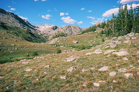 Cloud Peak, from Paint Rock Creek drainage. | |
| Highest point | |
| Elevation | 13,171 ft (4,015 m) [1] |
| Prominence | 7,067 ft (2,154 m) [2] |
| Listing |
|
| Coordinates | 44°22′56″N 107°10′26″W |
| Geography | |
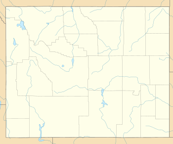 Cloud Peak Wyoming | |
| Location | Big Horn / Johnson counties, Wyoming, U.S. |
| Parent range | Bighorn Mountains |
| Topo map | USGS Cloud Peak |
| Climbing | |
| First ascent | 1897 |
| Easiest route | Hike/scramble |
Cloud Peak is on the border between Johnson County and Big Horn County in Wyoming and is the high point of both counties.[2] As the high point of an isolated range, Cloud Peak has the greatest topographic prominence in the state, 7,077 feet (2,157 m), one foot more than the state's highest mountain, 13,810 foot (4,210 m) Gannett Peak,[3] and fifteenth greatest in the contiguous United States.[4]
See also
- 4000 meter peaks of North America
- Central Rocky Mountains
- Mountain peaks of North America
- Mountain peaks of the Rocky Mountains
- Mountain peaks of the United States
- List of Ultras of North America
- List of Ultras of the United States
References
- "Cloud Peak". NGS data sheet. U.S. National Geodetic Survey. Retrieved 2011-05-13.
- "Cloud Peak, Wyoming". Peakbagger.com. Retrieved 2011-05-13.
- "Wyoming 13,000-foot Peaks". Retrieved 2011-05-09.
- "Most Prominent Peaks of the U.S. States". Peakbagger.com. Retrieved 2011-05-13.
External links
- "US ultra-prominent peaks". PeakList.org. Retrieved 2011-05-09.
- "Cloud Peak on Summitpost". SummitPost.org. Retrieved 2011-05-09.
- "Cloud Peak". Geographic Names Information System. United States Geological Survey. Retrieved 2011-05-09.