Mount Marcus Baker
Mount Marcus Baker is the highest peak of the Chugach Mountains of Alaska. It is located approximately 75 miles (121 km) east of Anchorage. This peak is very prominent because of its proximity to tidewater and is only 12 miles (19 km) north of the calving face of Harvard Glacier. When ranked by topographic prominence, Mount Marcus Baker is one of the top 75 peaks in the world.
| Mount Marcus Baker | |
|---|---|
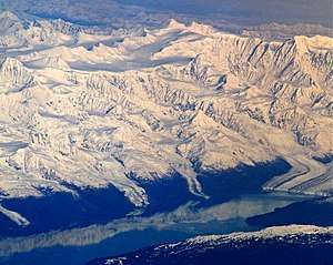 Mt. Marcus Baker centered at top | |
| Highest point | |
| Elevation | 13,176 ft (4,016 m) NGVD 29[1] |
| Prominence | 10,726 ft (3,269 m) [1] |
| Isolation | 204 km (127 mi) |
| Listing |
|
| Coordinates | 61°26′16″N 147°45′02″W [2] |
| Geography | |
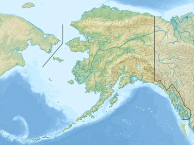 Mount Marcus Baker Location in Alaska | |
| Location | Matanuska-Susitna Borough, Alaska, U.S. |
| Parent range | Chugach Mountains |
| Topo map | USGS Anchorage B-3 Quadrangle |
| Climbing | |
| First ascent | 1938 by Norman Bright, Peter Gabriel, Norman Dyhrenfurth, Bradford Washburn |
| Easiest route | Snow/ice climb (Alaska grade 2) |
History
Mount Marcus Baker was originally called "Mount Saint Agnes"; according to Bradford Washburn, James W. Bagley of the USGS named it after his wife Agnes, adding the "Saint" in hopes of making the name stick. The name was later changed to honor a cartographer and geologist named Marcus Baker.[3]
The peak was first climbed on June 19, 1938 by a party led by famed explorer Bradford Washburn; the climb took almost two months owing to weather delays. Today's standard route is the North Ridge. Despite being much lower in elevation than Denali, Marcus Baker is a similarly serious ascent, due to the remoteness of the peak and the resulting length of the approach and climb.[3] A number of noted climbers have perished or sustained permanent injury in attempting to summit the peak as climbing conditions can change rapidly as storms arise. In early 1988, a State of Alaska Fish and Game biologist, 28-year-old Sylvia Jean Lane, succumbed to hypothermia as a two-day storm separated her from the two others in the climbing party attempting to dash to the top in a winter ascent.
See also
References
- "Mount Marcus Baker, Alaska". Peakbagger.com. Retrieved 2013-01-19.
- "Mount Marcus Baker". Geographic Names Information System. United States Geological Survey. Retrieved 2013-01-19.
- Michael Wood and Colby Coombs, Alaska: A Climbing Guide, The Mountaineers, 2001.
External links

Juneau (capital) | ||
| Topics |  | |
| Society |
| |
| Regions | ||
| Largest cities pop. over 25,000 | ||
| Smaller cities pop. over 2,000 | ||
| Boroughs | ||
| Census Areas | ||