List of extreme summits of North America
This article comprises four sortable tables of mountain summits of greater North America[1] that are the higher than any other point north or south of their latitude or east or west their longitude in North America.
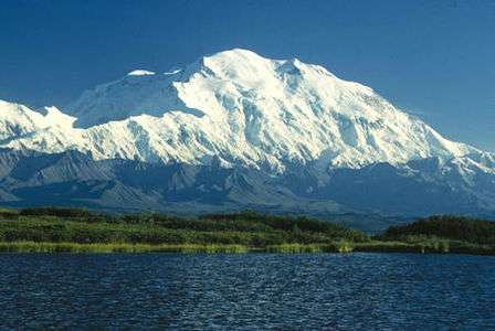
Denali in Alaska is the highest mountain peak of North America. Denali is the third most topographically prominent and third most topographically isolated summit on Earth after Mount Everest and Aconcagua.
The summit of a mountain or hill may be measured in three principal ways:
- The topographic elevation of a summit measures the height of the summit above a geodetic sea level.[2][3]
- The topographic prominence of a summit is a measure of how high the summit rises above its surroundings.[4][5][3]
- The topographic isolation (or radius of dominance) of a summit measures how far the summit lies from its nearest point of equal elevation.[6]
Northernmost high summits
The following summits range from Greenland and Ellesmere Island to Alaska.
Southernmost high summits
The following summits range from Panamá to Alaska.
Easternmost high summits
The following summits range from Greenland to Costa Rica to Alaska.
Westernmost high summits
All of the following summits are located in the US State of Alaska.
Gallery
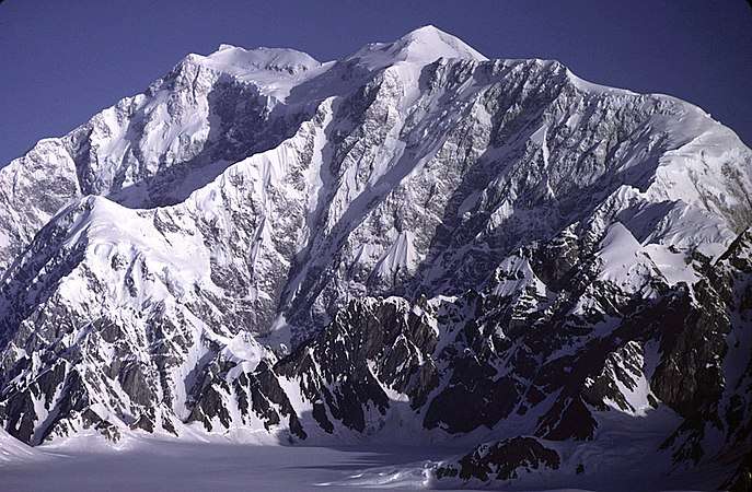 Mount Logan in Yukon is the highest summit of Canada.
 Pico de Orizaba is the highest summit of México.
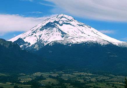 Popocatépetl is the second highest summit of México.
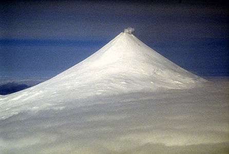
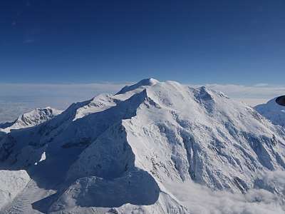 Mount Foraker is the second highest major summit of the Alaska Range.
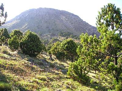 Volcán Tajumulco is the highest summit in Guatemala and all of Central America.
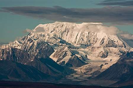 7Mount Hayes is the highest summit of the eastern Alaska Range.
.jpg) Volcán Acatenango in Guatemala.
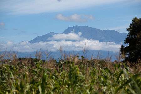
Volcán Acatenango in Guatemala. Chirripó Grande is the highest summit of Costa Rica.
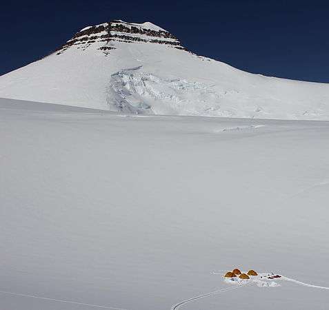
 Volcán Barú is the highest summit of Panamá.
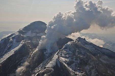
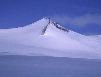
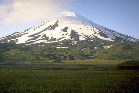 Mount Vsevidof is the highest summit of Umnak Island and the Fox Islands in the Aleutian Islands of Alaska.
 Tanaga Volcano is the highest summit of Tanaga Island and the Andreanof Islands in the Aleutian Islands of Alaska.


See also
- North America
- Geography of North America
- Geology of North America
- Lists of mountain peaks of North America
- List of mountain peaks of North America
- List of the highest major summits of North America
- List of the most prominent summits of North America
- List of the ultra-prominent summits of North America
- List of the most isolated major summits of North America
- List of extreme summits of North America
- List of mountain peaks of Greenland
- List of mountain peaks of Canada
- List of mountain peaks of the Rocky Mountains
- List of mountain peaks of the United States
- List of mountain peaks of México
- List of mountain peaks of Central America
- List of mountain peaks of the Caribbean
- Category:Mountains of North America
- List of mountain peaks of North America
- Physical geography
Notes
- Mara Mountain is the northernmost 1000-meter (3281-foot) summit on Earth.
- The apex of Peary Land is the northernmost summit of its elevation of Greenland and greater North America.
- The summit of Barbeau Peak is the highest point of Ellesmere Island and Nunavut of Canada.
- Barbeau Peak is the northernmost ultra-prominent summit of Canada and greater North America.
- Petermann Bjerg is the northernmost and easternmost summit of its elevation of Greenland and greater North America.
- The apex of the Greenland ice sheet is the northernmost 3000-meter (9843-foot) summit of Greenland and greater North America.
- The summit of Gunnbjørn Fjeld is the highest point of the Island of Greenland, Kalaallit Nunaat, the Kingdom of Denmark, and the entire Arctic.
- Gunnbjørn Fjeld is the easternmost summit of its elevation in greater North America.
- Mount Deborah is the northernmost summit of its elevation in Alaska, the United States, and greater North America.
- The summit of Mount Hayes is the highest point of the Hayes Range.
- Mount Hayes is the northernmost 4000-meter (13,123-foot) summit of Alaska, the United States, and greater North America.
- The summit of Denali is the highest point of the Alaska Range, the State of Alaska, the United States of America, and greater North America. Denali is the third most topographically prominent and third most topographically isolated summit on Earth after Mount Everest and Aconcagua.
- Cerro Hoya is the southernmost 1000-meter (3281-foot) summit of Central America and greater North America.
- Cerro Tacarcuna is the southernmost ultra-prominent summit of Central America and greater North America.
- The summit of Volcán Barú is the highest point of the Republic of Panama.
- Volcán Barú is the southernmost 3000-meter (9843-foot) summit of Central America and greater North America.
- The summit of Chirripó Grande is the highest point of the Republic of Costa Rica.
- Chirripó Grande is the southernmost and easternmost summit of its elevation in Central America and greater North America.
- Volcán Acatenango is the southernmost and easternmost summit of its elevation in Central America and greater North America.
- The summit of Volcán Tajumulco is the highest point of the Sierra de las Nubes, the Republic of Guatemala, and all of Central America.
- Volcán Tajumulco is the southernmost and easternmost 4000-meter (13,123-foot) summit of greater North America.
- Popocatépetl on the border of Puebla is the highest point of both Estado Libre y Soberano de México and Estado Libre y Soberano de Morelos.
- Popocatépetl is the southernmost 5000-meter (16,404-foot) summit of México and greater North America.
- The summit of Pico de Orizaba is the highest point of Estado Libre y Soberano de Puebla, Estado Libre y Soberano de Veracruz de Ignacio de la Llave, and all of México.
- The summit of Mount Logan is the highest point of the Saint Elias Mountains, Yukon, and all of Canada.
- The apex of Hahn Land is the easternmost ultra-prominent summit of Greenland and greater North America.
- Favres Bjerg is the easternmost 2000-meter (6562-foot) summit of Greenland and greater North America.
- Stauning Alper is the easternmost summit of its elevation of Greenland and greater North America.
- Ejnar Mikkelsen Fjeld is the easternmost 3000-meter (9843-foot) summit of Greenland and greater North America.
- The summit of Buldir Volcano is the highest point of Buldir Island.
- Buldir Volcano is the westernmost 500-meter (1640-foot) summit of Alaska, the United States, and greater North America.
- The summit of Kiska Volcano is the highest point of Kiska Island.
- Kiska Volcano is the westernmost 1000-meter (3281-foot) summit of Alaska, the United States, and greater North America.
- The summit of Anvil Peak is the highest point of Semisopochnoi Island and the Rat Islands.
- Anvil Peak is the westernmost summit of its elevation in Alaska, the United States, and greater North America.
- The summit of Gareloi Volcano is the highest point of Gareloi Island.
- Gareloi Volcano is the westernmost ultra-prominent summit of Alaska, the United States, and greater North America.
- The summit of Tanaga Volcano is the highest point of Tanaga Island and the Andreanof Islands.
- Tanaga Volcano is the westernmost summit of its elevation in Alaska, the United States, and greater North America.
- The summit of Mount Vsevidof is the highest point of Umnak Island and the Fox Islands.
- Mount Vsevidof is the westernmost 2000-meter (6562-foot) summit of Alaska, the United States, and greater North America.
- The summit of Shishaldin Volcano is the highest point of Unimak Island and the Aleutian Islands.
- Shishaldin Volcano is the westernmost summit of its elevation in Alaska, the United States, and greater North America.
- The summit of Mount Hesperus is the highest point of the western Alaska Range.
- Mount Hesperus is the westernmost summit of its elevation in Alaska and greater North America.
- Iliamna Volcano is the westernmost 3000-meter (9843-foot) summit of Alaska and greater North America.
- The summit of Redoubt Volcano is the highest point of the Chigmit Mountains.
- Redoubt Volcano is the westernmost summit of its elevation in Alaska and greater North America.
- The summit of Mount Torbert is the highest point of the Tordrillo Mountains.
- Mount Torbert is the westernmost summit of its elevation in Alaska and greater North America.
- Mount Russell is the westernmost summit of its elevation in Alaska and greater North America.
- Mount Foraker is the westernmost 5000-meter (16,404-foot) summit of Alaska, the United States, and greater North America.
References
- This article defines greater North America as the portion of the continental landmass of the Americas extending westward and northward from the Isthmus of Panama plus the ocean islands surrounding that landmass. This article defines the ocean islands of greater North America to include the coastal islands of North America, the islands of the Caribbean Sea, the Lucayan Archipelago, the islands of Greenland (Kalaallit Nunaat), the islands of Canada, and the islands of Alaska. The Hawaiian Islands are not included because they are considered part of Oceania.
- All elevations in the 48 states of the contiguous United States include an elevation adjustment from the National Geodetic Vertical Datum of 1929 (NGVD 29) to the North American Vertical Datum of 1988 (NAVD 88). For further information, please see this United States National Geodetic Survey note.
- If the elevation or prominence of a summit is calculated as a range of values, the arithmetic mean is shown.
- The topographic prominence of a summit is the topographic elevation difference between the summit and its highest or key col to a higher summit. The summit may be near its key col or quite far away. The key col for Denali in Alaska is the Isthmus of Rivas in Nicaragua, 7642 kilometers (4749 miles) away.
- This article defines a significant summit as a summit with at least 100 meters (328.1 feet) of topographic prominence, and a major summit as a summit with at least 500 meters (1640 feet) of topographic prominence. All summits in this article have at least 500 meters of topographic prominence. An ultra-prominent summit is a summit with at least 1500 meters (4921 feet) of topographic prominence.
- The topographic isolation of a summit is the great-circle distance to its nearest point of equal elevation.
- "To the Top of the World". ReadandRun.com. 1998. Archived from the original on May 1, 2008. Retrieved May 6, 2008.
- "Peary Land high point". Peakbagger.com. Retrieved May 4, 2016.
- "Barbeau Peak". Peakbagger.com. Retrieved May 4, 2016.
- "Barbeau Peak". Bivouac.com. Retrieved May 4, 2016.
- "Petermann Bjerg". Peakbagger.com. Retrieved May 4, 2016.
- "Greenland Ice Sheet high point". Peakbagger.com. Retrieved May 4, 2016.
- "Gunnbjørn Fjeld". Peakbagger.com. Retrieved May 4, 2016.
- "Gunnbjørn Fjeld". Bivouac.com. Retrieved May 4, 2016.
- "Mount Deborah". Peakbagger.com. Retrieved May 4, 2016.
- "Mount Deborah". Bivouac.com. Retrieved May 4, 2016.
- "Mount Hayes". Peakbagger.com. Retrieved May 4, 2016.
- "Mount Hayes". Bivouac.com. Retrieved May 4, 2016.
- "Denali". Peakbagger.com. Retrieved May 4, 2016.
- "Denali". Bivouac.com. Retrieved May 4, 2016.
- "Cerro Hoya". Peakbagger.com. Retrieved May 4, 2016.
- "Cerro Tacarcuna". Peakbagger.com. Retrieved May 4, 2016.
- "Volcán Barú". Peakbagger.com. Retrieved May 4, 2016.
- "Chirripó Grande". Peakbagger.com. Retrieved May 4, 2016.
- "Volcán Acatenango". Peakbagger.com. Retrieved May 4, 2016.
- "Volcán Tajumulco". Peakbagger.com. Retrieved May 4, 2016.
- "Popocatépetl". Peakbagger.com. Retrieved May 4, 2016.
- "Popocatépetl". Bivouac.com. Retrieved May 4, 2016.
- "Pico de Orizaba". Peakbagger.com. Retrieved May 4, 2016.
- "Pico de Orizaba". Bivouac.com. Retrieved May 4, 2016.
- "Mount Logan". Peakbagger.com. Retrieved May 4, 2016.
- "Mount Logan". Bivouac.com. Retrieved May 4, 2016.
- "Hahn Land high point". Peakbagger.com. Retrieved May 4, 2016.
- "Favres Bjerg". Peakbagger.com. Retrieved May 4, 2016.
- "Stauning Alper". Peakbagger.com. Retrieved May 4, 2016.
- "Ejnar Mikkelsen Fjeld". Peakbagger.com. Retrieved May 4, 2016.
- "BULDIR". Datasheet for NGS Station TT5847. U.S. National Geodetic Survey. Retrieved May 4, 2016.
- "Buldir Volcano". Peakbagger.com. Retrieved May 4, 2016.
- "Buldir Volcano". Bivouac.com. Retrieved May 4, 2016.
- "Kiska Volcano". Peakbagger.com. Retrieved May 4, 2016.
- "Kiska Volcano". Bivouac.com. Retrieved May 4, 2016.
- "Anvil Peak". Peakbagger.com. Retrieved May 4, 2016.
- "Anvil Peak". Bivouac.com. Retrieved May 4, 2016.
- "GARELOI VOLCANO". Datasheet for NGS Station TT5136. U.S. National Geodetic Survey. Retrieved May 4, 2016.
- "Gareloi Volcano". Peakbagger.com. Retrieved May 4, 2016.
- "Gareloi Volcano". Bivouac.com. Retrieved May 4, 2016.
- "Tanaga Volcano". Peakbagger.com. Retrieved May 4, 2016.
- "Tanaga Volcano". Bivouac.com. Retrieved May 4, 2016.
- "Mount Vsevidof". Peakbagger.com. Retrieved May 4, 2016.
- "Mount Vsevidof". Bivouac.com. Retrieved May 4, 2016.
- "Shishaldin Volcano". Peakbagger.com. Retrieved May 4, 2016.
- "Shishaldin Volcano". Bivouac.com. Retrieved May 4, 2016.
- "Mount Hesperus". Peakbagger.com. Retrieved May 4, 2016.
- "Mount Hesperus". Bivouac.com. Retrieved May 4, 2016.
- "Iliamna Volcano". Peakbagger.com. Retrieved May 4, 2016.
- "Iliamna Volcano". Bivouac.com. Retrieved May 4, 2016.
- "Redoubt Volcano". Peakbagger.com. Retrieved May 4, 2016.
- "Redoubt Volcano". Bivouac.com. Retrieved May 4, 2016.
- "Mount Torbert". Peakbagger.com. Retrieved May 4, 2016.
- "Mount Torbert". Bivouac.com. Retrieved May 4, 2016.
- "Mount Russell". Peakbagger.com. Retrieved May 4, 2016.
- "Mount Russell". Bivouac.com. Retrieved May 4, 2016.
- "Mount Foraker". Peakbagger.com. Retrieved May 4, 2016.
- "Mount Foraker". Bivouac.com. Retrieved May 4, 2016.
External links
- Natural Resources Canada (NRC)
- United States Geological Survey (USGS)
- United States National Geodetic Survey (NGS)
- Instituto Nacional de Estadística, Geografía e Informática (INEGI)
- Bivouac.com
- Peakbagger.com
- Peaklist.org
- Peakware.com
- Summitpost.org
This article is issued from Wikipedia. The text is licensed under Creative Commons - Attribution - Sharealike. Additional terms may apply for the media files.