List of Pennsylvania state historical markers in Philadelphia County
This is intended to be a complete list of the Pennsylvania state historical markers in Philadelphia County, as placed by the Pennsylvania Historical and Museum Commission (PHMC).

Location of Philadelphia in Pennsylvania
As of 2010, there were 244 combined Roadside (larger) and City (narrower) markers affixed on posts and Plaque markers affixed to buildings or structures in Philadelphia County, Pennsylvania, which is coterminous with the city of Philadelphia.[1]
Latitude and longitude coordinates are given as provided by the PHMC's database.
Historical markers
| Marker title | Image | Date dedicated | Location | Marker type | Topics | Notes |
|---|---|---|---|---|---|---|
| 9th Street Curb Market[2] | 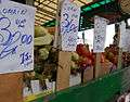 |
October 12, 2007 | NE corner of 9th & Christian Sts., Philadelphia 39.939°N 75.1578°W |
Roadside | Business & Industry, Ethnic & Immigration, Roads | |
| A.M.E. Book Concern | .jpg) |
June 1, 1991 | 631 Pine St., Philadelphia 39.94426°N 75.15304°W |
City | African American, Religion | |
| Academy of Natural Sciences | 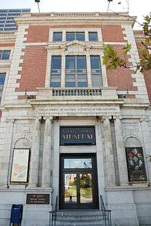 |
May 13, 2013 | 302 Market St., Philadelphia 39.95021°N 75.14581°W |
City | Education, Science & Medicine | |
| African American Baseball in Philadelphia |  |
April 25, 1998 | Belmont & Parkside Aves., Philadelphia 39.9777°N 75.21362°W |
Roadside | African American, Baseball, Sports | |
| African Zoar Methodist Episcopal Church | June 2, 1990 | 4th & Brown Sts., Philadelphia | City | African American, Religion, Underground Railroad | ||
| Alain Leroy Locke (1886-1954) | 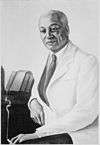 |
1991 | 2221 S 5th St., Philadelphia 39.9207°N 75.1554°W |
City | African American, Education, Professions & Vocations, Writers | --Missing-- |
| Albert M. Greenfield (1887-1967) | April 21, 2016 | 1315 Walnut St., Philadelphia 39.94931°N 75.16294°W |
City | African American, Business & Industry, Government & Politics 20th Century, Religion | ||
| Alfred J. Reach (1840-1928) | 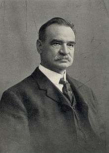 |
April 4, 2003 | 1820 Chestnut St., Philadelphia 39.95163°N 75.17062°W |
City | Baseball, Sports | |
| American Bandstand |  |
August 5, 1997 | 4601 Market St., Philadelphia 39.9585°N 75.2129°W |
Roadside | Business & Industry, Motion Pictures & Television | |
| American Friends Service Committee |  |
November 6, 1999 | 1501 Cherry St., Philadelphia 39.95567°N 75.16492°W |
City | Religion | |
| American Pharmaceutical Association | September 24, 2001 | Market & Seventh Sts., Philadelphia 39.951°N 75.15192°W |
City | Medicine & Science, Professions & Vocations | ||
| America's First Lager | .jpg) |
2001 | 455 St. John St., Philadelphia (800 block N. American St. post 1857) | City | Business & Industry | |
| Anne Brancato Wood (1903-1972) | .jpg) |
June 17, 1994 | SW corner, Broad & Chestnut Sts., Philadelphia 39.95165°N 75.16461°W |
City | Ethnic & Immigration, Government & Politics, Government & Politics 20th Century, Women | |
| Anthony Benezet (1713-1784) |  |
June 4, 2016 | 325 Chestnut St., Philadelphia 39.94904°N 75.14721°W |
City | African American, Education, Religion, Women, Writers | |
| Anthony J. Drexel (1826-1893) |  |
April 2005 | 48 South Third St., Philadelphia 39.94899°N 75.14581°W |
City | Business & Industry, Education, Entrepreneurs, Railroads | |
| Anthony Palmer (1664-1749) | October 17, 2015 | at Palmer Cemetery, just inside main gate on Palmer St., between Belgrade & Memphis Sts., Philadelphia 39.97425°N 75.13013°W |
Roadside | Early Settlement, Government & Politics 18th Century, Governors, Native American, Professions & Vocations | ||
| Arch Street Meeting House |  |
December 17, 1954 | Arch St., between 3rd & 4th Sts., Philadelphia 39.95237°N 75.14577°W |
City | Buildings & Architecture, Religion, William Penn | |
| Arthur Lee Hall (1934-2000) | June 11, 2011 | 2544 N Germantown Ave., Philadelphia 39.9909°N 75.14826°W |
City | African American, Music & Theater, Performers | ||
| Baker Bowl National League Park |  |
August 16, 2000 | Broad St. & Lehigh Ave., Philadelphia 39.9925°N 75.155°W |
City | African American, Baseball, Sports | |
| Baldwin Locomotive Works |  |
September 26, 2009 | Franklintown Park, 19th & Hamilton Sts., Philadelphia 39.962°N 75.1696°W |
Roadside | Business & Industry, Railroads | |
| Barbara Gittings (1932-2007) | 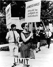 |
July 26, 2016 | 21st & Locust Sts., Philadelphia 39.94956°N 75.17609°W |
City | Civil Rights, Education, Science & Medicine, Publishing & Journalism | |
| Barrymores, The | 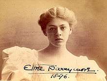 |
October 1, 1996 | 6th & Arch Sts., Philadelphia 39.95262°N 75.15002°W |
City | Performers | |
| Baruch S. Blumberg (1925-2001) | .jpg) |
September 24, 2016 | 323 S Lawrence Ct., Philadelphia 39.94447°N 75.14932°W |
City | Science & Medicine, Professions & Vocations | |
| Battle of Germantown | 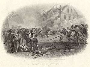 |
October 5, 1996 | 6401 Germantown Ave. at Cliveden, Germantown, Philadelphia 40.0463°N 75.1825°W |
City | American Revolution, George Washington, Military | |
| Benjamin Banneker Institute | 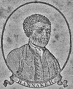 |
1991 | 409 S. 11th St, Philadelphia 39.94457°N 75.15998°W |
City | African American, Education | |
| Benjamin Franklin (1706-1790) | 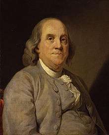 |
June 30, 1990 | Chestnut St. between 3rd & 4th Sts., Philadelphia 39.94883°N 75.14672°W |
City | Government & Politics, Government & Politics 18th Century, Invention, Medicine & Science, Professions & Vocations, Publishing, Writers | |
| Benjamin Rush (1745-1813) | 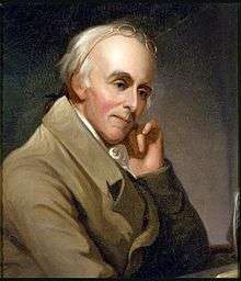 |
June 20, 2002 | Keswick & Rayland Roads, Philadelphia 40.07738°N 74.98563°W |
City | American Revolution, Education, Government & Politics, Government & Politics 18th Century, Medicine & Science, Professions & Vocations | |
| Benjamin Smith Barton (1766-1815) | 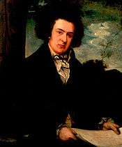 |
December 19, 2004 | 712 Arch St., Philadelphia 39.95398°N 75.1504°W |
City | Education, Exploration, Medicine & Science, Writers | |
| Berean Institute |  |
October 17, 1990 | 1901 W. Girard Ave., Philadelphia 39.97258°N 75.16755°W |
City | African American, Education, Religion | |
| Bethel Burying Ground | .jpg) |
October 1, 2019 | 425 Queen St., Philadelphia 39.93778°N 75.15105°W |
City | African Americans, Religion | |
| Betsy Ross (1752–1836) | 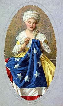 |
April 27, 2009 | 239 Arch St., Philadelphia 39.9522°N 75.1446°W |
City | American Revolution, Professions & Vocations, Women | |
| Billie Holiday (1915-1959) | 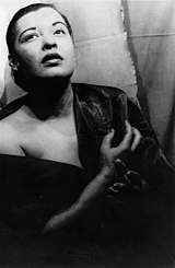 |
1993 | 1409 Lombard St., Philadelphia 39.94478°N 75.1659°W |
City | African American, Music & Theater, Performers, Women | |
| Booth Maternity Center | April 21, 2017 | St. Joseph's Univ. - Moore Hall, 6051 Overbrook Dr., Philadelphia 39.99104°N 75.2478°W |
Roadside | Science & Medicine, Professions & Vocations, Women | ||
| Broad Street Station | 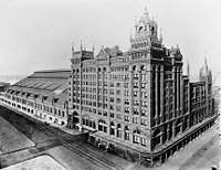 |
May 18, 1999 | NW corner, N 15th & Market Sts. 39.95295°N 75.16521°W |
City | Buildings & Architecture, Railroads, Transportation | |
| Byberry Hall | July 19, 2014 | 3003 Byberry Rd., Philadelphia 40.10173°N 74.98084°W |
Roadside | African American, Government & Politics 19th Century, Underground Railroad | ||
| C. DeLores Tucker (1927–2005) |  |
July 22, 2006 | 6700 Lincoln Dr., Philadelphia 40.0466°N 75.1925°W |
Roadside | African American, Civil Rights, Government & Politics 20th Century, Women | |
| Captain Thomas Holme (1624–1695) |  |
November 1924 | 113 Arch St., Philadelphia 39.951896°N 75.142235°W |
Plaque | Government & Politics 17th Century, William Penn | --Missing-- |
| Caspar Wistar (1761-1818) | 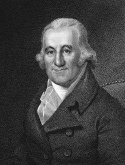 |
December 5, 2000 | 240 South 4th St., Philadelphia 39.94297°N 75.15195°W |
City | Education, Exploration, Medicine & Science, Professions & Vocations | |
| Central Library | 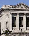 |
June 2, 2002 | 1901 Vine St., Philadelphia 39.95925°N 75.1712°W |
City | Buildings, Education | |
| Charles Willson Peale | 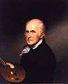 |
1999 | SW corner of 3rd & Lombard Sts., Philadelphia 39.94237°N 75.1474°W |
City | Artists, George Washington | --Missing-- |
| Children's Hospital of Philadelphia, The | 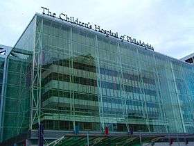 |
September 24, 2002 | 34th St. & Civic Center Boulevard, Philadelphia 39.9487°N 75.1931°W |
City | Buildings, Invention, Medicine & Science, Professions & Vocations | |
| Christ Church |  |
December 17, 1954 | 2nd St. between Market & Arch Sts., Philadelphia 39.95085°N 75.14368°W |
City | Government & Politics 18th Century, Religion | |
| Christian Street Hospital | .jpg) |
September 9, 2005 | 924 Christian St., Philadelphia 39.93902°N 75.15845°W |
City | Civil War, Invention, Medicine & Science | |
| Christian Street YMCA | 1991 | 1724 Christian St., Philadelphia 39.94075°N 75.1722°W |
City | African American, Education, Sports | ||
| Christopher Saur (1693–1758) |  |
April 19, 2009 | at Trinity Lutheran Church, 5300 Germantown Ave., Phila. 40.03211°N 75.16885°W |
City | Ethnic & Immigration, Professions & Vocations, Publishing, Religion | |
| Church of the Advocate |  |
July 29, 1999 | 18th & Diamond Sts., Philadelphia 39.9858°N 75.1633°W |
City | African American, Buildings, Government & Politics 20th Century, Religion, Women | |
| Citizens and Southern Bank | 1991 | 19th & South Sts., Philadelphia 39.9445°N 75.1734°W |
City | African American, Business & Industry | ||
| Civilian Public Service | |
October 26, 1996 | Friends Center at 1501 Cherry St., Philadelphia 39.95567°N 75.16502°W |
Roadside | Agriculture, Business & Industry, Labor, Medicine & Science, Military, Military Post-Civil War, Religion | |
| Commercial Digital Computer Birthplace | September 28, 2006 | 3747 Ridge Ave., Philadelphia 40.0022°N 75.187°W |
Roadside | Business & Industry, Invention | ||
| Commodore John Barry (1745-1803) |  |
September 3, 2014 | S Columbus Blvd. at Dock St. (near Hyatt and Indep. Seaport Mus.), Philadelphia 39.94548°N 75.14204°W |
Roadside | American Revolution, George Washington, Government & Politics 18th Century, Military, Professions & Vocations | |
| "Common Sense" | 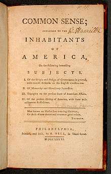 |
1993 | SE corner of S 3rd St. & Thomas Paine Place (Chancellor St), Philadelphia 39.94692°N 75.14793°W |
City | American Revolution, Government & Politics, Government & Politics 18th Century, Military, Professions & Vocations, Publishing | |
| Connie Mack (1862-1956) |  |
May 30, 1998 | 604 Cliveden St., Philadelphia 40.0379°N 75.192°W |
Roadside | Baseball, Sports | |
| Crystal Bird Fauset | 1991 | 5403 Vine St., Philadelphia 39.9651°N 75.228°W |
City | African American, Civil Rights, Government & Politics, Women | ||
| Cyrus Bustill (1732-1806) | 1992 | 210 Arch St., Philadelphia (missing) 39.952°N 75.1444°W |
City | African American, Education, Native American, Professions & Vocations | ||
| David Bustill Bowser (1820-1900) | 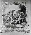 |
1991 | 841 N. 4th St., Philadelphia 39.96011°N 75.14527°W |
Roadside | African American, Artists | |
| David Salisbury Franks (c.1740–1793) | October 13, 2004 | South side of Arch St. near 5th St., Philadelphia 39.95243°N 75.1484°W |
City | American Revolution, Religion | ||
| Dewey's Sit-in | .jpg) |
October 1, 2018 | SE corner of 17th & Latimer Sts., Philadelphia 39.94912°N 75.16921°W |
City | LGBT Rights, Civil Rights | |
| Dixie Hummingbirds, The | .jpg) |
June 6, 2017 | 2435 N College Ave., Philadelphia 39.97454°N 75.17682°W |
Roadside | African American, Music & Theater, Performers, Religion | |
| Dr. A. S. W. Rosenbach (1876-1952) |  |
April 2, 2008 | 2010 Delancey Place (Philadelphia) 39.9475°N 75.175°W |
City | Education, Professions & Vocations | |
| Dr. Constantine Hering (1800-1880) | November 8, 2015 | NW corner of 12th & Arch Sts., Philadelphia 39.95404°N 75.15953°W |
City | Education, Science & Medicine, Professions & Vocations | ||
| Dr. Mary Davis Ridgway (1873-1927) | September 8, 2001 | Wissahickon Ave. between Lincoln Drive and Walnut Lane, Philadelphia 40.0313°N 75.1886°W |
Roadside | Civil Rights, Medicine & Science, Professions & Vocations, Women | ||
| Dunbar Theatre, The | .jpg) |
1992 | South & Broad Sts., Philadelphia 39.94455°N 75.16543°W |
City | African American, Buildings, Music & Theater, Performers | |
| Eastern State Penitentiary | 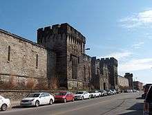 |
May 2, 1996 | 2200 Fairmount Ave., Philadelphia 39.96735°N 75.17315°W |
City | Education, Government & Politics, Government & Politics 19th Century | |
| Ebenezer Don Carlos Bassett (1833-1908) |  |
1993 | 2121 N 29th St., Philadelphia 39.98827°N 75.18039°W |
City | African American, Education | |
| Ebenezer Maxwell Mansion | 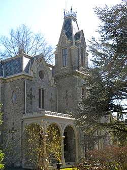 |
September 27, 2008 | 200 W Tulpehocken St., Germantown, Philadelphia 40.0386°N 75.1837°W |
City | Buildings, Cities & Towns, Mansions & Manors, Railroads | |
| Eddie Gottlieb (1898-1979) | 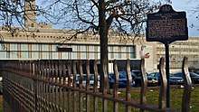 |
May 21, 2014 | S Phila. High School, Snyder Ave. & Broad St., Philadelphia 39.92416°N 75.16956°W |
Roadside | Basketball, Professions & Vocations, Sports & Recreation | |
| Eddie Lang |  |
October 15, 1995 | 7th St., just N of Clymer St., Philadelphia 39.9401°N 75.15437°W |
City | Performers | |
| Edmund N. Bacon (1910–2005) | September 13, 2006 | NW corner of 15th St. & JFK Blvd., Phila. 39.9539°N 75.1652°W |
City | Buildings, Cities & Towns, Professions & Vocations | ||
| Edward Drinker Cope |  |
November 6, 2002 | 2100–02 Pine St., Philadelphia 39.9471°N 75.1768°W |
City | Education, Medicine & Science, Professions & Vocations, Writers | |
| Elfreth's Alley | 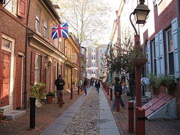 |
June 3, 2016 | 2nd St. & Elfreth's Alley, Philadelphia 39.95279°N 75.14292°W |
City | Buildings & Architecture, Business & Industry, Ethnic & Immigration, Labor | |
| Elisha Kent Kane (1820-1857) |  |
August 26, 2016 | Laurel Hill Cemetery, 3822 Ridge Ave., Philadelphia 40.00437°N 75.19037°W |
Roadside | Exploration | |
| Elizabeth T. Greenfield | 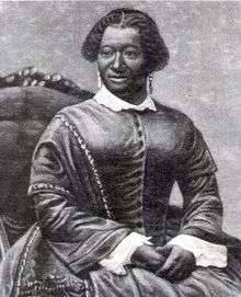 |
1992 | 1013 Rodman St., Philadelphia 39.9433°N 75.159°W |
City | African American, Music & Theater, Performers, Women | |
| Engine Company No. 11 | 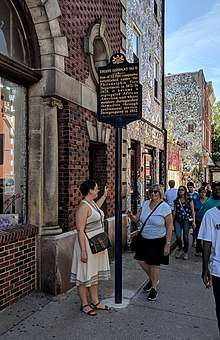 |
April 23, 2005 | 1016 South St., Philadelphia 39.94285°N 75.15922°W |
City | African American, Police and Safety | |
| ENIAC | 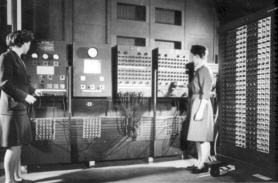 |
June 15, 2000 | S 33rd St., S of Walnut St. 39.9522°N 75.1901°W |
City | Business & Industry, Invention | |
| Fairmount Park - Commonwealth Treasure | 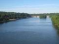 |
October 9, 2001 | Kelly Dr. & Sedgely Dr., Philadelphia 39.96961°N 75.18482°W |
Roadside | Buildings & Architecture, Environment, Sports & Recreation | |
| Fairmount Water Works |  |
April 9, 1997 | At waterworks, corner of Waterworks Dr. & Kelly Dr., Philadelphia 39.96906°N 75.18461°W |
Roadside | Buildings & Architecture, Business & Industry, Science & Medicine | |
| Father Divine | 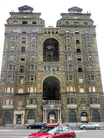 |
September 11, 1994 | NE corner, N Broad St. & Ridge Ave., Philadelphia 39.96675°N 75.16029°W |
City | African American, Civil Rights, Religion, Inns & Taverns | |
| Federal Street Burial Ground | _ELEVATION_-_Mikveh_Israel_Cemetery_Gatehouse%2C_1114_Federal_Street%2C_Philadelphia%2C_Philadelphia_County%2C_PA_HABS_PA%2C51-PHILA%2C409A-1.tif.jpg) |
October 4, 1990 | Federal St. between 11th & 12th Sts., Philadelphia 39.935°N 75.1627°W |
City | Civil War, Education, Military, Professions & Vocations, Publishing, Religion | |
| Female Medical College of Pennsylvania | 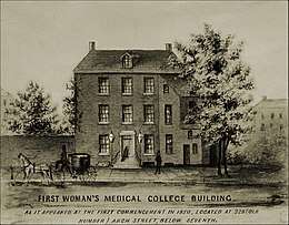 |
September 30, 1996 | 2900 W Queen Ln., at Drexel College of Med. entrance, Philadelphia 40.01972°N 75.18103°W |
City | Education, Medicine & Science, Women | |
| First African Baptist Church | September 23, 2017 | 6700 Lansdowne Ave., Philadelphia 39.97443°N 75.2537°W |
Roadside | African American, Education, Religion | ||
| First African Baptist Church | January 1, 1992 | 16th & Christian Sts., Philadelphia 39.93767°N 75.16533°W |
City | African American, Religion | ||
| First African Baptist Church Cemetery | 1992 | SW corner, N 8th & Vine Sts., Philadelphia 39.95649°N 75.15302°W |
City | African American, Religion | ||
| First African Presbyterian Church | 1993 | 42nd & Girard Ave., Philadelphia 39.9736°N 75.2096°W |
City | African American, Religion | ||
| First Protest Against Slavery |  |
September 8, 1990 | 5109 Germantown Ave. at Wister St., Philadelphia 40.03003°N 75.16496°W |
City | African American, Ethnic & Immigration, Government & Politics, Religion | |
| First Republican National Convention |  |
June 17, 2000 | 808 Locust St., Philadelphia 39.94712°N 75.15495°W |
City | Abraham Lincoln, Government & Politics, Government & Politics 19th Century | |
| Fort Mifflin | 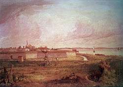 |
May 10, 1990 | At site near Fort Mifflin Rd., Philadelphia 39.8933°N 75.2089°W |
City | American Revolution, Forts, Military | |
| Frances E.W. Harper | 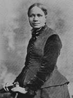 |
March 25, 1992 | 1006 Bainbridge St., Philadelphia 39.942°N 75.15938°W |
City | African American, Civil Rights, Education, Underground Railroad, Women, Writers | |
| Francis Daniel Pastorius – PLAQUE |  |
October 1924 | 502 S. Front St. (west side, near South St.), Philadelphia 39.941826°N 75.144086°W |
Plaque | Cities & Towns, Early Settlement, Ethnic & Immigration, Government & Politics 17th Century | --Missing-- |
| Francis Johnson (1792-1844) | 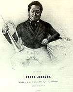 |
October 3, 1992 | 536 Pine St., Philadelphia 39.94383°N 75.15166°W |
City | African American, Performers | |
| Frank Furness (1839-1912) |  |
September 14, 2012 | 39.94567|-75.16642}} | City | Buildings & Architecture, Professions & Vocations | |
| Frank Gasparro (1909-2001) |  |
November 1, 2002 | 727 Carpenter St., Philadelphia 39.93703°N 75.15597°W |
Roadside | Artists, Government & Politics, Professions & Vocations | |
| Frank N. Piasecki (1919-2008) |  |
April 17, 2010 | 1937 Callowhill St., north side of Callowhill between 19th & 20th | Roadside | Business & Industry, Invention, Military, Professions & Vocations | |
| Fraunces Tavern | 1991 | 166 S 2nd St. (just W of Dock St.), Philadelphia 39.9465°N 75.14465°W |
City | Buildings, Business & Industry, George Washington, Professions & Vocations, Inns & Taverns | ||
| Frederick Douglass Memorial Hospital | 1992 | 1522 Lombard St., Philadelphia 39.94498°N 75.16807°W |
City | African American, Medicine & Science, Professions & Vocations | ||
| Free African Society |  |
1992 | 6th & Lombard Sts., Philadelphia 39.94325°N 75.15195°W |
City | African American, Government & Politics | |
| Freedom Now Rally | June 19, 2010 | intersection of 40th St., Lancaster Ave., and Haverford Ave., Philadelphia 39.96296°N 75.20232°W |
Roadside | African American, Civil Rights, Government & Politics 20th Century | ||
| Freedom Theatre |  |
May 16, 1991 | 1346 N. Broad St. (Pa. 611), Philadelphia 39.9744°N 75.15898°W |
City | African American, Music & Theater, Performers | |
| Gay Rights Demonstrations July 4, 1965 - 1969 |  |
July 1, 2005 | NW corner of 6th & Chestnut Sts. 39.9492°N 75.1508°W |
City | Civil Rights, Government & Politics 20th Century | |
| George Gordon Meade (1815-1872) |  |
November 6, 1999 | 1836 Delancey St., Philadelphia 39.9473°N 75.17302°W |
City | Civil War, Military | |
| German Society of Pennsylvania (The) | 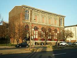 |
October 6, 2008 | 611 Spring Garden St. (at N 7th), Philadelphia 39.96155°N 75.14922°W |
Roadside | Ethnic & Immigration | |
| Germantown Meetinghouse | 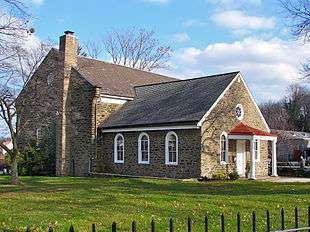 |
September 10, 2008 | 6611 Germantown Ave., Philadelphia 40.05004°N 75.1842°W |
City | Buildings, Religion | |
| Gertrude E. H. Bustill Mossell (1855-1948) | .jpg) |
1993 | 1423 Lombard St., Philadelphia 39.94469°N 75.16629°W |
City | Women, Writers | |
| Giannini Family | .jpg) |
October 1, 2005 | 735 Christian St., Philadelphia 39.93842°N 75.15573°W |
City | Music & Theater, Performers | |
| Giovanni's Room | .jpg) |
October 9, 2011 | NE corner, S 12th & Pine Sts., Philadelphia 39.94501°N 75.16128°W |
City | Buildings & Architecture, Civil Rights | |
| Girard College Civil Rights Landmark |  |
1992 | NE corner, Corinthian and Girard Aves., Philadelphia 39.97312°N 75.16986°W |
City | African American, Civil Rights, Education, Government & Politics, Professions & Vocations | |
| Girl Scout Cookies | .jpg) |
January 16, 2001 | 1401 Arch St., Philadelphia 39.95487°N 75.16367°W |
City | Business & Industry, Women | |
| Glomar Explorer | .jpg) |
August 2, 2006 | At Independence Seaport Mus., 211 S Columbus Blvd. & Walnut St., Philadelphia 39.94633°N 75.14014°W |
Roadside | Government & Politics 20th Century, Military | |
| Gloria Dei Church (Old Swedes') | _Church.png) |
December 17, 1954 | 916 Swanson St. at N facade of bldg., near Christian St. & Christopher Columbus Blvd. 39.9346°N 75.1436°W |
City | Buildings, Early Settlement, Ethnic & Immigration, Religion | |
| Grand Battery, The | .jpg) |
December 7, 1997 | S Columbus Blvd., at to US Coast Guard Station, Philadelphia 39.9327°N 75.1435°W |
Roadside | Forts, French & Indian War, Military | |
| Grand United Order of Odd Fellows, The | 1992 | S 12th & Spruce Sts., Philadelphia 39.946522°N 75.161056°W |
City | African American, Medicine & Science | --Missing-- | |
| Greenbelt Knoll |  |
June 10, 2007 | SW corner of Holme Ave. & Longford St., Philadelphia 40.0563°N 75.0221°W |
Roadside | African American, Buildings, Cities & Towns, Civil Rights, Houses & Homesteads | |
| Hannah Callowhill Penn | 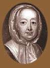 |
October 24, 2000 | S 2nd St. & Sansom St. Walkway (Welcome Park), Philadelphia 39.94743°N 75.14415°W |
City | Government & Politics, William Penn, Women | |
| Hannah Penn – PLAQUE | |
December 1926 | 135 S. 2nd St. (SE corner of 2nd & Sansom), Philadelphia 39.947155°N 75.144338°W |
Plaque | Government & Politics 18th Century, William Penn, Women | --Missing-- |
| Harvey Pollack (1922-2015) | May 19, 2016 | Grounds of Wells Fargo Center, near Xfinity, off Zinkoff Blvd., Philadelphia 39.90361°N 75.17009°W |
Roadside | Professions & Vocations, Sports & Recreation | ||
| Haym Salomon (1740-1785) | _-_NARA_-_532941.jpg) |
September 7, 1997 | 45 N. 5th St., Philadelphia 39.9513°N 75.14847°W |
City | American Revolution, Ethnic & Immigration, Military, Professions & Vocations, Religion | |
| Henry George | 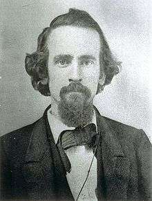 |
November 18, 1984 | 413 S. 10th St., Philadelphia 39.9443°N 75.1584°W |
City | Business & Industry, Government & Politics, Writers | |
| Henry L. Phillips (1847-1935) | .jpg) |
1993 | 620 S. 8th St., Philadelphia 39.94192°N 75.15563°W |
City | African American, Religion | |
| Henry O. Tanner (1859-1937) | 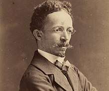 |
January 19, 1991 | 2908 W. Diamond St., Philadelphia 39.98792°N 75.18123°W |
City | African American, Artists, Religion | |
| Herman Herzog (1831-1932) | September 12, 2011 | 4101 Pine St. 39.95107°N 75.20582°W |
Roadside | Artists, Ethnic & Immigration | ||
| Hershey's First Candy Store | 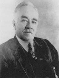 |
June 1, 2009 | 935 Spring Garden St., Philadelphia 39.96163°N 75.1543°W |
Roadside | Business & Industry, Entrepreneurs, Professions & Vocations | |
| Historical Society of Pennsylvania | 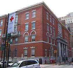 |
October 25, 2010 | 1300 Locust St. 39.94806°N 75.16261°W |
City | Education | |
| Hotel Brotherhood USA | October 22, 2016 | 1523-29 Bainbridge St., Philadelphia 39.94317°N 75.16839°W |
City | African American, Labor, Professions & Vocations | ||
| House of Industry | .jpg) |
June 27, 1996 | 714 Catharine St., Philadelphia 39.93903°N 75.15502°W |
City | Education, Ethnic & Immigration, Labor | |
| Institute for Colored Youth | 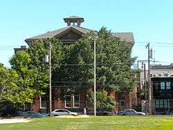 |
1991 | 915 Bainbridge Sts., Philadelphia 39.94177°N 75.15753°W |
City | African American, Agriculture, Education, Labor | |
| Insurance Company of North America | April 26, 2017 | 436 Walnut St., Philadelphia 39.94742°N 75.14904°W |
Roadside | Business & Industry, Invention | ||
| Isaac Leeser |  |
September 28, 1998 | Market St. between 54th & 55th, Philadelphia 39.9608°N 75.2307°W |
City | Ethnic & Immigration, Publishing, Religion, Writers | |
| Israel Goldstein (1896-1986) | 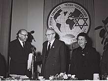 |
November 20, 2002 | At S Phila. High School, 2101 S Broad St., Philadelphia 39.92364°N 75.16969°W |
Roadside | Education, Ethnic & Immigration, Government & Politics 20th Century, Religion | |
| Jack and Jill of America Foundation | 1993 | 1605 Christian St., Philadelphia 39.94065°N 75.16978°W |
City | African American, Education, Women | ||
| Jacob C. White Jr. (1837-1902) | 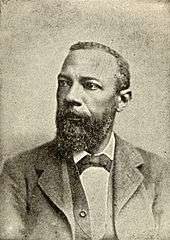 |
1991 | 1032 Lombard St., Philadelphia 39.944°N 75.1596°W |
City | African American, Baseball, Education, Medicine & Science, Sports, Underground Railroad | |
| James Forten (1766-1842) | .jpg) |
April 24, 1990 | 336 Lombard St., Philadelphia 39.94262°N 75.14858°W |
City | African American, Professions & Vocations, Underground Railroad | |
| Jefferson House | September 10, 1954 | 7th St. near Market St., Philadelphia (Missing) 39.950936°N 75.152°W |
City | Government & Politics, Government & Politics 18th Century, Houses & Homesteads | --Missing-- | |
| Jefferson Street Ballparks | September 30, 2017 | outside park on Jefferson St. at Bailey St., Philadelphia 39.97844°N 75.17868°W |
Roadside | African American, Baseball, Sports & Recreation | ||
| Jessie Redmon Fauset | 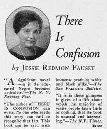 |
1993 | 1853 N. 17th St., Philadelphia 39.98284°N 75.16189°W |
City | African American, Women, Writers | |
| Jewish Hospital, The | October 11, 2017 | At hospital, 5501 Old York Rd., at intersection of Albert Einstein Dr., Philadelphia 40.03695°N 75.14461°W |
Roadside | Ethnic & Immigration, Science & Medicine, Religion | ||
| Joe Venuti (1903-1978) |  |
April 18, 1997 | NE corner 8th & Fitzwater Sts., Philadelphia 39.9407°N 75.1558°W |
City | Music & Theater, Performers | |
| John Bartram (1699-1777) |  |
June 6, 1955 | Harley Ave. at Lindbergh Blvd., West Philadelphia 39.9329°N 75.21546°W |
City | Environment, Professions & Vocations | |
| John C. Asbury (1862-1941) | April 24, 2014 | 1710 Christian St., Philadelphia 39.94058°N 75.17157°W |
City | African American, Government & Politics 20th Century, Science & Medicine, Publishing & Journalism | ||
| John E. Fryer, M.D. (1937-2003) |  |
October 3, 2017 | 13th St. at Locust, Philadelphia 39.94807°N 75.16228°W |
Roadside | Civil Rights, Science & Medicine | |
| John J. McDermott (1891-1971) |  |
October 9, 2014 | Kingsessing Library, 1201 S 51st St., Philadelphia 39.94203°N 75.21821°W |
Roadside | Professions & Vocations, Sports & Recreation | |
| Johann Nepomuk Maelzel (1772-1838) | 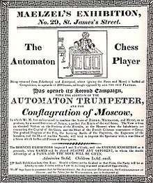 |
July 5, 2004 | NW corner, S 5th St. & St. James Ct., Philadelphia 39.94694°N 75.15044°W |
City | Business & Industry, Entrepreneurs, Ethnic & Immigration, Invention, Performers, Sports | --Missing-- |
| John Page Nicholson (1842-1922) | May 2, 1998 | 1805 Pine St., Philadelphia 39.94665°N 75.1716°W |
City | Civil War, Military, Professions & Vocations | ||
| John Penn - PLAQUE | .jpg) |
October 1932 | 242 S 3rd St., Philadelphia 39.94572°N 75.14658°W |
Plaque | Government & Politics 18th Century, William Penn | |
| John W. Coltrane (1926-1967) |  |
July 17, 1990 | 1511 N. 33rd St., Philadelphia 39.9803°N 75.18878°W |
City | African American, Music & Theater, Performers | |
| John Wanamaker (1838-1922) |  |
July 11, 1998 | S 13th & Market Sts., Philadelphia 39.95123°N 75.16621°W |
Roadside | Business & Industry, Education, Entrepreneurs, Government & Politics 19th Century, Invention, Professions & Vocations, Religion | |
| Johnson House (The) |  |
June 1, 1995 | 6306 Germantown Ave., Philadelphia 40.0434°N 75.1811°W |
City | African American, Houses & Homesteads, Religion, Underground Railroad | |
| Joseph and Amy Cassey (1789–1848)/(1809-56) |  |
March 13, 2009 | S 4th St., between Chestnut and Market, Philadelphia 39.94924°N 75.14785°W |
City | African American, Professions & Vocations | |
| Joseph Bonaparte (1768-1844) | .jpg) |
January 9, 2000 | 260 South 9th St., Philadelphia 39.94628°N 75.15628°W |
City | Government & Politics, Government & Politics 19th Century | |
| Joseph Huston (1866-1940) |  |
October 20, 2005 | 5829 Wissahickon Ave., Germantown, Philadelphia 40.0289°N 75.1854°W |
City | Buildings, Houses & Homesteads, Professions & Vocations | |
| Julian Abele | February 12, 1991 | At Philadelphia Museum of Art steps, 26th & Franklin Pkwy. 39.965°N 75.17958°W |
Roadside | African American, Buildings, Professions & Vocations | ||
| Kahal Kodosh Mikveh Israel |  |
1991 | 313 Cherry St. at Orianna St., Philadelphia 39.95311°N 75.14584°W |
City | Ethnic & Immigration, Religion | |
| Kelly Family, The | 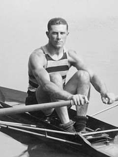 |
October 27, 2012 | At the corner of W Coulter St. & Henry Ave., Philadelphia 40.01784°N 75.18896°W |
Roadside | Government & Politics 20th Century, Motion Pictures & Television, Performers, Sports & Recreation, Women | |
| Kelpius Community | 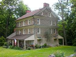 |
April 17, 2004 | Hermit Lane near Henry Ave., Fairmount Park, Philadelphia 40.0251°N 75.2009°W |
Roadside | Education, Ethnic & Immigration, Native American, Religion, William Penn | |
| Knowlton |  |
November 12, 1994 | 8001 Verree Road, Philadelphia 40.07233°N 75.07452°W |
City | Buildings, Houses & Homesteads | |
| Laura Wheeler Waring |  |
1992 | 756 N. 43rd St., Philadelphia 39.9663°N 75.2095°W |
City | African American, Artists, Education, Women | |
| Laurel Hill Cemetery | 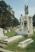 |
May 20, 2000 | 3822 Ridge Ave., Philadelphia 40.00427°N 75.18743°W |
Roadside | Environment | |
| Legendary Blue Horizon, The | 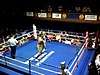 |
October 24, 2003 | 1314 N. Broad St., Philadelphia 39.97382°N 75.1591°W |
City | African American, Sports | |
| Liberation of Jane Johnson, The | 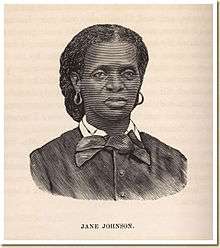 |
July 18, 2009 | Penn's Landing near Walnut St. pedestrian walkway and entrance to Independence Seaport Museum, Philadelphia 39.9464°N 75.141°W |
Roadside | African American, Government & Politics 19th Century, Women | |
| Lombard Street Riot | November 23, 2005 | SE corner of 6th & Lombard Sts., Philadelphia 39.94298°N 75.15197°W |
City | African American | ||
| London Coffee House | 1991 | SW corner, Front & Market Sts., Philadelphia 39.9496°N 75.14222°W |
City | African American, Business & Industry | ||
| Lorenzo L. Langstroth (1810-1895) |  |
September 10, 2010 | 106 S Front St., Phila. 39.94802°N 75.14248°W |
City | Business & Industry, Invention, Science & Medicine, Writers | |
| Louis I. Kahn (1901-1974) | June 24, 2004 | 1501 Walnut St., Philadelphia 39.94903°N 75.16572°W |
City | Buildings, Education, Professions & Vocations | ||
| Louisa May Alcott | 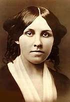 |
November 7, 1996 | 5427 Germantown Ave., Philadelphia 40.0337°N 75.1716°W |
City | Women, Writers | |
| Marc Blitzstein (1905-1964) | 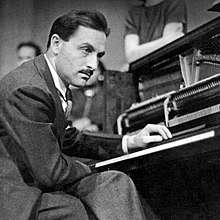 |
June 12, 2017 | 419 Pine St., Philadelphia 39.94386°N 75.14961°W |
City | Music & Theater, Performers, Professions & Vocations, Writers | |
| Marian Anderson | 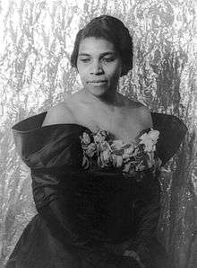 |
1993 | At Union Baptist Church, 1910 Fitzwater St., Philadelphia 39.94312°N 75.1745°W |
City | African American, Performers, Women | |
| Mario Lanza (1921-1959) | 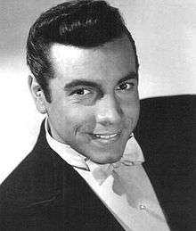 |
November 7, 1993 | 634-36 Christian St., Philadelphia 39.9381°N 75.15453°W |
City | Motion Pictures & Television, Music & Theater, Performers | |
| Mason-Dixon Survey | .jpg) |
August 30, 2013 | Front & South Sts., Philadelphia 39.94089°N 75.14369°W |
Roadside | Exploration, Government & Politics 17th Century, Government & Politics 18th Century, Science & Medicine, Native American, Professions & Vocations | |
| Masonic Temple Philadelphia | 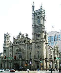 |
December 5, 2007 | One N Broad St. 39.95544°N 75.16145°W |
City | Buildings & Architecture | |
| Mathew Carey (1760-1839) | 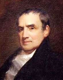 |
September 14, 2014 | 324 Marker St., Philadelphia 39.95063°N 75.14668°W |
Roadside | Ethnic & Immigration, Government & Politics 18th Century, Government & Politics 19th Century, Professions & Vocations, Publishing & Journalism, Writers | |
| Maxfield Parrish (1870-1966) | 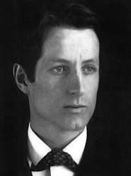 |
September 16, 2015 | in front of Curtis Bldg., S 6th St. between Sansom & Walnut. 39.94796°N 75.15114°W |
Roadside | Artists, Professions & Vocations | |
| McClellan House | October 14, 1997 | 912 Walnut St., Philadelphia 39.94817°N 75.15652°W |
City | Education | ||
| Mechanics' Union of Trade Associations | 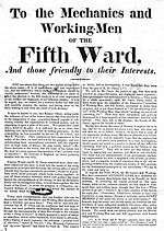 |
June 30, 2004 | Chestnut and Bank Sts., Philadelphia 39.94865°N 75.14505°W |
City | Education, Government & Politics 19th Century, Labor | |
| Medical Library Association | .jpg) |
November 4, 2015 | 1420-22 Chestnut St., Philadelphia 39.95065°N 75.16508°W |
City | Education, Science & Medicine, Women | |
| Mercy Hospital | 1992 | NW corner, S 17th & Fitzwater Sts., Philadelphia 39.9424°N 75.1708°W |
City | African American, Science & Medicine, Professions & Vocations | ||
| Meriwether Lewis (1774-1809) | 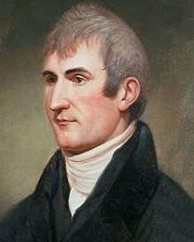 |
August 12, 2003 | 1900 Ben Franklin Pky., Philadelphia 39.95728°N 75.17115°W |
City | Education, Environment, Exploration, Science & Medicine | |
| Meta V.W. Fuller (1877–1968) | 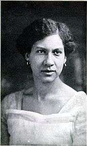 |
1992 | 254 S 12th St., Philadelphia 39.94697°N 75.16101°W |
City | African American, Artists, Women | |
| Mikveh Israel Cemetery | 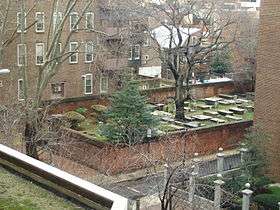 |
1957 | Spruce St. between Schell & Darien Sts., Philadelphia 39.9464°N 75.1564°W |
City | Ethnic & Immigration, Religion | |
| Mother Bethel A.M.E. Church |  |
March 19, 1991 | NE corner, S 6th & Lombard Sts., Philadelphia 39.94298°N 75.15198°W |
City | African American, Religion, Underground Railroad | |
| Mother Jones (1830-1930) |  |
November 12, 1994 | N Broad St. & JFK Blvd., N side of City Hall, Philadelphia 39.95347°N 75.16473°W |
City | Labor, Women | |
| Mother's Day |  |
June 1, 1998 | Traffic island, Market & Juniper Sts. (E side of City Hall), Philadelphia 39.95228°N 75.16282°W |
City | Women | |
| Mower General Hospital | 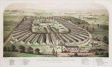 |
September 17, 2000 | Willow Grove Ave. & Wyndmoor St., Philadelphia 40.07381°N 75.19753°W |
City | Civil War, Military | |
| Moyamensing Prison |  |
May 4, 2011 | E Passyunk Ave. & S 10th St., at corner of Reed, Philadelphia 39.9319°N 75.16111°W |
Roadside | ||
| Muhammad's Temple of Islam #12 | August 20, 2016 | 4218 Lancaster Ave., Philadelphia 39.96687°N 75.20848°W |
City | African American, Religion | ||
| National Funeral for President Washington | December 14, 1999 | SE corner, N 4th & Cherry Streets, Philadelphia 39.9529°N 75.1467°W |
Roadside | George Washington, Government & Politics, Government & Politics 18th Century | ||
| New Century Guild | 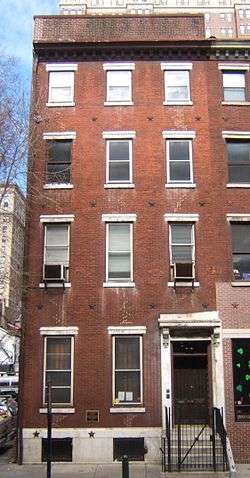 |
June 19, 1997 | 1307 Locust St., Philadelphia 39.9479°N 75.1628°W |
City | Labor, Women | |
| NFL Films |  |
July 23, 2009 | 230 N 13th St. 39.95678°N 75.16031°W |
City | ||
| Nicholas Biddle (1786-1844) |  |
2000 | 715 Spruce St., Philadelphia 39.94562°N 75.15357°W |
City | Business & Industry, Entrepreneurs, Exploration | |
| Nicola Monachesi (c. 1795-1851) | May 24, 2017 | at St. Augustine's R.C. Church, 246-60 N 4th St., Philadelphia 39.95552°N 75.14621°W |
Roadside | Artists, Buildings & Architecture, Ethnic & Immigration, Professions & Vocations, Religion | ||
| Octavius V. Catto (1839-1871) |  |
1992 | 812 South St., Philadelphia 39.9425°N 75.15593°W |
City | African American, Civil Rights, Civil War, Education, Government & Politics, Military | |
| Old St. Joseph's Roman Catholic Church | July 31, 2014 | 324 Walnut St., Philadelphia 39.94722°N 75.14765°W |
Roadside | Buildings & Architecture, Religion | ||
| Old St. Mary's Roman Catholic Church | 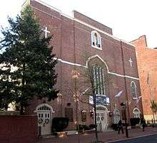 |
2013 | at church, 250-252 S 4th St., Philadelphia 39.94563°N 75.14838°W |
Roadside | American Revolution, Buildings & Architecture, Government & Politics 18th Century, Religion | |
| Oldest Photograph |  |
September 25, 1989 | NW corner, Chestnut & Juniper Sts., Philadelphia 39.95067°N 75.16322°W |
City | Artists, Business & Industry, Invention, Medicine & Science, Professions & Vocations | |
| Opportunities Industrialization Centers | November 23, 1990 | N 19th St., between Turner & Oxford Sts., Philadelphia 39.9786°N 75.1661°W |
City | African American, Education | ||
| Ora Washington (1899-1971) | November 5, 2004 | 6128 Germantown Ave., Philadelphia 40.0413°N 75.1794°W |
City | African American, Sports, Women | ||
| Owen Wister (1860-1938) |  |
October 7, 2001 | 5203 Germantown Ave., Philadelphia 40.03101°N 75.16672°W |
City | Motion Pictures & Television, Writers | |
| Paul Philippe Cret (1876-1945) |  |
May 23, 1992 | 516 Woodland Terrace, Philadelphia 39.94902°N 75.20455°W |
City | Bridges, Buildings & Architecture, Professions & Vocations | |
| Paul Robeson (1898-1976) | 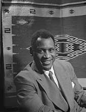 |
April 8, 1991 | 4951 Walnut St. (at 50th), Philadelphia 39.95651°N 75.22143°W |
City | African American, Music & Theater, Performers | |
| Pearl Bailey (1919-1990) | 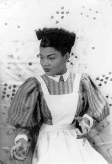 |
1992 | 1946 N 23rd St., Philadelphia 39.98494°N 75.17152°W |
City | African American, Performers, Women | |
| Penn Relays, The | _100m_Dash.jpg) |
April 29, 1995 | At Franklin Field track entrance, 233 S 33rd St., Philadelphia 39.9511°N 75.1906°W |
Roadside | Sports & Recreation | |
| Penn Treaty Park | 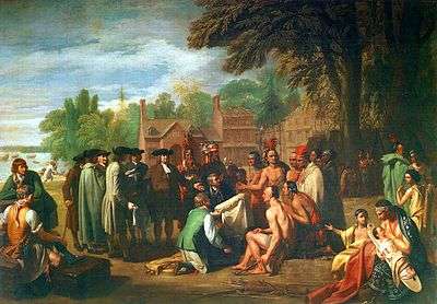 |
September 18, 1976 | At Park on Delaware River, foot of Cecil B. Moore (Columbia) Ave., Philadelphia 39.96711°N 75.12849°W |
Roadside | Native American, William Penn | |
| Pennepack Baptist Church | 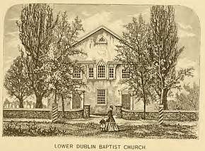 |
June 1, 2013 | 8732 Krewstown Rd., Philadelphia 40.08113°N 75.05098°W |
Roadside | Buildings & Architecture, Early Settlement, Religion, William Penn | |
| Pennsylvania Abolition Society | 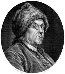 |
1992 | Front St. below S Chestnut St., Philadelphia 39.94743°N 75.14253°W |
City | African American, Education, Underground Railroad | |
| Pennsylvania Academy of the Fine Arts | 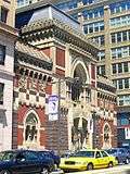 |
November 17, 2004 | At the Academy, 118 N Broad St., Philadelphia 39.95517°N 75.16307°W |
City | Artists, Buildings & Architecture, Education | |
| Pennsylvania Bible Society | April 26, 2014 | NW corner of 7th & Walnut Sts., Philadelphia 39.94799°N 75.15281°W |
City | Education, Publishing & Journalism, Religion | ||
| Pennsylvania Hall | .jpg) |
1992 | N 6th St. south of Race St., Philadelphia 39.9538°N 75.1498°W |
City | African American, Government & Politics, Government & Politics 19th Century, Underground Railroad | |
| Pennsylvania Hospital | 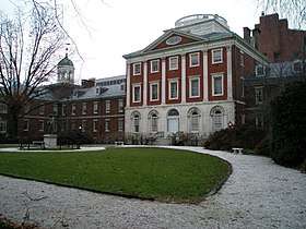 |
December 17, 1954 | Pine St. between 8th & 9th Sts., Philadelphia 39.94438°N 75.15562°W |
City | Medicine & Science, Professions & Vocations | |
| Pennsylvania Slave Trade, The | August 5, 2016 | at Independence Seaport Museum near waterfront, 211 S Columbus Blvd., Philadelphia 39.94618°N 75.13991°W |
Roadside | African American, Government & Politics 17th Century, William Penn | ||
| Pennsylvania Station | 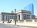 |
December 17, 1996 | N side of Market St. between 29th & 30th Sts., Philadelphia 39.956667°N 75.181667°W |
City | Railroads, Transportation | --Missing-- |
| Pennypack Creek Bridge | 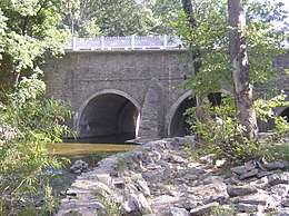 |
October 13, 2012 | Pennypack Park, Frankford Ave. & Solly Ave., Philadelphia 40.04362°N 75.01993°W |
Roadside | American Revolution, Bridges, Early Settlement, Native American, Roads | |
| Philadelphia |  |
December 6, 1982 | Traffic island at N. Broad St. (PA 611) & John F. Kennedy Blvd., just N of City Hall 39.9535°N 75.1635°W |
City | Cities & Towns, William Penn | |
| Philadelphia & Columbia Railroad |  |
May 17, 2001 | Edgley Ave. off Belmont Ave. (W Fairmount Park), Philadelphia 39.9956°N 75.21644°W |
Roadside | Business & Industry, Government & Politics 19th Century, Railroads, Transportation | |
| Philadelphia Chinatown | 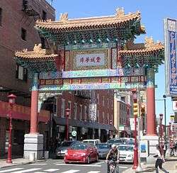 |
October 8, 2010 | 913 Race St. 39.95515°N 75.15501°W |
City | Ethnic & Immigration | |
| Philadelphia College of Pharmacy and Science | January 4, 1971 | At entrance, 43rd St. & Kingsessing Ave., West Philadelphia 39.947°N 75.2087°W |
Roadside | Education | ||
| Philadelphia College of Textiles and Science | May 16, 1969 | Campus, School House land near Henry Ave., Germantown 40.0214°N 75.1916°W |
Roadside | Education | ||
| Philadelphia Contributionship, The |  |
December 17, 1954 | 212 S. 4th St., Philadelphia 39.94692°N 75.14793°W |
City | Business & Industry | |
| Philadelphia Female Anti-Slavery Society | 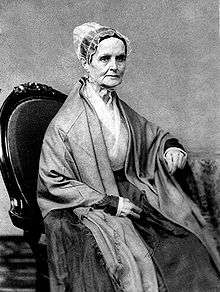 |
1992 | 5th & Arch Sts., Philadelphia 39.95275°N 75.14836°W |
City | African American, Government & Politics, Underground Railroad, Women | |
| Philadelphia General Hospital | _Wellcome_L0004918.jpg) |
November 5, 2007 | Curie Blvd. & Osler Circle, Penn campus 39.94884°N 75.19646°W |
Roadside | Buildings & Architecture, Science & Medicine, Professions & Vocations, Women | |
| Philadelphia Knights of Pythias | 1992 | 19th & Addison Sts., Philadelphia 39.94593°N 75.1733°W |
City | African American | ||
| Philadelphia Pyramid Club | 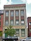 |
1992 | 1517 Girard Ave., Philadelphia 39.97182°N 75.1619°W |
City | African American | |
| Philadelphia Sketch Club | 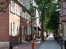 |
October 11, 2008 | 235 S Camac St., Philadelphia 39.9474°N 75.16164°W |
City | Artists | |
| Philadelphia Tribune | July 1, 1992 | 520-26 S 16th St., Philadelphia 39.94443°N 75.16868°W |
City | African American, Business & Industry | ||
| Philadelphia Zoo, The | 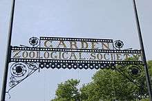 |
June 27, 1996 | 3400 Girard Ave. at zoo entrance, Philadelphia 39.9747°N 75.19557°W |
City | Sports & Recreation | |
| Philip Syng, Jr. (1703–1789) | September 28, 2003 | Corner of Chestnut St. & S Front St., Philadelphia 39.9496°N 75.14222°W |
City | Government & Politics, Government & Politics 18th Century, Professions & Vocations | ||
| Presbyterian Church in the U.S.A. | %2C_President_(1768-94).jpg) |
July 1, 1989 | NW corner, Arch St. & N 3rd St., Philadelphia 39.95224°N 75.14543°W |
City | Religion | |
| Prince Hall Grand Lodge | September 8, 1990 | 4301 N. Broad St., between St. Luke & Bristol, Philadelphia 40.01908°N 75.1489°W |
City | African American | ||
| Printz's (Old Swedes) Mill | October 18, 2008 | 7303 Woodland Ave., next to Cobbs Creek, Philadelphia 39.917°N 75.2468°W |
Roadside | Business & Industry, Early Settlement, Mills, Native American, William Penn | --Missing-- | |
| PSFS Building | 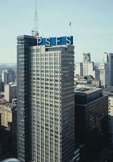 |
November 11, 2005 | 1200 Market St., Philadelphia 39.9519°N 75.16037°W |
City | Buildings | |
| Public Sector Collective Bargaining | September 26, 2008 | City Hall, north side, Broad & Market Sts. (near Mother Jones marker), Philadelphia 39.95337°N 75.16378°W |
City | Government & Politics, Labor | ||
| Ralph Modjeski (1861–1940) | 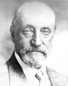 |
September 15, 2007 | NW corner of 6th & Race Sts., near Franklin Sq. Park entrance, Philadelphia | City | Bridges, Business & Industry, Ethnic & Immigration, Professions & Vocations | |
| Reading Terminal and Market | 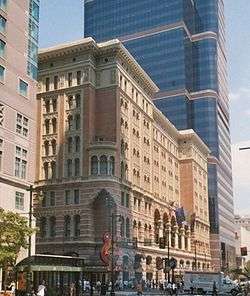 |
September 10, 2003 | On site at Market St. near 12th, at Convention Ctr., Philadelphia 39.9518°N 75.15923°W |
Roadside | Business & Industry, Railroads, Transportation | |
| Rev. Dr. Leon Howard Sullivan (1922-2001) |  |
October 16, 2017 | At Zion Baptist Church, 3600 N Broad St., Philadelphia 40.00779°N 75.1517°W |
Roadside | African American, Civil Rights, Government & Politics, Government & Politics 20th Century, Religion | |
| Rev. Isaac Leeser (1806-1868) | |
September 28, 1998 | Market St. between 54th & 55th, Philadelphia 39.96082°N 75.23076°W |
City | Ethnic & Immigration, Publishing & Journalism, Religion, Writers | |
| Rev. Jehu Jones, Jr. (1786-1852) | February 22, 1998 | 310 S. Quince St., Philadelphia (at Mask & Wig Club) 39.94591°N 75.16041°W |
City | African American, Religion | ||
| Ricketts' Circus | 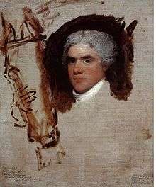 |
July 15, 1982 | S 12th & Market Sts., at Loew's Hotel, Philadelphia 39.95158°N 75.15994°W |
City | George Washington, Performers | |
| Rittenhouse Town | .jpg) |
April 8, 1991 | Lincoln Dr. at Rittenhouse St. just off Wissahickon Ave., Fairmount Park, Philadelphia 40.02925°N 75.1899°W |
Roadside | Buildings & Architecture, Business & Industry, Cities & Towns, Early Settlement, Mansions & Manors, Science & Medicine, Mills, Religion | |
| Robert Aitken (1734-1802) | October 19, 2012 | 11 Market St., Philadelphia 39.94965°N 75.14258°W |
Roadside | American Revolution, Government & Politics 18th Century, Professions & Vocations, Publishing & Journalism, Religion | ||
| Robert Bogle (1774-1848) | 1991 | 112 S 8th St., Philadelphia 39.941536°N 75.15567°W |
City | African American, Professions & Vocations | ||
| Robert Cornelius | 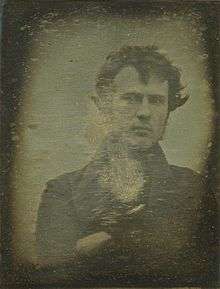 |
December 9, 1994 | S 8th & Ranstead Sts. (next to Siegmund Lubin marker), Philadelphia 39.95047°N 75.15368°W |
City | Business & Industry, Invention, Science & Medicine, Professions & Vocations | |
| Robert Mara Adger (1837–1910) | .jpg) |
1993 | 823 South St. (at Darien St.), Philadelphia 39.94253°N 75.15634°W |
City | African American, Professions & Vocations, Underground Railroad | |
| Robert Patterson (1743–1824) | July 22, 2004 | West side of 9th St., south of Market St., Philadelphia 39.95017°N 75.15545°W |
City | Education, Exploration | ||
| Robert Purvis (1810-1898) |  |
February 21, 1992 | 1601 Mt. Vernon St., Philadelphia 39.96494°N 75.16432°W |
City | African American, Civil Rights, Professions & Vocations, Underground Railroad, Writers | |
| Robert Smith | January 14, 1983 | 606 S. 2nd St., Philadelphia 39.94085°N 75.14578°W |
City | Buildings, Ethnic & Immigration, Professions & Vocations | ||
| Roy Campanella (1921-1993) | 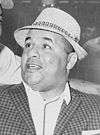 |
May 29, 1996 | Simon Gratz High School, 18th St. & Hunting Park Ave., Philadelphia 40.0148°N 75.1562°W |
City | African American, Baseball, Sports & Recreation | |
| Sadie T.M. Alexander (1898-1989) | 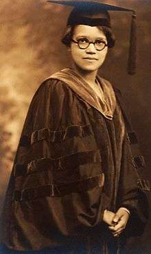 |
1993 | 700 Westview St., Philadelphia 40.0443°N 75.1963°W |
City | African American, Civil Rights, Government & Politics, Government & Politics 20th Century, Women | |
| Salvation Army, The | 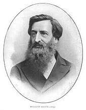 |
June 19, 1998 | N 4th & Oxford Sts., Philadelphia 39.9752°N 75.1418°W |
City | Religion, Women | |
| Samuel Hopkins (1743–1818) |  |
July 29, 2000 | 119 Arch St., Philadelphia 39.95194°N 75.14265°W |
City | Business & Industry, George Washington, Government & Politics, Invention, Science & Medicine | |
| Samuel S. Fleisher Art Memorial | 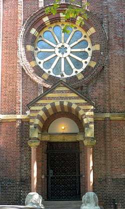 |
September 13, 2005 | 719 Catherine St., Philadelphia 39.93903°N 75.15517°W |
City | Artists, Education | |
| Sarah Josepha Hale (1788-1879) | 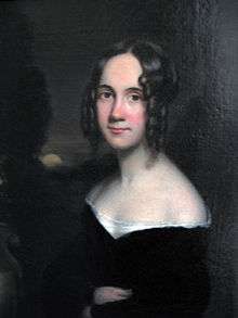 |
November 14, 2015 | 922 Spruce St., Philadelphia 39.94583°N 75.15742°W |
City | Abraham Lincoln, Civil Rights, Government & Politics 19th Century, Professions & Vocations, Publishing & Journalism, Women, Writers | |
| Satterlee U.S.A. General Hospital |  |
November 8, 2003 | At the Gettysburg Stone in Clark Park, between 43rd and 44th Sts. on Baltimore Ave., Philadelphia 39.9491°N 75.211°W |
City | Civil War, Medicine & Science, Military | |
| Schuylkill Arsenal | 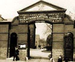 |
June 10, 2004 | E Greys Ferry Rd. at Washington Ave., Philadelphia 39.94042°N 75.18767°W |
City | Civil War, Exploration, Military, Military Post-Civil War | |
| Schuylkill Navy of Philadelphia | October 11, 2008 | #4 Boathouse Row, Kelly Dr., Philadelphia 39.96945°N 75.1862°W |
Roadside | Buildings & Architecture, Sports & Recreation | ||
| Shibe Park/Connie Mack Stadium | 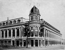 |
November 1, 1997 | N 21st St. & Lehigh Ave., Philadelphia 39.9953°N 75.1646°W |
City | African American, Baseball, Sports & Recreation | |
| Shot Tower | 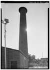 |
April 19, 1997 | Carpenter & Front Sts., Philadelphia 39.9348°N 75.1463°W |
City | Buildings & Architecture, Business & Industry, Military, Religion, War of 1812 | |
| Siegmund Lubin (1851-1923) | 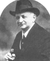 |
April 11, 2007 | 1608 N 15th St., Philadelphia 39.97796°N 75.16003°W |
City | Invention, Motion Pictures & Television, Professions & Vocations | |
| Siegmund Lubin (1851-1923) | |
May 6, 1994 | 21 S. 8th St., Philadelphia 39.95047°N 75.15368°W |
City | Business & Industry, Invention, Motion Pictures & Television, Professions & Vocations | |
| Sigma Sound Studios | October 15, 2015 | In front of parking lot at 211-219 N 12th St. (across the st. from site), Philadelphia 39.95639°N 75.15889°W |
City | Music & Theater | ||
| Sister Rosetta Tharpe (1915-1973) | October 24, 2011 | 1102 Master St., Philadelphia 39.97377°N 75.15377°W |
City | African American, Music & Theater, Performers, Religion, Women | ||
| Smith Memorial Playground & Playhouse | 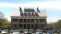 |
September 23, 2017 | 3500 Reservoir Dr., Philadelphia 39.9828°N 75.19456°W |
City | Buildings & Architecture, Sports & Recreation | |
| Solitude, The | 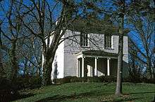 |
October 11, 2009 | at site on Phila. Zoo grounds, 3400 W Girard Ave., Philadelphia 39.9729°N 75.1956°W |
City | Buildings & Architecture, William Penn | |
| South 9th Street Curb Market | 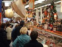 |
October 12, 2007 | NE corner of 9th & Christian Sts., Phila. 39.939°N 75.15778°W |
Roadside | Business & Industry, Ethnic & Immigration, Roads | |
| SPHAs Basketball Team, The | April 14, 2013 | Broad & Wood Sts., Philadelphia 39.95883°N 75.16232°W |
Roadside | Basketball, Ethnic & Immigration, Sports & Recreation | ||
| St. Augustine's Roman Catholic Church | 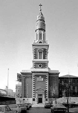 |
October 28, 1995 | 235 N 4th St. at New St., Philadelphia 39.95547°N 75.14617°W |
City | Buildings & Architecture, Government & Politics, Government & Politics 19th Century, Religion | |
| St. John Neumann | 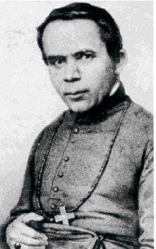 |
March 28, 1981 | St. Peter's Church, N 5th St. & Girard Ave., Philadelphia 39.97013°N 75.14483°W |
City | Religion | |
| St. John the Evangelist Roman Catholic Church | October 4, 2015 | 21 S 13th St (at Ludlow), Philadelphia | Roadside | Artists, Music & Theater, Religion | ||
| St. Mary Magdalen De Pazzi Parish | .jpg) |
May 2, 1994 | 714 Montrose St., Philadelphia 39.9376°N 75.1556°W |
City | Buildings & Architecture, Ethnic & Immigration, Religion | |
| St. Peter Claver Catholic Church | .jpg) |
1991 | SW corner, S 12th & Lombard Sts., Philadelphia 39.94418°N 75.1617°W |
City | African American, Buildings & Architecture, Religion | |
| St. Thomas' African Episcopal Church | 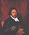 |
September 30, 1984 | SW corner, S 5th St. & St. James Ct., Philadelphia 39.9465°N 75.14995°W |
City | African American, Buildings & Architecture, Religion | |
| Standard Theatre | _Lobby_Entrance.jpg) |
1992 | South St. between 11th & 12th, Philadelphia 39.94312°N 75.16093°W |
City | African American, Buildings & Architecture, Entrepreneurs, Music & Theater, Performers | |
| Stephen Decatur | 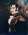 |
October 21, 1988 | 600 block, S. Front St., Philadelphia 39.94063°N 75.14402°W |
City | Military, War of 1812 | |
| Stephen Girard (1750–1831) | 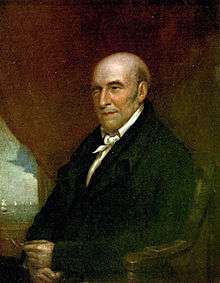 |
October 1, 1993 | Girard Park, Shunk Sts. between S 21st & S 22nd, Philadelphia 39.92012°N 75.18305°W |
Roadside | Buildings & Architecture, Business & Industry, Education, Ethnic & Immigration, Mansions & Manors, Professions & Vocations | |
| Stephen Smith (1795-1873) | June 19, 1991 | 1050 Belmont Ave., Philadelphia 39.9728°N 75.2122°W |
City | African American, Business & Industry, Coal, Professions & Vocations, Underground Railroad | ||
| Sullivan Progress Plaza | September 14, 2016 | 1501 N Broad St., Philadelphia 39.97652°N 75.15825°W |
Roadside | African American, Business & Industry, Government & Politics 20th Century, Religion | ||
| Terminal Commerce Building | 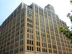 |
September 14, 2017 | 401 N Broad St., Philadelphia 39.95979°N 75.16183°W |
City | Buildings & Architecture, Railroads | |
| Thaddeus Kosciuszko | 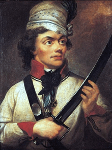 |
October 22, 1967 | NW corner 3rd & Pine Sts., Philadelphia 39.94342°N 75.14737°W |
City | American Revolution, Ethnic & Immigration, Military | |
| The MOVE Bombing | June 24, 2017 | Cobbs Creek Pkwy. on Cobbs Creek Park side of street opposite Osage Ave. 39.95573°N 75.24834°W |
City | African American, Government & Politics 20th Century, Police and Safety | ||
| Thomas A. Edison High School and the Vietnam War | November 8, 2014 | 8th St. & Lehigh Ave., Philadelphia 39.99272°N 75.14438°W |
Roadside | Education, Government & Politics 20th Century, Military Post-Civil War | ||
| Thomas E. Cahill (1828–1878) | 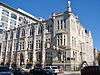 |
September 29, 2009 | E side of N Broad St., between Vine & Pearl, Philadelphia 39.95829°N 75.16222°W |
Roadside | Education, Entrepreneurs, Ethnic & Immigration, Religion | |
| Thomas Eakins (1844-1916) | 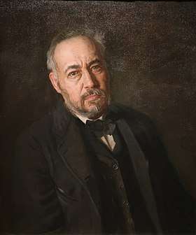 |
1996 | 1729 Mt. Vernon St., Philadelphia 39.96531°N 75.16692°W |
City | Artists, Science & Medicine, Sports & Recreation | |
| Thomas Holme (1624–1695) |  |
July 29, 1995 | Pennypack Park, 3000 Holme Ave., Philadelphia 40.05678°N 75.20148°W |
Roadside | Early Settlement, Government & Politics, Government & Politics 17th Century, William Penn | |
| Thomas Ustick Walter (1804–1877) | 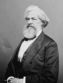 |
October 29, 2009 | 1218 Arch St., Philadelphia 39.95416°N 75.16043°W |
City | Buildings & Architecture, Professions & Vocations | |
| Tindley Temple | 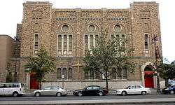 |
1992 | 762 S. Broad St., Philadelphia 39.94137°N 75.16607°W |
City | African American, Buildings & Architecture, Religion | |
| Tomas Garrigue Masaryk (1850-1937) | 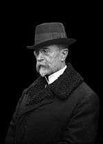 |
July 23, 2002 | Independence Mall West, S 6th St. between Chestnut and Samson, Philadelphia 39.94865°N 75.15073°W |
City | Ethnic & Immigration, Government & Politics, Government & Politics 20th Century | |
| Tommy Loughran (1902–1982) | 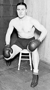 |
July 7, 2006 | SW corner, S 17th & Ritner Sts., Philadelphia 39.9211°N 75.1754°W |
Roadside | Sports & Recreation | |
| Tun Tavern | 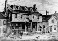 |
November 11, 2005 | Front St., between Chestnut & Walnut, Philadelphia 39.94725°N 75.1426°W |
City | American Revolution, Military, Inns & Taverns | |
| U.S.S. United States | 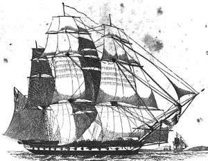 |
October 16, 1983 | 555 S Columbus Blvd. (S of Independence Seaport Museum, and near Delaware Ave. and Chart House restaurant), Philadelphia 39.94145°N 75.14098°W |
City | Military, War of 1812 | |
| Union Fire Company (1736-1843) | 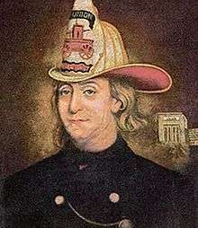 |
October 1, 2011 | Market St., between 2nd & 3rd (Grindstone Alley) 39.95006°N 75.14453°W |
City | Cities & Towns, Government & Politics 18th Century, Invention, Police and Safety | |
| Union League of Philadelphia | 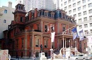 |
February 12, 2004 | 140 S. Broad St., Philadelphia 39.94997°N 75.16363°W |
City | Abraham Lincoln, Civil War, Government & Politics, Military | |
| Union Local 274, American Federation of Musicians | .jpg) |
1993 | 912 S. Broad St., Philadelphia 39.93765°N 75.16527°W |
City | African American, Labor, Music & Theater, Performers | |
| Universal Negro Improvement Association |  |
April 11, 1992 | 1609–11 Cecil B. Moore Ave., Philadelphia 39.97923°N 75.16146°W |
City | African American | |
| US Sanitary Commission Great Central Fair | .jpg) |
June 16, 2012 | Logan Sq., 19th & Ben Franklin Pkwy., near Swann Fountain, Philadelphia 39.95744°N 75.17083°W |
Roadside | Abraham Lincoln, Civil War, Government & Politics 19th Century, Military, Women | |
| Veterans Stadium |  |
September 28, 2005 | NE corner, S Broad St. & Pattison Ave., Philadelphia 39.9052°N 75.1714°W |
Roadside | Baseball, Football, Sports & Recreation | |
| Vincent Persichetti (1915-1987) | May 9, 1997 | Curtis Institute of Music, 1724 Locust St., Philadelphia 39.9489°N 75.1704°W |
City | Education, Music & Theater | ||
| Violet Oakley (1874-1961) | 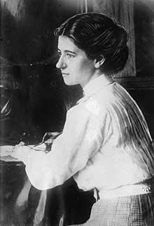 |
October 20, 1998 | 615 St. George's Rd., off McCallum St., Philadelphia 40.05321°N 75.20386°W |
City | Artists, Glass, Government & Politics, Women | |
| W. C. Fields (1880-1948) |  |
October 13, 1997 | NW corner, N 8th & Market Sts., Philadelphia 39.9512°N 75.1537°W |
City | Motion Pictures & Television, Performers | |
| W.E.B. DuBois (1868-1963) | 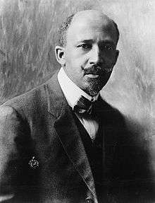 |
October 29, 1995 | NW corner, S 6th & Rodman Sts., Philadelphia 39.94245°N 75.15233°W |
City | African American, Civil Rights, Education, Writers | |
| Walnut Lane Bridge | .jpg) |
October 18, 2008 | Walnut Lane, SW side of bridge over Wissahickon Creek (Roxborough side), Philadelphia 40.0315°N 75.2003°W |
Roadside | Bridges, Business & Industry, Transportation | |
| Walnut Lane Bridge | 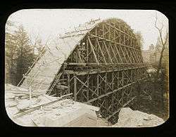 |
October 18, 2008 | Walnut Lane, NE side of bridge over Wissahickon Creek (Germantown side), Philadelphia 40.0329°N 75.1992°W |
Roadside | Bridges, Business & Industry, Transportation | |
| Walnut Street Prison | .jpg) |
1964 | SE corner, S 6th St. near Walnut St., Philadelphia 39.9475°N 75.1512°W |
City | Government & Politics, Government & Politics 18th Century | |
| Walnut Street Theatre | 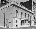 |
September 25, 1996 | S 9th & Walnut Sts., Philadelphia 39.9482°N 75.1554°W |
City | Buildings, Music & Theater, Performers | |
| Walter Golaski (1913-1996) | May 17, 2014 | On Drexel campus on Lancaster Walk, near Lancaster Ave. and 34th St. interesection, Philadelphia 39.95721°N 75.19081°W |
Roadside | Business & Industry, Ethnic & Immigration, Invention, Science & Medicine, Professions & Vocations | ||
| Washington Avenue Immigration Station | .jpg) |
September 14, 1994 | S Columbus Blvd. at Washington Ave., adjacent to US Coast Guard Station, Philadelphia 39.9331°N 75.1433°W |
City | Ethnic & Immigration | |
| Whitaker Mill Cedar Grove | May 27, 2006 | 5100 block of Tabor Rd. betw. E Olney Ave. & Garland St., Phila. 40.03125°N 75.11065°W |
Roadside | Business & Industry, Mills | ||
| William Allen (1704-1780) | 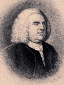 |
September 26, 2009 | 7300 Germantown Ave., near Allen's Ln., at Lutheran Seminary 40.06096°N 75.19151°W |
Roadside | ||
| William Lewis (1751-1819) | October 19, 2013 | Historic Strawberry Mansion, 2450 Strawberry Mansion Dr., Philadelphia 39.99408°N 75.18932°W |
Roadside | African American, Government & Politics 18th Century, Professions & Vocations | ||
| William Penn – Slate Roof House – PLAQUE | 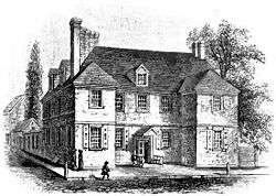 |
November 1924 | 135 S. 2nd St.(SE corner 2nd & Sansom), Philadelphia 39.947155°N 75.144338°W |
Plaque | Buildings, Government & Politics 17th Century, Houses & Homesteads, William Penn | --Missing-- |
| William Penn Charter School | 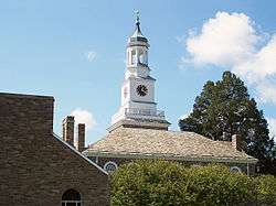 |
October 23, 2015 | Left side of main entrance, 3000 W Schoolhouse Ln., Philadelphia 40.02212°N 75.18689°W |
Roadside | African American, Education, Religion, William Penn, Women | |
| William Still (1821–1902) | 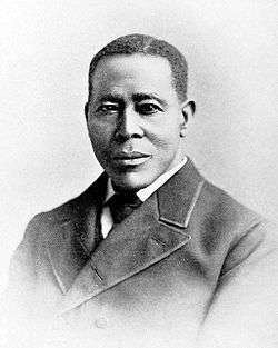 |
July 3, 1991 | 244 S 12th St., Philadelphia 39.94699°N 75.16101°W |
City | African American, Coal, Underground Railroad | |
| William Whipper (1804?–1876) | 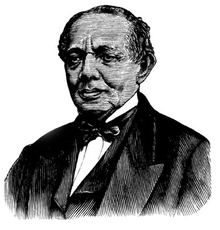 |
June 28, 1992 | 919 Lombard St., Philadelphia 39.94373°N 75.15753°W |
City | African American, Business & Industry, Underground Railroad, Writers | |
| Wills Eye Hospital | 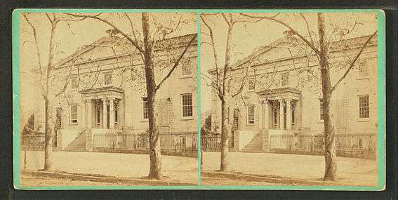 |
October 9, 2009 | 840 Walnut St., Philadelphia 39.9481°N 75.1554°W |
City | Education, Invention, Medicine & Science, Professions & Vocations | |
| Wilt Chamberlain (1936-1999) | 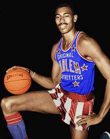 |
September 28, 2000 | Overbrook High School, 59th & Lancaster Sts., Philadelphia 39.98087°N 75.23925°W |
Roadside | Basketball, Sports & Recreation | |
| Wissahickon Boys Club | 2001 | 328 West Coulter St., Germantown, Philadelphia 40.027°N 75.177°W |
Roadside | African American | ||
| Wissahickon Inn | 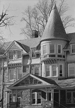 |
June 14, 1988 | Springfield Ave. in front of inn, Chestnut Hill Academy, Philadelphia 40.0621°N 75.2073°W |
City | Buildings, Business & Industry, Education, Inns & Taverns | |
| Wistar Institute For Anatomy and Biology, The | 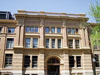 |
November 14, 2007 | 3601 Spruce St. 39.950934°N 75.195485°W |
City | Education, Invention, Medicine & Science | |
| Wood Street Riverbank Steps | October 12, 2013 | 323 N Front St., between Vine & Callowhill Sts., Philadelphia 39.95624°N 75.1401°W |
City | Business & Industry, Government & Politics 18th Century, Transportation, William Penn | ||
| Woodlands, The | 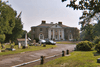 |
December 28, 1996 | 4000 Woodland Ave., Philadelphia 39.94902°N 75.20343°W |
Roadside | Buildings, Environment, Mansions & Manors | |
| Wyoming Branch of the Free Library |  |
October 29, 2005 | 231 E Wyoming Ave., or "B" St. & Wyoming Ave., Phila | City | Buildings, Business & Industry, Education |
See also

- List of Pennsylvania state historical markers
- National Register of Historic Places listings in Philadelphia, Pennsylvania
References
- "PHMC Historical Markers Search" (Searchable database). Pennsylvania Historical and Museum Commission. Commonwealth of Pennsylvania. Retrieved 2010-07-19.
- PHMC listing
External links
- Pennsylvania Historical Marker Program
- Pennsylvania Historical & Museum Commission
- ExplorePAhistory.com, a collaborative effort of the PHMC and WITF
This article is issued from Wikipedia. The text is licensed under Creative Commons - Attribution - Sharealike. Additional terms may apply for the media files.