Le Puy, Doubs
Le Puy is a commune in the department of Doubs in the eastern French region of Bourgogne-Franche-Comté.
Le Puy | |
|---|---|
 The town hall in Le Puy | |
Location of Le Puy 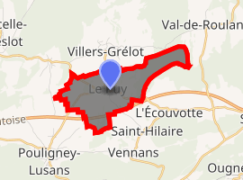
| |
 Le Puy  Le Puy | |
| Coordinates: 47°20′46″N 6°13′44″E | |
| Country | France |
| Region | Bourgogne-Franche-Comté |
| Department | Doubs |
| Arrondissement | Besançon |
| Canton | Baume-les-Dames |
| Intercommunality | Vaîte-Aigremont |
| Government | |
| • Mayor (2008–2014) | Christian Bermont |
| Area 1 | 3.42 km2 (1.32 sq mi) |
| Population (2017-01-01)[1] | 112 |
| • Density | 33/km2 (85/sq mi) |
| Time zone | UTC+01:00 (CET) |
| • Summer (DST) | UTC+02:00 (CEST) |
| INSEE/Postal code | 25474 /25640 |
| Elevation | 297–375 m (974–1,230 ft) (avg. 300 m or 980 ft) |
| 1 French Land Register data, which excludes lakes, ponds, glaciers > 1 km2 (0.386 sq mi or 247 acres) and river estuaries. | |
Geography
The village of Le Puy lies 16 km (9.9 mi) from Besançon on Route D115 and 5 km (3.1 mi) north of Roulans. It is close to its intersection with the D336 on the east and the A36 on the west.
Population
The inhabitants of Le Puy are known as Puylots.
| Historical population | ||
|---|---|---|
| Year | Pop. | ±% |
| 1962 | 48 | — |
| 1968 | 41 | −14.6% |
| 1975 | 35 | −14.6% |
| 1982 | 45 | +28.6% |
| 1990 | 48 | +6.7% |
| 1999 | 46 | −4.2% |
| 2008 | 81 | +76.1% |
| 2012 | 102 | +25.9% |
Sights
The chapel of Notre-Dame de la Délivrance was erected in 1854 by the parishioners in thanksgiving to Our Lady for being spared from a cholera epidemic. An outdoor mass is celebrated on the Sunday nearest the Feast of the Immaculate Conception, 8 December each year.
Etymology
The village is labeled le Puits (French: the Well) on the Cassini map. The French le Puy usually correlates to the Provençal word Puech (an isolated hill). Here, as the Cassini map shows, it refers to the local wells.
See also
External links
| Wikimedia Commons has media related to Le Puy (Doubs). |
All sites are in French, unless otherwise indicated.
- Le Puy on the Institut Géographique National site
- Financial Data for Le Puy from the Ministry of the Economy, Finances and Industry
- Tax information for Le Puy
- Closest communes to Le Puy
- My hometown (Monclocher) site(Location of townhall only)
- Le Puy on the intercommunal Web site of the department
| Authority control |
|
|---|