Levier
Levier is a commune in the Doubs department in the Bourgogne-Franche-Comté region in eastern France. On 1 January 2017, the former commune of Labergement-du-Navois was merged into Levier.[2]
Levier | |
|---|---|
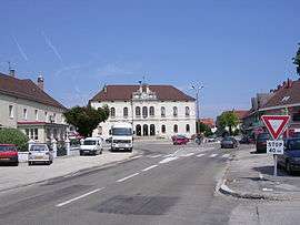 Town center | |
Location of Levier 
| |
 Levier  Levier | |
| Coordinates: 46°57′15″N 6°07′10″E | |
| Country | France |
| Region | Bourgogne-Franche-Comté |
| Department | Doubs |
| Arrondissement | Pontarlier |
| Canton | Frasne and Ornans |
| Intercommunality | Altitude 800 |
| Government | |
| • Mayor (2008–2014) | Albert Jeannin |
| Area 1 | 44.34 km2 (17.12 sq mi) |
| Population (2016-01-01)[1] | 2,395 |
| • Density | 54/km2 (140/sq mi) |
| Time zone | UTC+01:00 (CET) |
| • Summer (DST) | UTC+02:00 (CEST) |
| INSEE/Postal code | 25334 /25270 |
| Elevation | 679–901 m (2,228–2,956 ft) |
| 1 French Land Register data, which excludes lakes, ponds, glaciers > 1 km2 (0.386 sq mi or 247 acres) and river estuaries. | |
Geography
Levier is located 20 km (12 mi) from Pontarlier, 45 km (28 mi) from Besançon, and 14 km (8.7 mi) from the TGV station at Frasne.
Population
| Historical population | ||
|---|---|---|
| Year | Pop. | ±% |
| 1962 | 1,332 | — |
| 1968 | 1,395 | +4.7% |
| 1975 | 1,446 | +3.7% |
| 1982 | 1,619 | +12.0% |
| 1990 | 1,785 | +10.3% |
| 1999 | 1,700 | −4.8% |
| 2005 | 1,881 | +10.6% |
| 2012 | 2,021 | +7.4% |
Economy
The economy is based on forestry.
See also
References
- "Populations légales 2016". INSEE. Retrieved 25 April 2019.
- Arrêté préfectoral 16 November 2016 (in French)
External links
| Wikimedia Commons has media related to Levier (Doubs). |
| Authority control |
|
|---|
This article is issued from Wikipedia. The text is licensed under Creative Commons - Attribution - Sharealike. Additional terms may apply for the media files.