Le Moutherot
Le Moutherot is a commune in the Doubs department in the Bourgogne-Franche-Comté region in eastern France.
Le Moutherot | |
|---|---|
 The chapel in Le Moutherot | |
 Coat of arms | |
Location of Le Moutherot 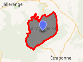
| |
 Le Moutherot  Le Moutherot | |
| Coordinates: 47°14′38″N 5°43′59″E | |
| Country | France |
| Region | Bourgogne-Franche-Comté |
| Department | Doubs |
| Arrondissement | Besançon |
| Canton | Saint-Vit |
| Intercommunality | Rives de l'Ognon |
| Government | |
| • Mayor (2008–2014) | Valery Vanlande |
| Area 1 | 1.3 km2 (0.5 sq mi) |
| Population (2017-01-01)[1] | 127 |
| • Density | 98/km2 (250/sq mi) |
| Time zone | UTC+01:00 (CET) |
| • Summer (DST) | UTC+02:00 (CEST) |
| INSEE/Postal code | 25414 /25170 |
| Elevation | 239–324 m (784–1,063 ft) |
| 1 French Land Register data, which excludes lakes, ponds, glaciers > 1 km2 (0.386 sq mi or 247 acres) and river estuaries. | |
Geography
The commune lies 25 km (16 mi) from Besançon, Dole, and Gray between the Ognon and the Doubs River.
On a top of a hill, the village offers a view on fields, forests. In bright weather we can see the Mount Blanc, the Mount Poupet and the "Ballon of Alsace".
Population
| Historical population | ||
|---|---|---|
| Year | Pop. | ±% |
| 1962 | 20 | — |
| 1968 | 23 | +15.0% |
| 1975 | 30 | +30.4% |
| 1982 | 37 | +23.3% |
| 1990 | 61 | +64.9% |
| 1999 | 78 | +27.9% |
| 2008 | 103 | +32.1% |
| 2012 | 131 | +27.2% |
See also
External links
| Wikimedia Commons has media related to Le Moutherot. |
| Authority control |
|
|---|
This article is issued from Wikipedia. The text is licensed under Creative Commons - Attribution - Sharealike. Additional terms may apply for the media files.