Laissey
Laissey is a commune in the Doubs department in the Bourgogne-Franche-Comté region in eastern France.
Laissey | |
|---|---|
 The town hall in Laissey | |
 Coat of arms | |
Location of Laissey 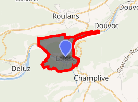
| |
 Laissey  Laissey | |
| Coordinates: 47°17′55″N 6°13′54″E | |
| Country | France |
| Region | Bourgogne-Franche-Comté |
| Department | Doubs |
| Arrondissement | Besançon |
| Canton | Baume-les-Dames |
| Intercommunality | Vaîte-Aigremont |
| Government | |
| • Mayor (2008–2014) | Dominique Mesnier |
| Area 1 | 2.86 km2 (1.10 sq mi) |
| Population (2017-01-01)[1] | 439 |
| • Density | 150/km2 (400/sq mi) |
| Time zone | UTC+01:00 (CET) |
| • Summer (DST) | UTC+02:00 (CEST) |
| INSEE/Postal code | 25323 /25820 |
| Elevation | 251–592 m (823–1,942 ft) |
| 1 French Land Register data, which excludes lakes, ponds, glaciers > 1 km2 (0.386 sq mi or 247 acres) and river estuaries. | |
Geography
The village lies in the deep valley of the Doubs River.
The Rognon forms a 17-meter waterfall, where it flows into the Doubs.
Population
| Historical population | ||
|---|---|---|
| Year | Pop. | ±% |
| 1962 | 545 | — |
| 1968 | 545 | +0.0% |
| 1975 | 501 | −8.1% |
| 1982 | 495 | −1.2% |
| 1990 | 399 | −19.4% |
| 1999 | 416 | +4.3% |
| 2008 | 442 | +6.2% |
| 2012 | 458 | +3.6% |
Economy
The village housed a mill from its inception, which served the villages of the Roulans plateau and Bouclans.
At the beginning of the 19th century, an iron mine was opened that employed up to 60 miners. However, with the arrival of the railroad in 1860, the mine was closed.
About 1870, a textile mill was established on the site of the old mill. It employed about 30 women, but it closed when the Bost brothers opened a tool factory at the end of the 19th century. From that time on, the village grew along with the factory. Of its 500 inhabitants, 200 worked at the factory.
See also
External links
| Wikimedia Commons has media related to Laissey. |
| Authority control |
|
|---|