Étray
Étray is a commune in the Doubs department in the Bourgogne-Franche-Comté region in eastern France.
Étray | |
|---|---|
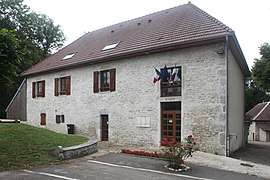 The town hall in Étray | |
.svg.png) Coat of arms | |
Location of Étray 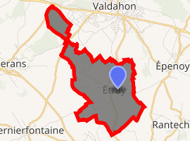
| |
 Étray  Étray | |
| Coordinates: 47°07′26″N 6°20′37″E | |
| Country | France |
| Region | Bourgogne-Franche-Comté |
| Department | Doubs |
| Arrondissement | Pontarlier |
| Canton | Valdahon |
| Intercommunality | Pays de Pierrefontaine–Vercel |
| Government | |
| • Mayor (2008–2014) | Daniel Peseux |
| Area 1 | 6.0 km2 (2.3 sq mi) |
| Population (2017-01-01)[1] | 261 |
| • Density | 44/km2 (110/sq mi) |
| Time zone | UTC+01:00 (CET) |
| • Summer (DST) | UTC+02:00 (CEST) |
| INSEE/Postal code | 25227 /25800 |
| Elevation | 623–759 m (2,044–2,490 ft) |
| 1 French Land Register data, which excludes lakes, ponds, glaciers > 1 km2 (0.386 sq mi or 247 acres) and river estuaries. | |
Population
| Historical population | ||
|---|---|---|
| Year | Pop. | ±% |
| 1962 | 99 | — |
| 1968 | 109 | +10.1% |
| 1975 | 88 | −19.3% |
| 1982 | 104 | +18.2% |
| 1990 | 115 | +10.6% |
| 1999 | 132 | +14.8% |
| 2008 | 181 | +37.1% |
| 2012 | 233 | +28.7% |
See also
References
- "Populations légales 2017". INSEE. Retrieved 6 January 2020.
| Wikimedia Commons has media related to Étray. |
This article is issued from Wikipedia. The text is licensed under Creative Commons - Attribution - Sharealike. Additional terms may apply for the media files.