Les Pontets
Les Pontets is a commune in the Doubs department in the Bourgogne-Franche-Comté region in eastern France.
Les Pontets | |
|---|---|
 A general view of Les Pontets | |
Location of Les Pontets 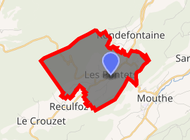
| |
 Les Pontets  Les Pontets | |
| Coordinates: 46°43′11″N 6°10′20″E | |
| Country | France |
| Region | Bourgogne-Franche-Comté |
| Department | Doubs |
| Arrondissement | Pontarlier |
| Canton | Frasne |
| Intercommunality | Hauts du Doubs |
| Government | |
| • Mayor (2008–2014) | Joani Lepine |
| Area 1 | 6.36 km2 (2.46 sq mi) |
| Population (2017-01-01)[1] | 135 |
| • Density | 21/km2 (55/sq mi) |
| Time zone | UTC+01:00 (CET) |
| • Summer (DST) | UTC+02:00 (CEST) |
| INSEE/Postal code | 25464 /25240 |
| Elevation | 970–1,237 m (3,182–4,058 ft) |
| 1 French Land Register data, which excludes lakes, ponds, glaciers > 1 km2 (0.386 sq mi or 247 acres) and river estuaries. | |
Geography
The commune lies 3 km (1.9 mi) northeast of Mouthe in the valley of Combes Derniers. It is dominated by the Haute Joux, with the peaks of Turchet (1227 m) and Saint Sorlin (1237 m), from which there is a view of the Alps.
Population
| Historical population | ||
|---|---|---|
| Year | Pop. | ±% |
| 1962 | 93 | — |
| 1968 | 100 | +7.5% |
| 1975 | 73 | −27.0% |
| 1982 | 69 | −5.5% |
| 1990 | 65 | −5.8% |
| 1999 | 84 | +29.2% |
| 2008 | 104 | +23.8% |
| 2012 | 132 | +26.9% |
See also
References
- "Populations légales 2017". INSEE. Retrieved 6 January 2020.
External links
| Wikimedia Commons has media related to Les Pontets. |
| Authority control |
|
|---|
This article is issued from Wikipedia. The text is licensed under Creative Commons - Attribution - Sharealike. Additional terms may apply for the media files.