Les Alliés
Les Alliés is a commune in the Doubs department in the Bourgogne-Franche-Comté region in eastern France.
Les Alliés | |
|---|---|
 A general view of Les Alliés | |
Location of Les Alliés 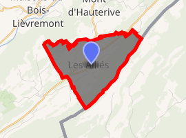
| |
 Les Alliés  Les Alliés | |
| Coordinates: 46°56′56″N 6°26′54″E | |
| Country | France |
| Region | Bourgogne-Franche-Comté |
| Department | Doubs |
| Arrondissement | Pontarlier |
| Canton | Ornans |
| Intercommunality | Canton of Montbenoît |
| Government | |
| • Mayor (2008–2014) | Christian Granié |
| Area 1 | 5.28 km2 (2.04 sq mi) |
| Population (2017-01-01)[1] | 158 |
| • Density | 30/km2 (78/sq mi) |
| Time zone | UTC+01:00 (CET) |
| • Summer (DST) | UTC+02:00 (CEST) |
| INSEE/Postal code | 25012 /25300 |
| Elevation | 943–1,171 m (3,094–3,842 ft) |
| 1 French Land Register data, which excludes lakes, ponds, glaciers > 1 km2 (0.386 sq mi or 247 acres) and river estuaries. | |
Population
| Historical population | ||
|---|---|---|
| Year | Pop. | ±% |
| 1790 | 223 | — |
| 1851 | 273 | +22.4% |
| 1901 | 179 | −34.4% |
| 1926 | 136 | −24.0% |
| 1954 | 118 | −13.2% |
| 1962 | 83 | −29.7% |
| 1968 | 61 | −26.5% |
| 1975 | 67 | +9.8% |
| 1982 | 63 | −6.0% |
| 1990 | 56 | −11.1% |
| 1999 | 103 | +83.9% |
| 2008 | 108 | +4.9% |
See also
References
- "Populations légales 2017". INSEE. Retrieved 6 January 2020.
| Wikimedia Commons has media related to Les Alliés. |
This article is issued from Wikipedia. The text is licensed under Creative Commons - Attribution - Sharealike. Additional terms may apply for the media files.