Laguna Woods, California
Laguna Woods (/ləˈɡuːnə/) is a city in Orange County, California, United States. The population was 16,192 at the 2010 census, down from 16,507 at the 2000 census with a median age of 78.
Laguna Woods, California | |
|---|---|
City in California | |
 Laguna Woods Village Golf Course | |
 Seal | |
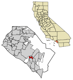 Location of Laguna Woods in Orange County, California. | |
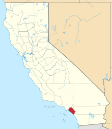
 Laguna Woods, California Location in the United States | |
| Coordinates: 33°36′33″N 117°43′58″W | |
| Country | |
| State | |
| County | Orange |
| Incorporated | March 24, 1999[1] |
| Government | |
| • Mayor | Cynthia Conners[2] |
| Area | |
| • Total | 3.35 sq mi (8.67 km2) |
| • Land | 3.35 sq mi (8.66 km2) |
| • Water | 0.00 sq mi (0.00 km2) 0.01% |
| Elevation | 381 ft (116 m) |
| Population (2010) | |
| • Total | 16,192 |
| • Estimate (2019)[5] | 15,850 |
| • Density | 4,864.57/sq mi (1,878.26/km2) |
| Time zone | UTC-8 (Pacific) |
| • Summer (DST) | UTC-7 (PDT) |
| ZIP codes | 92637 |
| Area code | 949 |
| FIPS code | 06-39259 |
| GNIS feature ID | 1848119 |
| Website | www |
About ninety percent of the city consists of Laguna Woods Village, a private gated retirement community, formerly known as Leisure World. The other ten percent consists of businesses and the city hall, which are available to the public. Incorporation efforts in the late 1990s were largely driven by the need for residents to have a stronger voice against the prospective construction of an international airport at the nearby decommissioned Marine Corps Air Station El Toro. The airport proposal was defeated and the land in question has been tabbed for development as the Orange County Great Park.
Geography
Laguna Woods is located at 33°36′33″N 117°43′58″W (33.609165, -117.732791).[6] According to the United States Census Bureau, the city has a total area of 3.1 square miles (8.0 km2), which is virtually all land.
It is bordered by Laguna Hills on the north and east, Aliso Viejo on the south, Laguna Beach on the southwest, the Crystal Cove State Park on the west, and Irvine on the northwest.
Demographics
| Historical population | |||
|---|---|---|---|
| Census | Pop. | %± | |
| 2000 | 16,507 | — | |
| 2010 | 16,192 | −1.9% | |
| Est. 2019 | 15,850 | [5] | −2.1% |
| U.S. Decennial Census[7] | |||
2010
At the 2010 census Laguna Woods had a population of 16,192. The population density was 5,196.9 people per square mile (2,006.6/km²). The racial makeup of Laguna Woods was 14,133 (87.3%) White (84.0% Non-Hispanic White),[8] 110 (0.7%) African American, 24 (0.1%) Native American, 1,624 (10.0%) Asian, 10 (0.1%) Pacific Islander, 90 (0.6%) from other races, and 201 (1.2%) from two or more races. Hispanic or Latino of any race were 650 people (4.0%).[9]
The census reported that 16,025 people (99.0% of the population) lived in households, 167 (1.0%) lived in non-institutionalized group quarters, and no one was institutionalized.
There were 11,302 households, 36 (0.3%) had children under the age of 18 living in them, 3,278 (29.0%) were married couples living together, 482 (4.3%) had a female householder with no husband present, 113 (1.0%) had a male householder with no wife present. There were 194 (1.7%) unmarried couples or partnerships, and 54 (0.5%) same-sex married couples or partnerships. 6,924 households (61.3%) were one person and 6,097 (53.9%) had someone living alone who was 65 or older. The average household size was 1.42. There were 3,873 families (34.3% of households); the average family size was 2.07.
The age distribution was 48 people (0.3%) under the age of 18, 56 people (0.3%) aged 18 to 24, 266 people (1.6%) aged 25 to 44, 2,948 people (18.2%) aged 45 to 64, and 12,874 people (79.5%) who were 65 or older. The median age was 77.0 years. For every 100 females, there were 55.1 males. For every 100 females age 18 and over, there were 55.0 males.
There were 13,016 housing units at an average density of 4,177.6 per square mile, of the occupied units 8,730 (77.2%) were owner-occupied and 2,572 (22.8%) were rented.The homeowner vacancy rate was 4.1%; the rental vacancy rate was 10.2%. 12,456 people (76.9% of the population) lived in owner-occupied housing units and 3,569 people (22.0%) lived in rental housing units.
According to the 2010 United States Census, Laguna Woods had a median household income of $36,818, with 9.9% of the population living below the federal poverty line.[8]
2000
At the 2000 census there were 16,507 people in 11,699 households, including 3,989 families, in the city. The population density was 5,158.4 inhabitants per square mile (1,991.7/km²). There were 12,650 housing units at an average density of 3,953.1 per square mile (1,526.3/km²). The racial makeup of the city was 96.12% White, 0.25% Black, 0.12% American Indian, 2.50% Asian, 0.05% Pacific Islander, 0.19% from other races, and 0.78% from two or more races. Hispanic or Latino of any race were 2.06%.[10]
Of the 11,699 households 0.4% had children under the age of 18 living with them, 30.7% were married couples living together, 2.8% had a female householder with no husband present, and 65.9% were non-families. 62.2% of households were one person and 57.5% were one person aged 65 or older. The average household size was 1.40 and the average family size was 2.06.
The age distribution was 0.6% under the age of 18, 0.2% from 18 to 24, 2.2% from 25 to 44, 10.6% from 45 to 64, and 86.4% 65 or older. The median age was 78 years. For every 100 females, there were 51.8 males. For every 100 females age 18 and over, there were 51.6 males.
The median household income was $30,493 and the median family income was $46,889. Males had a median income of $56,563 versus $35,188 for females. The per capita income for the city was $32,071. About 2.6% of families and 6.0% of the population were below the poverty line, including none of those under age 18 and 5.8% of those age 65 or over.
Government
| Year | Democratic | Republican | Third Parties |
|---|---|---|---|
| 2016[11] | 51.53% 6,096 | 44.97% 5,320 | 3.49% 413 |
| 2012[12] | 48.19% 5,598 | 50.74% 5,895 | 1.07% 124 |
| 2008[13] | 51.64% 6,182 | 46.35% 5,548 | 2.01% 241 |
| 2004[14] | 53.03% 6,721 | 46.06% 5,838 | 0.91% 115 |
| 2000[15] | 54.58% 7,258 | 42.50% 5,651 | 2.93% 389 |
In the state legislature, Laguna Woods is in the 37th Senate District, represented by Republican John Moorlach, and in the 74th Assembly District, represented by Democrat Cottie Petrie-Norris.[16]
In the United States House of Representatives, Laguna Woods is in California's 45th congressional district, represented by Democrat Katie Porter.[17]
According to the California Secretary of State, as of February 10, 2019, Laguna Woods has 14,027 registered voters. Of those, 5,081 (36.22%) are registered Republicans, 5,041 (35.94%) are registered Democrats, and 3,392 (24.18%) have declined to state a political party/are independents.[18]
Emergency services
Fire protection in Laguna Woods is provided by the Orange County Fire Authority with ambulance service by Care Ambulance Service. Law enforcement is provided by the Orange County Sheriff's Department. Security services are provided by Laguna Woods Village Security.
See also

References
- "California Cities by Incorporation Date". California Association of Local Agency Formation Commissions. Archived from the original (Word) on November 3, 2014. Retrieved August 25, 2014.
- "City Budget". City of Laguna Woods. Retrieved April 16, 2015.
- "2016 U.S. Gazetteer Files". United States Census Bureau. Retrieved July 19, 2017.
- "Laguna Woods". Geographic Names Information System. United States Geological Survey. Retrieved April 16, 2015.
- "Population and Housing Unit Estimates". Retrieved May 21, 2020.
- "US Gazetteer files: 2010, 2000, and 1990". United States Census Bureau. February 12, 2011. Retrieved April 23, 2011.
- "Census of Population and Housing". Census.gov. Retrieved June 4, 2015.
- https://web.archive.org/web/20131030084329/http://quickfacts.census.gov/qfd/states/06/0639259.html. Archived from the original on October 30, 2013. Missing or empty
|title=(help) - "2010 Census Interactive Population Search: CA - Laguna Woods city". U.S. Census Bureau. Archived from the original on July 15, 2014. Retrieved July 12, 2014.
- "U.S. Census website". United States Census Bureau. Retrieved January 31, 2008.
- https://www.ocvote.com/fileadmin/live/gen2016/sov.pdf
- https://www.ocvote.com/fileadmin/live/gen2012/sov-for-web.pdf
- https://www.ocvote.com/fileadmin/user_upload/sov/gen2008/sov.pdf
- https://www.ocvote.com/fileadmin/user_upload/sov/e13/sov1.pdf
- https://www.ocvote.com/fileadmin/user_upload/sov/gen2000/gen2000-SOV.pdf
- "Statewide Database". UC Regents. Archived from the original on February 1, 2015. Retrieved October 20, 2014.
- "California's 45th Congressional District - Representatives & District Map". Civic Impulse, LLC.
- "CA Secretary of State – Report of Registration – February 10, 2019" (PDF). ca.gov. Retrieved June 27, 2019.
External links
| Wikimedia Commons has media related to Laguna Woods, California. |
Municipalities and communities of Orange County, California, United States | ||
|---|---|---|
| Cities |
|  Orange County map |
| CDPs | ||
| Unincorporated communities | ||
| Ghost towns | ||

| Authority control |
|---|