Batiaghata Upazila
Batiaghata (Bengali: বটিয়াঘাটা) is an Upazila of Khulna District in the Division of Khulna, Bangladesh.[1]
Baterdanga বাইটেরডাংগা | |
|---|---|
Upazila | |
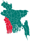
 Baterdanga Location in Bangladesh | |
| Coordinates: 22°44.5′N 89°31′E | |
| Country | |
| Division | Khulna Division |
| District | Khulna District |
| Area | |
| • Total | 248.33 km2 (95.88 sq mi) |
| Population (1991) | |
| • Total | 128,184 |
| • Density | 520/km2 (1,300/sq mi) |
| Time zone | UTC+6 (BST) |
| Website | Official Map of Batiaghata |
Geography
Batiaghata is located at 22.7417°N 89.5167°E. The Kajibacha river divides it into an eastern and a western part.[1] It has 23698 households and total area 248.33 km2.
Demographics
According to the 1991 Bangladesh census, Batiaghata had a population of 128184. Males constituted 51.07% of the population, and females 48.93%. The population aged 18 or over is 71,463. Batiaghata has an average literacy rate of 37.7% (7+ years), compared to the national average of 32.4%.[2]
Points of interest
- Baroaria Bazar
- Baintala Bazaar
- Pagol r Mandir
- Prem Kanon
- Batiaghata Bridge
- Gopalkhali Park
- Kazibacha River
- Batiaghata Bazaar
- Guptamari Gram
- Premkanon Family Picnic Corner
- Tamim teleicom hatbati
Administration
Batiaghata has 7 Unions/Wards, 132 Mauzas/Mahallas, and 158 villages.
Education
Primary schools
- Batiaghata Govt. Primary School
- Bayarbhanga Govt. Primary School
- Bayarbhanga Paschim Para Primary School
- Guptamary Govt. Primary School
- Chakrakhali Govt. Primary School
- Kashiadanga Govt. Primary School
- Khalshibunia Govt. Primary School
- Maitvanga Govt. Primary school
- 44 no. K. Baintala Govt. Primary School
- Saleha begum govt primary School
Secondary school
- Batiaghata Thana Head Quarters Pilot Model Secondary School
- Batiaghata High School
- Bayarbhanga Biswambhara High school
- Jolma Chokrakhali Secondary School
- Khalshibunia G.P.B. High School
- Kharabad Baintala High School
- Gaoghara High School
- Batiaghata Thana Head Quarters Girls High School
- Rashmohan Girls High School, Bayarbhanga
- B.L.G. High school
College
- Khagendranath Girls College
- Gariardanga Adarsha College
- Batiaghata College
- Kharabad Baintala School & College
Nearest tourist points
- Shat Gombuj Mosque
- Sundarban
- Mongla Port
- Khulna City
- Shitala Bari Temple
- Chandramohol
See also
- Upazilas of Bangladesh
- Districts of Bangladesh
- Divisions of Bangladesh
- Jalma Union
References
- Shah Siddiq (2012), "Batiaghata Upazila", in Sirajul Islam and Ahmed A. Jamal (ed.), Banglapedia: National Encyclopedia of Bangladesh (Second ed.), Asiatic Society of Bangladesh
- "Population Census Wing, BBS". Archived from the original on 2005-03-27. Retrieved November 10, 2006.
| Upazila/Thana: | ||
|---|---|---|
This article is issued from Wikipedia. The text is licensed under Creative Commons - Attribution - Sharealike. Additional terms may apply for the media files.