Terokhada Upazila
Terokhada (Bengali: তেরখাদা) is an Upazila in Khulna District, Khulna, Bangladesh.[1]
Terokhada তেরখাদা | |
|---|---|
Upazila | |
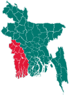
 Terokhada Location in Bangladesh | |
| Coordinates: 22°56.5′N 89°40.2′E | |
| Country | |
| Division | Khulna Division |
| District | Khulna District |
| Area | |
| • Total | 189.48 km2 (73.16 sq mi) |
| Population (1991) | |
| • Total | 102,972 |
| • Density | 540/km2 (1,400/sq mi) |
| Time zone | UTC+6 (BST) |
| Website | terokhada |
Geography
Terokhada is located at 22.9417°N 89.6694°E . It has 18372 households and total area 189.48 km².
Demographics
As of the 1991 Bangladesh census, Terokhada has a population of 102972. Males constitute 51.01% of the population, and females 48.99%. This Upazila's eighteen up population is 50377. Terokhada has an average literacy rate of 31.6% (7+ years), and the national average of 32.4% literate.[2]
Administration
Terokhada has 6 unions/wards, 31 mauzas/mahallas, and 96 villages.
See also
- Upazilas of Bangladesh
- Districts of Bangladesh
- Divisions of Bangladesh
References
- Ekramul Kabir (2012), "Terokhada Upazila", in Sirajul Islam and Ahmed A. Jamal (ed.), Banglapedia: National Encyclopedia of Bangladesh (Second ed.), Asiatic Society of BangladeshCS1 maint: uses authors parameter (link)
- "Population Census Wing, BBS". Archived from the original on 2005-03-27. Retrieved November 10, 2006.
| Upazila/Thana: | ||
|---|---|---|
This article is issued from Wikipedia. The text is licensed under Creative Commons - Attribution - Sharealike. Additional terms may apply for the media files.