Xunhua Salar Autonomous County
.png)
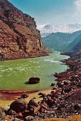
Xunhua Salar Autonomous County (Chinese: 循化撒拉族自治县; pinyin: Xúnhuà Sǎlázú Zìzhìxiàn; Salar: Göxdeñiz Velayat Yisır Salır Özbaşdak Yurt) is an autonomous Salar county in the southeast of Haidong Prefecture of Qinghai Province, China. The county has an area of around 2,100 square kilometres (810 sq mi) and approximately 110,000 inhabitants (2002). In the east it borders on the province of Gansu, in the south and the west to the Huangnan Tibetan Autonomous Prefecture, its postal code is 811100, and its capital is the town of Jishi.
The Salar language is the official language in Xunhua, as in all Salar autonomous areas.[1]
As of April 2009 Xunhua is also the site of a mosque containing the oldest hand-written copy of the Quran in China, believed to have been written sometime between the 8th and 13th centuries.[2]
Xunhua county is the location of the Bronze Age necropolis Suzhi (Suzhi mudi 苏志墓地) of the Kayue culture.
In 1917 the Hui Muslim General Ma Anliang ordered his younger brother Ma Guoliang to suppress a rebellion of Tibetans in Xunhua who rebelled because of taxes Ma Anliang imposed on them. Ma Anliang did not report it to the central government in Beijing and was reprimanded for it, and the Hui Muslim General Ma Qi was sent by the government to investigate the case and suppress the rebellion.[3]
| Part of a series on Islam in China | ||||||
|---|---|---|---|---|---|---|
 | ||||||
|
||||||
|
| ||||||
Ethnic groups in Xunhua, 2000 census
| Nationality | Population | Percentage |
|---|---|---|
| Salar Turkic | 63,859 | 61.14% |
| Tibetan | 25,783 | 24.68% |
| Hui | 8,155 | 7.81% |
| Han | 6,217 | 5.95% |
| Tu | 134 | 0.13% |
| Dongxiang | 116 | 0.11% |
| Mongol | 39 | 0.04% |
| Qiang | 35 | 0.03% |
| Bonan | 22 | 0.02% |
| Blang | 18 | 0.02% |
| Buyei | 12 | 0.01% |
| Others | 62 | 0.06% |
See also
References
- ↑ Fèlix Martí (2005). Fèlix Martí, ed. Words and worlds: world languages review (illustrated ed.). Multilingual Matters. p. 123. ISBN 1-85359-827-5. Retrieved 2011-06-03.
- ↑ http://news.xinhuanet.com/english/2009-04/09/content_11159058.htm
- ↑ 赵颂尧,马安良其人与民初的甘肃政争,西北民族大学学报(哲学社会科学版) 1989年第02期