White Flint station
White Flint | |||||||||||
|---|---|---|---|---|---|---|---|---|---|---|---|
|
| |||||||||||
 | |||||||||||
| Location |
5500 Marinelli Road North Bethesda, MD 20852 | ||||||||||
| Coordinates | 39°02′53″N 77°06′47″W / 39.048043°N 77.113131°WCoordinates: 39°02′53″N 77°06′47″W / 39.048043°N 77.113131°W | ||||||||||
| Owned by | WMATA | ||||||||||
| Line(s) |
| ||||||||||
| Platforms | 1 island platform | ||||||||||
| Tracks | 2 | ||||||||||
| Connections |
| ||||||||||
| Construction | |||||||||||
| Structure type | open-cut | ||||||||||
| Parking | 982 spaces | ||||||||||
| Bicycle facilities | 32 racks, 20 lockers | ||||||||||
| Disabled access | Yes | ||||||||||
| Other information | |||||||||||
| Station code | A12 | ||||||||||
| History | |||||||||||
| Opened | December 15, 1984 | ||||||||||
| Traffic | |||||||||||
| Passengers (2016) |
3,456 daily [1] | ||||||||||
| Services | |||||||||||
| |||||||||||
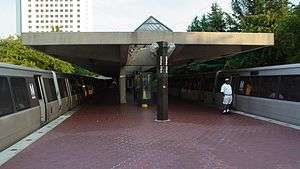
White Flint is an island platformed Washington Metro station in North Bethesda, Maryland, United States. The station was opened on December 15, 1984, and is operated by the Washington Metropolitan Area Transit Authority (WMATA). Providing service for the Red Line, the station serves residential and commercial areas of North Bethesda and Rockville and is located near the former White Flint Mall.
Location
White Flint serves commercial and residential areas of North Bethesda and Rockville. White Flint's namesake, the White Flint Mall, was located about .4 mi (0.64 km) southeast of the station.
Transport-oriented development
White Flint station is planned to be the center of a large transport-oriented development. The development will include new zoning to allow taller buildings to be built closer to the station along with a new street grid to link what are now currently disjointed areas.[2]
History
The station opened on December 15, 1984.[3] Its opening coincided with the completion of 7 miles (11 km)[4] of rail northwest of the then named Grosvenor station and the opening of the Rockville, Shady Grove, and Twinbrook stations.[3] White Flint was originally known as Nicholson Lane in planning documents,[5] but the station was renamed after the White Flint Mall before it opened. A pylon at Farragut North still bears the original name of the station; extensions were originally printed on pylons throughout the system and covered up until they opened.[6]
Station layout
| P Platform level |
Westbound | ← |
| Island platform, doors will open on the left | ||
| Eastbound | → | |
| M | Mezzanine | One-way faregates, ticket machines, station agent |
| G | Street Level | Exit/ Entrance |
Notable places nearby
- Nuclear Regulatory Commission
- Kennedy Shriver Aquatic Center
- Westfield Montgomery Mall is accessible via Ride On 26 or 42 bus.
References
- ↑ "Metrorail Average Weekday Passenger Boardings" (PDF). WMATA. Retrieved April 26, 2017.
- ↑ White Flint sector plan Montgomery Planning Retrieved November 28, 2009
- 1 2 Zibart, Eve (December 16, 1984), "A rainbow coalition flocks to Red Line; 4 stops open amid hoopla", The Washington Post, p. A1
- ↑ Washington Metropolitan Area Transit Authority (July 2009). "Sequence of Metrorail openings" (PDF). Archived from the original (PDF) on January 13, 2010. Retrieved July 30, 2010.
- ↑ Johnson, Janis (September 28, 1978). "Metro in Montgomery: Plans Are Unveiled for Preserving Old Neighborhoods and Creating New Development Near Metro". The Washington Post. p. MD1.
- ↑ Zoological Park metro station? Archived December 31, 2009, at the Wayback Machine. DCist Retrieved November 28, 2009
External links
- WMATA: White Flint Station
- StationMasters Online: White Flint Station
- The Schumin Web Transit Center: White Flint Station
- Marinelli Road entrance from Google Maps Street View
| Wikimedia Commons has media related to White Flint (WMATA station). |