East Falls Church station
East Falls Church | ||||||||||||||||
|---|---|---|---|---|---|---|---|---|---|---|---|---|---|---|---|---|
|
| ||||||||||||||||
 | ||||||||||||||||
| Location |
2001 North Sycamore Street Arlington, VA 22205 | |||||||||||||||
| Owned by | Washington Metropolitan Area Transit Authority | |||||||||||||||
| Line(s) |
| |||||||||||||||
| Platforms | 1 island platform | |||||||||||||||
| Tracks | 2 | |||||||||||||||
| Bus stands | 4 | |||||||||||||||
| Bus operators |
| |||||||||||||||
| Construction | ||||||||||||||||
| Structure type | Surface | |||||||||||||||
| Parking | 422 spaces | |||||||||||||||
| Bicycle facilities | 12 racks, 6 lockers | |||||||||||||||
| Disabled access | Yes | |||||||||||||||
| Other information | ||||||||||||||||
| Station code | K05 | |||||||||||||||
| History | ||||||||||||||||
| Opened | June 7, 1986 | |||||||||||||||
| Traffic | ||||||||||||||||
| Passengers (2017) |
3,955 daily [1] | |||||||||||||||
| Services | ||||||||||||||||
| ||||||||||||||||
East Falls Church is an island platformed Washington Metro station in Arlington, Virginia on the Orange and Silver Lines. East Falls Church station is the last aboveground, at grade, or open cut station for eastbound trains. East of this station, the trains heading toward downtown DC descends underground, therefore leaving the median of I-66 and entering subway mode.
The station serves the communities of Falls Church and Arlington, Virginia and is located in the median of Interstate 66 near Lee Highway (U.S. Route 29). Service began on June 7, 1986. East Falls Church has a parking lot with 422 spaces on the Lee Highway side of the station.
Transit-oriented development
Of the six stations on the Orange Line in Arlington, East Falls Church has the least transit-oriented development. Unlike the Rosslyn-Ballston corridor, East Falls Church station is located in the median of Interstate 66, posing pedestrian access issues.[2] Arlington County is currently considering plans to develop the site.[3]
History
East Falls Church opened as part of the final westward extension of the Orange Line to Vienna on June 7, 1986.[4]
The Silver Line began service on July 26, 2014, resulting in East Falls Church becoming the final transfer point before its split with the Orange Line.[5]
Station layout
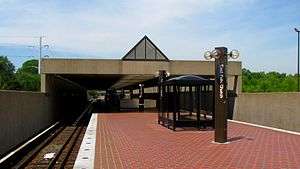
Similar to all stations within the Interstate 66 median apart from West Falls Church, East Falls Church utilizes a simple island platform setup with two tracks. There is an exit in the central part of the platform that leads to a mezzanine on the western side of North Sycamore Street. The station's parking lot and bus bays are located to the north of this exit at the southwestern corner of the intersection of North Sycamore Street and North Washington Boulevard.[2]
| P Platform level |
Westbound | ← ← |
| Island platform, doors will open on the left | ||
| Eastbound | → → | |
| M | Mezzanine | One-way faregates, ticket machines, station agent |
| G | Street level | Exit/entrance |
References
- ↑ "Metrorail Average Weekday Passenger Boardings" (PDF). Washington Metropolitan Area Transit Authority. May 2017. Retrieved February 17, 2018.
- 1 2 "Station Vicinity Map: East Falls Church" (PDF). WMATA. Retrieved March 28, 2018.
- ↑ "East Falls Church Planning at a Glance". arlingtonva.us. Projects & Planning. Retrieved 29 August 2018.
- ↑ "Sequence of Metrorail openings" (PDF). Washington Metropolitan Area Transit Authority. 2017. p. 3. Retrieved March 28, 2018.
- ↑ "All aboard! Metro's new Silver Line rolls down the tracks for the first time". Washington Post. Retrieved March 28, 2018.
External links
![]()
- WMATA: East Falls Church Station
- StationMasters Online: East Falls Church Station
- The Schumin Web Transit Center: East Falls Church Station
- Sycamore Street entrance from Google Maps Street View
Coordinates: 38°53′10″N 77°09′24″W / 38.886038°N 77.156531°W