Farragut North station
Farragut North | ||||||||||||||||||||||||||||||||||||
|---|---|---|---|---|---|---|---|---|---|---|---|---|---|---|---|---|---|---|---|---|---|---|---|---|---|---|---|---|---|---|---|---|---|---|---|---|
|
| ||||||||||||||||||||||||||||||||||||
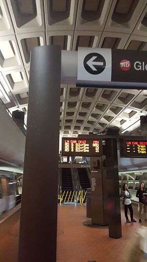 Station platform (October 2016) | ||||||||||||||||||||||||||||||||||||
| Location |
1001 Connecticut Avenue, NW Washington, DC 20036 | |||||||||||||||||||||||||||||||||||
| Coordinates | 38°54′11″N 77°02′23″W / 38.903192°N 77.039766°WCoordinates: 38°54′11″N 77°02′23″W / 38.903192°N 77.039766°W | |||||||||||||||||||||||||||||||||||
| Owned by | WMATA | |||||||||||||||||||||||||||||||||||
| Line(s) |
| |||||||||||||||||||||||||||||||||||
| Platforms | 1 island platform | |||||||||||||||||||||||||||||||||||
| Tracks | 2 | |||||||||||||||||||||||||||||||||||
| Connections |
| |||||||||||||||||||||||||||||||||||
| Construction | ||||||||||||||||||||||||||||||||||||
| Structure type | Underground | |||||||||||||||||||||||||||||||||||
| Depth | 64 feet (20 m) | |||||||||||||||||||||||||||||||||||
| Bicycle facilities | 8 racks | |||||||||||||||||||||||||||||||||||
| Disabled access | Yes | |||||||||||||||||||||||||||||||||||
| Other information | ||||||||||||||||||||||||||||||||||||
| Station code | A02 | |||||||||||||||||||||||||||||||||||
| History | ||||||||||||||||||||||||||||||||||||
| Opened | March 27, 1976 | |||||||||||||||||||||||||||||||||||
| Traffic | ||||||||||||||||||||||||||||||||||||
| Passengers (2016) |
22,949 daily[1] | |||||||||||||||||||||||||||||||||||
| Services | ||||||||||||||||||||||||||||||||||||
| ||||||||||||||||||||||||||||||||||||
Farragut North is a Washington Metro station in Washington, D.C., on the Red Line.
Farragut North serves downtown Washington and is located just north of Farragut Square. It lies at the heart of the business district on Connecticut Avenue, with two entrances at L Street and one at K Street. Adjacent to the L Street entrance was a food court which has its own stairway to the surface; the food court closed in 2007 and was later replaced with a Results Gym location. It is the third-busiest station in the Metro system, averaging 22,949 passengers per weekday as of May 2017.[1] It is also one of the most shallow, with a lower-than-usual ceiling. The low, flat ceiling at the west end was built to accommodate a proposed freeway ramp to Interstate 66, which was never built. Service began on March 27, 1976.[2]
Description
Farragut North station features unique architecture not seen in other stations throughout the system. Its mezzanine stretches across more of the platform and is longer than most, with an open depression looking onto the platform in the middle. There are two elevated “aisles” that serve different escalators and exits. Special buttress-like structures support these stretches of the mezzanine.
It is only a block away (across the Square) from Farragut West station; however, there is no direct connection between the two stations. WMATA originally planned to have a single Farragut station that would serve as an alternate transfer station to ease congestion that would develop in Metro Center. However, it would have been done using the cut and cover method, disrupting the Square above. Therefore, this proposal was not favored and the two separate stations were built instead. As part of its long-term capital improvement plan dated September 12, 2002, Metro has proposed building an underground pedestrian tunnel (similarly to the connection tunnel between Sofia (Bulgaria)’s Serdika and Serdika-2 metro stations) connecting this station with Farragut West. On October 28, 2011, Metro announced its Farragut Crossing program, allowing riders using a SmarTrip card up to 30 minutes to transfer for free by foot between Farragut West and Farragut North stations.[3]
The station is named for the adjacent Farragut Square, which takes its name from Admiral David Farragut, the senior officer of the U.S. Navy during the American Civil War.
On November 24, 2009, a large crack was found in the ceiling during a routine inspection; repairs began the following day.[4]
On February 12, 2010 at approximately 10:13 a.m. a train derailed in the pocket track immediately north of this station when the front car left the tracks.[5] Of the approximately 345 passengers on board, one person was transported to the hospital. All of the passengers were evacuated without incident. The cause of the derailment is being investigated by the National Transportation Safety Board.[6]
As of 2011, the station is undergoing structural repairs. The renovation will add a new structural support column. Cracks in the ceiling where moisture is entering the station are being patched and ceiling tiles replaced. In addition, the escalators are being overhauled.[7]
South of this station, a non-revenue track diverges from the outbound track that connects with the outbound track on the shared Orange/Blue/Silver Line tracks between Farragut West and McPherson Square.
Station layout
| G | Street Level | Exit/ Entrance |
| M | Mezzanine | One-way faregates, ticket machines, station agent |
| P Platform level |
Westbound | ← |
| Island platform, doors will open on the left | ||
| Eastbound | → | |
Notable places nearby
See also
- Pulse (sculpture), installed at the station's Connecticut Avenue and K Street, NW entrance
References
- 1 2 "Metrorail Average Weekday Passenger Boardings" (PDF). WMATA. Washington Metropolitan Area Transit Authority. May 2017. Retrieved March 27, 2018.
- ↑ "Sequence of Metrorail openings" (PDF). Washington Metropolitan Area Transit Authority. 2017. p. 3. Retrieved March 28, 2018.
- ↑ "Metro launches Farragut Crossing" (Press release). WMATA. October 28, 2011. Retrieved March 28, 2018.
- ↑ "Repairs being made to ceiling inside Farragut North Metrorail station" (Press release).
- ↑ "Minor Injuries Reported After Metro Train Derails". NBC.
- ↑ "NTSB issues updates on three Washington Metrorail accident investigations; announces board meeting date for 2009 Red Line collision investigation in Washington, D.C." NTSB. May 20, 2010. Retrieved March 28, 2018.
- ↑ Tyson, Ann Scott (February 14, 2011). "Repairs at Farragut North Metrorail station to last into summer". The Washington Post. Retrieved February 15, 2011.
External links
| Wikimedia Commons has media related to Farragut North (WMATA station). |
- WMATA: Farragut North Station
- StationMasters Online: Farragut North Station
- The Schumin Web Transit Center: Farragut North Station
- L Street entrance from Google Maps Street View
- K Street entrance from Google Maps Street View