Van Ness–UDC station
Van Ness – UDC | |||||||||||
|---|---|---|---|---|---|---|---|---|---|---|---|
|
| |||||||||||
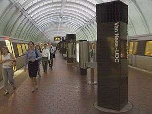 The Van Ness–UDC station in June 2004 | |||||||||||
| Location |
4200 Connecticut Avenue, NW Washington, DC 20008 | ||||||||||
| Coordinates | 38°56′40.4″N 77°3′48.7″W / 38.944556°N 77.063528°WCoordinates: 38°56′40.4″N 77°3′48.7″W / 38.944556°N 77.063528°W | ||||||||||
| Owned by | WMATA | ||||||||||
| Line(s) |
| ||||||||||
| Platforms | 1 island platform | ||||||||||
| Tracks | 2 | ||||||||||
| Connections |
| ||||||||||
| Construction | |||||||||||
| Structure type | Underground | ||||||||||
| Depth | 90 feet (27 m) | ||||||||||
| Bicycle facilities | 9 racks, 8 lockers | ||||||||||
| Disabled access | Yes | ||||||||||
| Other information | |||||||||||
| Station code | A06 | ||||||||||
| History | |||||||||||
| Opened | December 5, 1981 | ||||||||||
| Traffic | |||||||||||
| Passengers (2017) |
5,557 daily [1] | ||||||||||
| Services | |||||||||||
| |||||||||||
Van Ness–UDC is an island platformed Washington Metro station serving the Forest Hills and North Cleveland Park neighborhoods of Washington, D.C., United States. The station was opened on December 5, 1981, and is operated by the Washington Metropolitan Area Transit Authority (WMATA). Providing service for the Red Line, the station is on the 4200 block of Connecticut Avenue Northwest, with exits on either side of Connecticut Avenue. The station is also close to the University of the District of Columbia (UDC), as well as to both Howard University School of Law and the Edmund Burke School. Other attractions are easily reachable from the station because of its position at the intersection of Veazey Street and Connecticut Avenue.[2]
Location
Van Ness–UDC station is the northernmost station in the tunnel beneath Connecticut Avenue, one of Washington's busiest thoroughfares. After northbound trains leave the station, the tunnel shifts westwards underneath Yuma Street[2] and at the next station, Tenleytown–AU, the tunnel then parallels the route of Wisconsin Avenue into Maryland.
Notable places nearby
History
The station opened on December 5, 1981.[3][4] Its opening coincided with the completion of 2.1 miles (3.4 km) of rail northwest of the Dupont Circle station and the opening of the Cleveland Park and Woodley Park stations.[3][4][5] It would serve as the northwestern terminus of the Red Line until the opening of an extension to the then-named Grosvenor station on August 25, 1984.[6]
Station layout
Architecturally, Van Ness–UDC is similar to other stations along the underground stretch of the Red Line between Woodley Park and Medical Center. Because of the high cost of the waffle design and the relative large depth of these stations, pre-fabricated concrete segments were shipped to the construction site and placed together to form the structure of the station.[3] This resulted in what is now known as the "Arch I" station design of the Washington Metro.[7]
| G | Street Level | Exit/ Entrance |
| M | Mezzanine | One-way faregates, ticket machines, station agent |
| P Platform level |
Westbound | ← |
| Island platform, doors will open on the left | ||
| Eastbound | → | |
References
- ↑ "Metrorail Average Weekday Passenger Boardings" (PDF). WMATA. Retrieved July 31, 2018.
- 1 2 Wayne Whitehorne (January 17, 2009). "The Red Line". Retrieved August 1, 2010.
- 1 2 3 Burgess, John (December 4, 1981), "The new northwest passage; 3 more stops on the Red Line...", The Washington Post, p. B1
- 1 2 Burgess, John (December 5, 1981), "3 Metro stations opening today", The Washington Post, p. B7
- ↑ "Sequence of Metrorail openings" (PDF). WMATA. 2017. p. 3. Retrieved July 23, 2018.
- ↑ Brisbane, Arthur S. (August 26, 1984), "All aboard; Metro festivities welcome latest Red Line extension", The Washington Post, p. A1
- ↑ Washington, D.C. Metro by NYC Subway
External links
- WMATA: Van Ness–UDC Station
- StationMasters Online: Van Ness–UDC Station
- Veazey Terrace West entrance from Google Maps Street View
- Veazey Terrace East entrance from Google Maps Street View