Congress Heights station
Congress Heights | |||||||||||
|---|---|---|---|---|---|---|---|---|---|---|---|
|
| |||||||||||
 | |||||||||||
| Location |
1290 Alabama Avenue, Southeast Washington, D.C. 20020 | ||||||||||
| Owned by | Washington Metropolitan Area Transit Authority | ||||||||||
| Line(s) |
| ||||||||||
| Platforms | 1 island platform | ||||||||||
| Tracks | 2 | ||||||||||
| Connections |
Congress Heights – Union Station | ||||||||||
| Construction | |||||||||||
| Structure type | Underground | ||||||||||
| Bicycle facilities | 10 racks, 12 lockers | ||||||||||
| Disabled access | Yes | ||||||||||
| Other information | |||||||||||
| Station code | F07 | ||||||||||
| History | |||||||||||
| Opened | January 13, 2001 | ||||||||||
| Traffic | |||||||||||
| Passengers (2017) |
2,173 daily [1] | ||||||||||
| Services | |||||||||||
| |||||||||||
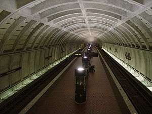
Congress Heights is an island platformed Washington Metro station in the Congress Heights neighborhood of Washington, D.C., United States. The station was opened on January 13, 2001, and is operated by the Washington Metropolitan Area Transit Authority (WMATA). Providing service for only the Green Line, the station is located at Alabama Avenue and 13th Street, lying under St. Elizabeths Hospital. Congress Heights is the last Green Line station in the District of Columbia going southeast.
Groundbreaking for the final segment of the Green Line occurred on September 23, 1995,[2] and the station opened on January 13, 2001.[3] Its opening coincided with the completion of approximately 6.5 miles (10.5 km) of rail southeast of the Anacostia station and the opening of the Branch Avenue, Naylor Road, Southern Avenue and Suitland stations.[3]
Station layout
| G | Street level | Exit/entrance |
| M | Mezzanine | One-way faregates, ticket machines, station agent |
| P Platform level |
Northbound | ← |
| Island platform, doors will open on the left | ||
| Southbound | → | |
References
- ↑ "Metrorail Average Weekday Passenger Boardings" (PDF). WMATA. Retrieved July 31, 2018.
- ↑ Fehr, Stephen C. (September 23, 1995), "After 25 years of building, Metro nears finish line", The Washington Post, p. B1
- 1 2 Layton, Lyndsey (January 14, 2001), "All Metro doors now open; Five new Green Line stations complete 32-year project, but expansions continue", The Washington Post, p. A1
External links
- WMATA: Congress Heights Station
- StationMasters Online: Congress Heights Station
- The Schumin Web Transit Center: Congress Heights Station
- Alabama Avenue entrance from Google Maps Street View
Coordinates: 38°50′43.4″N 76°59′16″W / 38.845389°N 76.98778°W