Mount Vernon Square station
Mount Vernon Square7th Street – Convention Center | ||||||||||||||||||||
|---|---|---|---|---|---|---|---|---|---|---|---|---|---|---|---|---|---|---|---|---|
|
| ||||||||||||||||||||
 | ||||||||||||||||||||
| Location |
700 M Street NW Washington, DC 20001 | |||||||||||||||||||
| Owned by | WMATA | |||||||||||||||||||
| Line(s) |
| |||||||||||||||||||
| Platforms | 1 island platform | |||||||||||||||||||
| Tracks | 2 | |||||||||||||||||||
| Connections |
| |||||||||||||||||||
| Construction | ||||||||||||||||||||
| Structure type | Underground | |||||||||||||||||||
| Bicycle facilities | 6 racks | |||||||||||||||||||
| Disabled access | Yes | |||||||||||||||||||
| Other information | ||||||||||||||||||||
| Station code | E01 | |||||||||||||||||||
| History | ||||||||||||||||||||
| Opened | May 11, 1991 | |||||||||||||||||||
| Previous names |
Mt Vernon Square-UDC (1991–2001) Mt Vernon Sq/7th St-Convention Center (2001–2011) | |||||||||||||||||||
| Traffic | ||||||||||||||||||||
| Passengers (2017) |
4,172 daily [1] | |||||||||||||||||||
| Services | ||||||||||||||||||||
| ||||||||||||||||||||
Mount Vernon Square is a Washington Metro station in Washington, D.C., on the Green and Yellow Lines. During rush hours, this is sometimes used as the northern terminus for Yellow Line service to Huntington, and trains reverse direction using a pocket track just north of the station. Metro has been running off-peak and weekend Yellow Line trains north to Fort Totten since 2006.
Location
Mount Vernon Square station is located at the border of the neighborhoods of Downtown and Shaw in the northwestern quadrant of Washington. Its namesake, Mount Vernon Square, is located two blocks to the south at the convergence of New York Avenue and Massachusetts Avenues and 7th, 9th, and K Streets. The station's subtitle is derived from the station's location along 7th Street NW, and its close proximity to the Washington Convention Center, although the station is only one of five Metro stations that run underneath 7th Street NW.
Transit-oriented development
Like many other Metro stations in the Washington Metropolitan Area, Mount Vernon Square station has spurred development in its proximity. Most prominent is the Washington Convention Center, although a number of smaller residential and commercial projects have been completed within the surrounding blocks. To the southeast of the station is the Mount Vernon Triangle, a business improvement district (BID) seeing rapid mixed-use growth. To the southwest of the station is the mixed-use CityCenterDC development project, which is home to luxury condominiums and luxury retail franchises such as Louis Vuitton, Moncler, Gucci, Hugo Boss, Tesla, Del Frisco's Double Eagle Steak House, Fig & Olive and other upscale dining and shopping destinations. [2]
History
Service began on May 11, 1991. The station mezzanine was renovated in 2003 to coincide with the opening of the Walter E. Washington Convention Center. The renovation included additional faregates and a new street entrance.
On January 7, 2007, the fifth car of a six-car train derailed in the tunnel at the interlocking south of the station, sending twenty people to the hospital for minor injuries and significantly damaging a rail car.[3][4] Service resumed the next day at 5 AM.[5]
Name changes
Originally to be named "Federal City College", the station was named Mount Vernon Square - UDC at the time of its 1991 opening, reflecting the establishment of the University of the District of Columbia. The station was renamed Mt Vernon Sq/7th Street-Convention Center in 2001; the "7th Street" helped distinguish that the stop served the new Walter E. Washington Convention Center as opposed to the old Washington Convention Center at 9th Street NW. On November 3, 2011, the station was again renamed, taking "Mount Vernon Square" as the main name, with "7th Street - Convention Center" as a subtitle.[6]
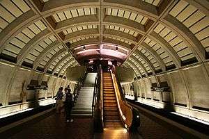
Station layout
| G | Street level | Exit/entrance |
| M | Mezzanine | One-way faregates, ticket machines, station agent |
| P Platform level |
Southbound | ← ← |
| Island platform, doors will open on the left | ||
| Northbound | → → → | |
References
- ↑ "Metrorail Average Weekday Passenger Boardings" (PDF). WMATA. Retrieved August 29, 2018.
- ↑ "CityCenterDC". Retrieved January 19, 2018.
- ↑ Karush, Sarah (January 7, 2007). "20 Hurt After D.C. Subway Train Derails". The Washington Post. Retrieved January 8, 2007.
- ↑ "Train passenger: 'I felt a very violent impact'". CNN. January 7, 2007. Retrieved January 8, 2007.
- ↑ Monday Metrorail service back to normal after Sunday derailment WMATA Retrieved September 10, 2008
- ↑ "Station names updated for new map" (Press release). Washington Metropolitan Area Transit Authority. November 3, 2011. Archived from the original on November 5, 2011. Retrieved November 5, 2011.
External links
| Wikimedia Commons has media related to Mount Vernon Square (WMATA station). |
- WMATA: Mt. Vernon Square Station
- StationMasters Online: Mt Vernon Square Station
- The Schumin Web Transit Center: Mt. Vernon Square Station
- M Street entrance from Google Maps Street View
Coordinates: 38°54′20″N 77°01′19″W / 38.905645°N 77.021928°W