West Haldon, Queensland
| West Haldon Queensland | |||||||||||||||
|---|---|---|---|---|---|---|---|---|---|---|---|---|---|---|---|
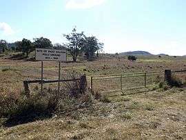 Former polo ground, 2014 | |||||||||||||||
| Population | 62 (2016 census)[1] | ||||||||||||||
| Postcode(s) | 4359 | ||||||||||||||
| LGA(s) | |||||||||||||||
| State electorate(s) | |||||||||||||||
| Federal Division(s) | |||||||||||||||
| |||||||||||||||
West Haldon is a locality split between the Lockyer Valley Region and Toowoomba Region of South East Queensland, Australia. At the 2016 Australian Census, West Haldon and surrounds recorded a population of 62. The southern boundary roughly follows the watershed of Lockyer Creek.
References
- ↑ Australian Bureau of Statistics (27 June 2017). "West Haldon (State Suburb)". 2016 Census QuickStats. Retrieved 25 March 2018.

This article is issued from
Wikipedia.
The text is licensed under Creative Commons - Attribution - Sharealike.
Additional terms may apply for the media files.